
Close

Gain unmatched visibility into assets, structures, and environments with Thermal & RGB Inspection services from Skyglimps Technologies. Using advanced drones and sensor fusion, we deliver both high-resolution visual (RGB) and thermal (infrared) imagery to instantly spot defects, inefficiencies, and risks across a diverse range of industries such as infrastructure, energy, agriculture, and facilities management. Our certified team combines specialized training with the latest sensor technology to ensure your inspections are thorough, accurate, and actionable.
RGB imaging captures traditional, high-resolution color visuals of surfaces, components, and environments, making it easy to identify visible defects or site details. Thermal imaging detects infrared heat signatures, visualizing temperature variations invisible to the human eye. By fusing these technologies, we reveal structural faults, electrical issues, moisture leaks, insulation gaps, and equipment overheating all at once, providing a comprehensive health assessment that cannot be achieved by visual inspection alone.
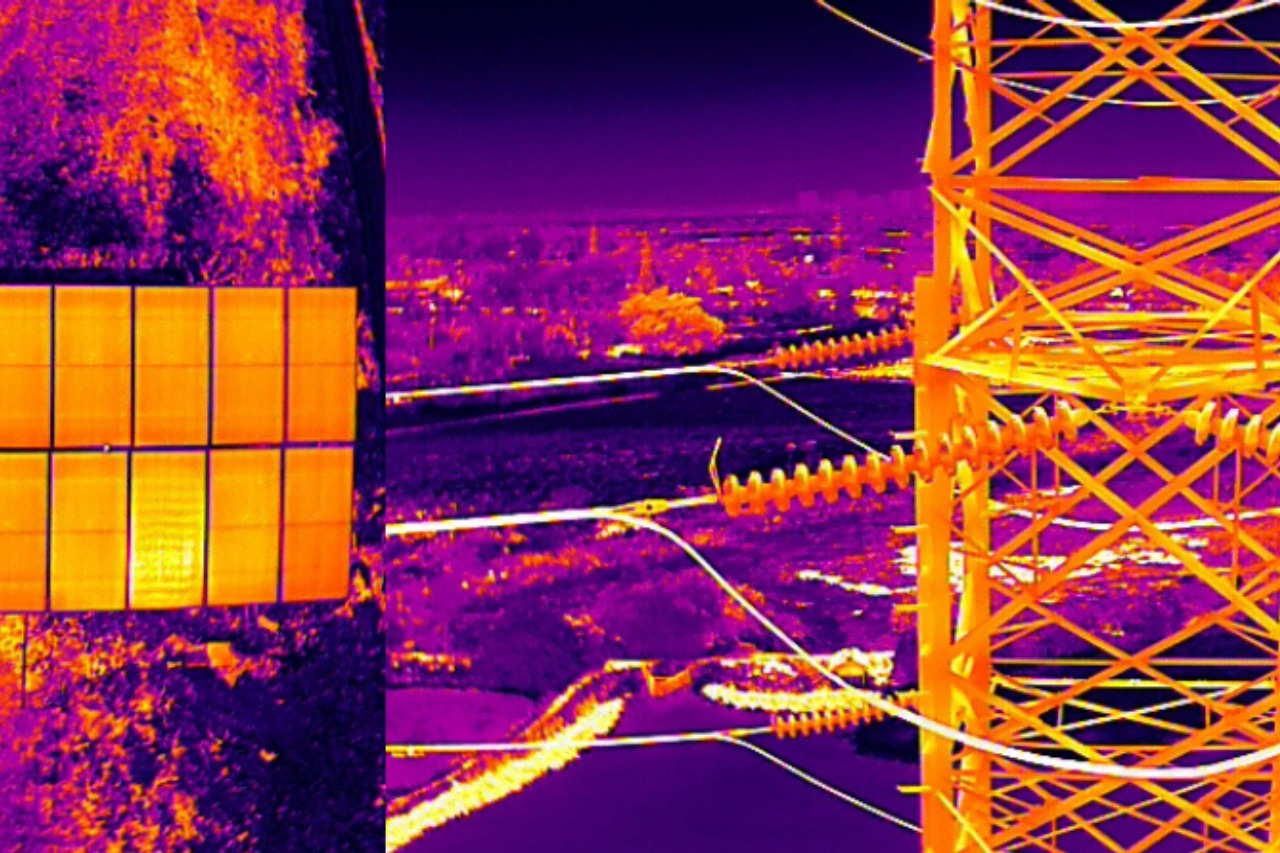
Using drones, we collect synchronized visual and thermal data in a single flight for rapid, disruption-free inspections.
Data fusion technology overlays color imagery with thermal maps, allowing precise pinpointing and measurement of defects or hotspots.
Digital inspection reports include annotated visuals and temperature analytics, delivered in various formats suitable for engineers, asset managers, and compliance teams.
Identify surface damage, heat leaks, wet spots, failing solar panels, electrical faults, and much more in a single inspection.
Perform inspections quickly, covering large or inaccessible areas while reducing manual labor and minimizing downtime or safety risks.
Integrated visual and thermal analysis delivers a clear, prioritized assessment for preventive maintenance and corrective action.
Eliminates the need for personnel to access hazardous environments, increasing safety for inspection teams and site workers.
Find quick answers about Skyglimps Thermal & RGB drone inspections, infrared imaging, visual inspection reports, asset monitoring, defect detection, and preventive maintenance.
Thermal & RGB drone inspection combines high-resolution visual imagery with infrared thermal imaging to assess assets, structures, equipment, and environments. RGB imaging captures clear colour visuals of visible defects, while thermal imaging detects heat patterns, temperature variations, overheating, moisture issues, insulation gaps, and other risks that may not be visible through normal inspection.
Skyglimps uses advanced drones equipped with visual and thermal sensors to capture synchronized RGB and infrared data in a single flight. The collected data is then processed and analysed to identify defects, hotspots, temperature anomalies, surface damage, leaks, electrical faults, and other asset-related issues with greater accuracy and clarity.
Thermal & RGB inspections can help identify electrical overheating, failing solar panels, insulation gaps, moisture leaks, heat loss, wet spots, surface damage, structural faults, equipment overheating, and other maintenance risks. This makes the service useful for preventive maintenance, safety checks, asset monitoring, and corrective action planning.
Thermal & RGB drone inspections are useful for infrastructure, energy, solar power, utilities, agriculture, industrial facilities, buildings, warehouses, and facilities management. These sectors use drone-based thermal and visual data to inspect large, hazardous, or difficult-to-access areas more efficiently while reducing manual inspection risks.
Depending on the project scope, Skyglimps can provide high-resolution RGB images, thermal imagery, annotated inspection visuals, hotspot identification, temperature analytics, defect observations, and digital inspection reports. These reports help engineers, asset managers, maintenance teams, and compliance teams make informed decisions for repairs, safety improvements, and preventive maintenance.
Explore our related services, including 2D Surveying & Mapping for precise site data capture, 3D LiDAR & GIS Solutions for advanced terrain and asset modelling, Live Aerial Surveillance for real-time monitoring, FPV Videography for engaging aerial visuals, and Documentation & Progress Tracking for recording inspection updates, project milestones, and operational progress.