
Close

Skyglimps provides high-precision 3D LiDAR and GIS solutions for industries that demand accurate and actionable geospatial data. Our integrated approach combines cutting-edge LiDAR scanning with advanced Geographic Information Systems (GIS) analysis, delivering transformative insights for engineering, infrastructure, urban planning, environmental monitoring, and beyond. Make confident, future-ready decisions with the power of advanced geospatial analysis.
3D LiDAR (Light Detection and Ranging) uses pulsed laser measurements to create accurate point clouds and three-dimensional maps of landscapes, buildings, and infrastructure. GIS (Geographic Information System) integrates, visualizes, and analyzes location-based data transforming raw LiDAR measurements into practical, decision-driving maps and models. These combined technologies deliver precise elevation models, digital twins, and advanced geospatial intelligence for all project needs.
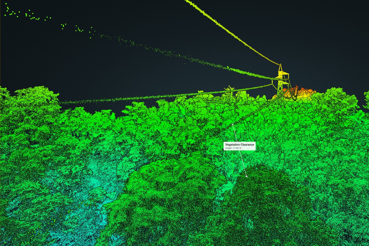
We deploy drones and terrestrial scanners to collect dense 3D data across any terrain or structure, including urban, industrial, and remote areas.
Leading GIS software transforms raw point clouds into usable 3D models, terrain maps, and elevation profiles.
Final outputs include interactive 3D maps, digital elevation models (DEMs), and GIS-friendly datasets ready for integration into design, planning, or monitoring workflows.
Achieve centimeter-level accuracy and complete site visibility with high-density LiDAR data.
Ideal for engineering, infrastructure, urban planning, energy, forestry, transportation, environmental monitoring, and asset maintenance.
Minimize field time with fast, safe LiDAR data collection enabling more projects, faster decisions, and reduced costs.
Combine LiDAR and GIS for advanced analytics like volume calculations, change detection, terrain analysis, and automated modeling, supporting future-proof planning and operations.
Find quick answers about Skyglimps 3D LiDAR mapping, GIS solutions, point cloud data, digital elevation models, terrain analysis, and geospatial deliverables.
3D LiDAR and GIS mapping is an advanced geospatial data solution that uses laser-based scanning to capture accurate three-dimensional information of land, buildings, infrastructure, terrain, and assets. Skyglimps combines LiDAR data with GIS analysis to convert raw survey information into practical maps, models, elevation data, and decision-ready geospatial insights.
Skyglimps uses aerial and terrestrial LiDAR capture to collect dense 3D data across different project environments, including urban, industrial, remote, and infrastructure sites. The collected point cloud data is then processed through GIS software to create usable 3D models, terrain maps, elevation profiles, and GIS-ready datasets.
Depending on the project requirement, Skyglimps can provide point cloud data, 3D maps, digital elevation models, terrain models, elevation profiles, GIS-compatible datasets, digital twin outputs, spatial analysis reports, and interactive 3D mapping data. These deliverables help project teams use accurate geospatial information for planning, design, monitoring, and asset management.
3D LiDAR and GIS solutions are useful for engineering, infrastructure, urban planning, smart cities, transportation, energy, forestry, environmental monitoring, mining, asset maintenance, and large-scale land development projects. These industries use LiDAR-based data to understand site conditions, monitor assets, calculate volumes, detect changes, and make informed project decisions.
3D LiDAR helps capture detailed site information quickly, safely, and with high accuracy, especially across complex terrain, structures, industrial sites, and large project areas. It reduces field time, improves site visibility, supports centimeter-level mapping, and enables advanced analysis such as volume calculation, terrain assessment, change detection, and future-ready project planning.
Explore our related services, including 2D Surveying & Mapping for accurate aerial mapping and site planning, Thermal & RGB Inspections for detailed infrastructure and asset reviews, Live Aerial Surveillance for real-time operational visibility, FPV Videography for dynamic aerial content, and Documentation & Progress Tracking for monitoring project movement, execution stages, and on-site progress.