

Stay one step ahead with real-time aerial surveillance from Skyglimps Technologies. Our advanced drone systems stream high-quality video and thermal imagery live from the sky, giving you instant visibility when and where it matters most. Whether it’s for security, emergency response, infrastructure oversight, or operational monitoring, our live surveillance solutions deliver fast, accurate information to support quick and informed decisions. Powered by AI-driven analytics and equipped with cutting-edge sensors, we help you monitor critical areas with precision, speed, and maximum safety without ever stepping into a risky zone.
What is Live Aerial Surveillance?
Live aerial surveillance refers to the continuous real-time streaming of high-resolution video and sensor data from drones directly to ground teams or control centers. Unlike traditional post-mission data review, live feeds enable immediate decision-making for risk mitigation, asset protection, crowd management, and emergency responses.With the ability to stream live footage directly to control rooms or mobile devices, aerial surveillance improves situational awareness, supports faster decision-making, and reduces the need for physical patrols in risky or remote locations.
Our Process
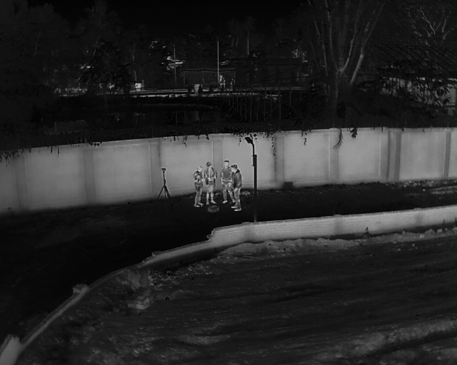
Drones equipped with multi-sensor payloads capture live HD video, thermal imagery, and environmental data.
Using 5G, dedicated radio frequencies, or satellite communication, data streams to ground stations or mobile teams with minimal latency.
Onboard AI systems detect unusual activities, track objects, and provide alerts, reducing monitoring workload.
Live feeds are monitored on secure platforms, enabling fast response or recording for later review and compliance.
Benefits of Our Live Aerial Surveillance
Immediate Situational Awareness
Real-time visuals provide live monitoring of critical zones, allowing rapid detection and response.
24/7 Operation & All-Weather Capability
Equipped for day/night and adverse weather conditions, ensuring continuous coverage.
Enhanced Safety
Remote monitoring reduces the need for personnel in hazardous or inaccessible areas.
Scalable & Versatile
Suitable for security surveillance, disaster management, infrastructure inspection, event monitoring, and law enforcement.
Frequently Asked Questions
Find quick answers about Skyglimps Live Aerial Surveillance, real-time drone monitoring, aerial video feeds, thermal surveillance, AI-enabled analytics, and reporting.
Live Aerial Surveillance is the use of drones to stream real-time aerial video, thermal imagery, and sensor data directly to ground teams, control rooms, or mobile devices. Skyglimps uses drone-based live monitoring to help clients improve situational awareness, track critical areas, and make faster decisions during security, emergency, infrastructure, or operational activities.
Skyglimps deploys drones equipped with multi-sensor payloads to capture live HD video, thermal imagery, and environmental data from the air. The live feed can be transmitted to ground stations, control centres, or mobile teams using communication systems such as 5G, radio frequency, or satellite-based transmission, depending on the project requirement.
Live Aerial Surveillance can be used for security monitoring, crowd management, event surveillance, law enforcement support, disaster response, infrastructure oversight, industrial site monitoring, emergency operations, and remote area observation. It is especially useful for locations where manual patrolling may be slow, unsafe, or difficult.
Drone-based live surveillance provides immediate visibility over large or sensitive areas, supports faster response, reduces the need for personnel in hazardous zones, and improves monitoring efficiency. With aerial coverage, project teams and security teams can detect risks, review live site conditions, track movement, and respond to incidents with better information.
Yes. Skyglimps’ Live Aerial Surveillance solutions can include AI-enabled analytics for detecting unusual activities, tracking objects, and generating alerts. Live feeds can also be recorded and reviewed later for compliance, reporting, investigation, incident analysis, or operational documentation.
Other Related Services
Explore our related services, including 2D Surveying & Mapping for accurate site surveys, 3D LiDAR & GIS Solutions for detailed spatial analysis, Thermal & RGB Inspections for asset and infrastructure assessment, FPV Videography for immersive aerial footage, and Documentation & Progress Tracking for maintaining a clear visual record of project activity and progress.