
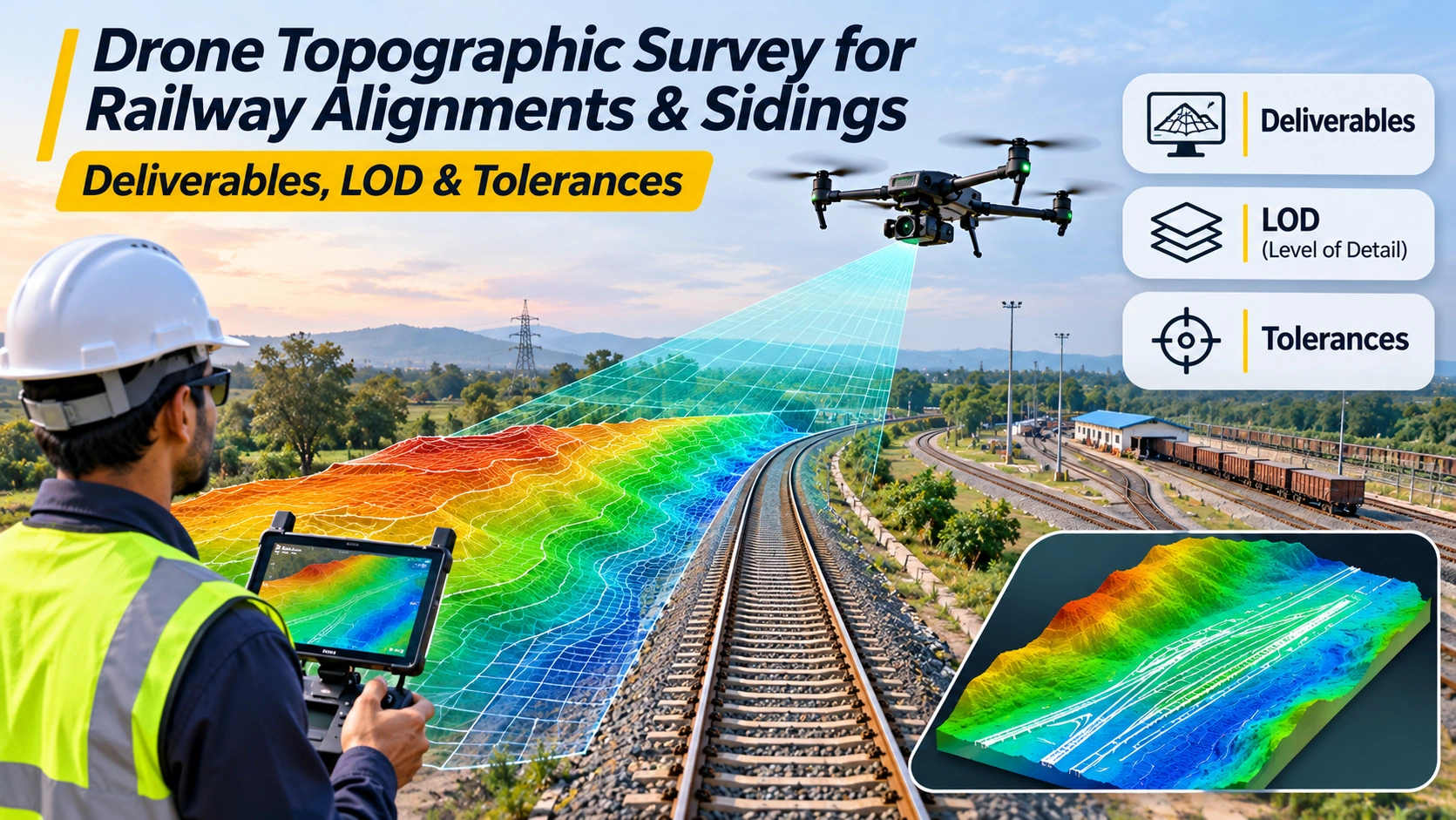
Railway projects require much more than a visual map of the corridor.
Whether the project involves a new railway alignment, doubling, gauge conversion, yard redevelopment, siding, station expansion or infrastructure modification, engineers need reliable information about terrain, existing tracks, structures, utilities, drainage, crossings and surrounding land.
A drone topographic survey for railway projects can capture a large amount of this information efficiently and convert it into measurable 2D and 3D datasets.
But the success of a railway drone survey depends on how the survey is specified.
The important questions are:
- What area needs to be surveyed?
- What features must be captured?
- What accuracy is required?
- What level of detail is appropriate?
- Which deliverables are needed?
- How will accuracy be independently verified?
- Is the survey intended for planning, preliminary engineering or detailed design?
Indian Railways’ Engineering Code distinguishes between reconnaissance, preliminary and Final Location Surveys and specifies progressively more detailed survey information for the latter stages. It also identifies detailed plans, sections, cross-sections, station-yard plans and junction arrangements among the required project outputs.
That makes one principle particularly important:
A railway drone survey should be designed around the engineering decision it needs to support, not simply around the capabilities of the drone.
What Is a Drone Topographic Survey for Railway Projects?
A drone topographic survey uses aerial imagery, LiDAR or a combination of sensors to capture the terrain and visible features along a railway corridor.
The collected data can be processed into:
- Orthomosaic maps
- Digital Elevation Models
- Digital Surface Models
- Digital Terrain Models
- Contours
- Point clouds
- Longitudinal profiles
- Cross-sections
- 3D models
- Alignment reference data
- GIS layers
- CAD-ready outputs
Railway Board’s modern-survey report specifically identifies drone photogrammetry and LiDAR as technologies that can support Railway Preliminary Engineering and Final Location Surveys. It also notes that DEMs can be used to generate alignment drawings, L-sections, cross-sections and yard layouts.
The drone therefore becomes a data-capture platform within a broader engineering survey workflow.
Where Can Drone Topographic Surveys Be Used in Railway Projects?
The application can vary significantly depending on the project stage.
New Railway Alignments
For a proposed railway line, aerial mapping can help teams understand:
- Existing terrain
- Slopes
- Rivers and water bodies
- Roads
- Settlements
- Existing infrastructure
- Vegetation
- Land-use patterns
- Potential construction constraints
The resulting terrain data can support route comparison and preliminary alignment studies.
Doubling Projects
For railway doubling, the survey needs to capture the existing railway and the surrounding corridor.
Important features can include:
- Existing track
- Formation
- Embankments
- Cuttings
- Bridges
- Culverts
- Drainage
- OHE infrastructure
- Signals
- Roads
- Utilities
- Adjacent land
Railway Board’s modern-survey report specifically discusses modern surveying for new lines, gauge conversion and doubling projects.
Railway Sidings
Siding projects can require detailed mapping of the existing yard and surrounding facilities.
Depending on the scope, the survey may need to capture:
- Existing track geometry
- Siding locations
- Turnouts
- Platforms
- Buildings
- Roads
- Drainage
- Utility structures
- Signals
- OHE
- Storage areas
- Loading/unloading facilities
- Boundary features
Station and Yard Redevelopment
Railway Engineering Code provisions for station-yard plans include lines, sidings, platforms, buildings, tanks, signals and other relevant infrastructure within the station-yard boundary.
A drone survey can provide the current spatial reference from which these features can be mapped and coordinated.
What Should a Railway Drone Topographic Survey Capture?
A good survey should begin with a feature inventory.
The exact inventory depends on the project, but a railway corridor may require:
Terrain
- Ground elevations
- Embankments
- Cuttings
- Slopes
- Ridges
- Depressions
- Drainage paths
Railway Infrastructure
- Existing tracks
- Track centreline
- Platforms
- Sidings
- Turnouts
- Level crossings
- Bridges
- Culverts
- Station structures
Electrification and Signalling
Where visible and relevant:
- OHE masts
- Portals
- Gantries
- Signals
- Signal structures
- Cable routes
- Other railway equipment
Railway Board’s modern-survey report specifically notes that LiDAR can be useful for narrow features such as OHE masts and wires, sleepers, rails, power lines and telecom towers.
Surrounding Features
- Roads
- Buildings
- Water bodies
- Canals
- Utilities
- Industrial units
- Trees
- Boundary features
- Adjacent development
The objective is to capture enough surrounding context to allow engineers to understand how the railway interacts with the existing environment.
What Are the Main Deliverables?
A railway survey should not be defined simply as “drone images.”
The deliverables should be specified before fieldwork.
1. Orthomosaic
A georeferenced aerial image providing a detailed top-down view of the railway corridor.
Useful for:
- Site interpretation
- Feature mapping
- Existing-condition documentation
- Design coordination
2. Digital Elevation Model
A terrain-based elevation representation useful for:
- Drainage
- Slope analysis
- Alignment planning
- Earthwork assessment
3. Digital Surface Model
Represents the visible surface, including above-ground features where captured.
4. Point Cloud
A 3D dataset containing spatial points representing terrain and visible objects.
This can support:
- 3D analysis
- Feature extraction
- Measurement
- Engineering coordination
5. Contour Map
Contours show changes in elevation and can support:
- Terrain interpretation
- Drainage studies
- Design
- Earthwork planning
6. Longitudinal Section / L-Section
A profile along the railway alignment showing existing ground and, where applicable, proposed formation information.
Indian Railways’ Engineering Code specifically requires the section to show ground and formation levels and identifies longitudinal levels as part of detailed railway survey documentation.
7. Cross-Sections
Cross-sections can show the terrain perpendicular to the alignment.
They can be useful for:
- Formation design
- Embankment assessment
- Cutting design
- Drainage
- Earthwork quantities
8. CAD/GIS-Ready Data
Depending on the project, outputs can be supplied in formats suitable for:
- CAD
- GIS
- Engineering design
- Spatial analysis
SkyGlimps’ 2D surveying workflow specifically provides topographic maps, orthomosaics and site plans in formats compatible with CAD, GIS and design workflows, and identifies railways among its applications. SkyGlimps 2D Surveying & Mapping
9. Survey Report
The final report should document:
- Survey methodology
- Equipment
- Coordinate system
- Control points
- Checkpoints
- Accuracy assessment
- Processing methodology
- Deliverables
- Limitations
What Does LOD Mean in a Railway Drone Survey?
LOD, or Level of Detail, describes how much information and geometric detail is captured and represented.
However, one important distinction is necessary:
There is no single universal railway drone-survey LOD that applies to every project.
LOD should be defined according to the intended use.
For railway projects, a practical way to frame it is:
LOD for Corridor Planning
The focus is broad spatial understanding.
Typical requirements may include:
- Terrain
- Existing railway
- Roads
- Water bodies
- Major structures
- Land-use features
- Major utilities
The purpose is to compare alternatives and understand corridor constraints.
LOD for Preliminary Engineering
The survey becomes more detailed.
The dataset may need:
- Detailed terrain
- Track centreline
- Embankments
- Cuttings
- Bridges
- Culverts
- Drainage
- Buildings
- Utilities
- OHE structures
- Station areas
LOD for Detailed Design Support
The survey needs to provide a much stronger engineering reference.
It may require:
- Dense point cloud
- Detailed terrain model
- Breaklines
- Accurate feature extraction
- Cross-sections
- L-section
- Track-related geometry
- Detailed structures
- Survey control
- Independent checkpoints
The exact LOD should be written into the project specification instead of relying only on a label such as “LOD 300.”
What Should a Railway Survey LOD Specification Include?
A useful LOD specification should answer several questions.
Feature Completeness
What must be captured?
For example:
Track + OHE + Signals + Drainage + Structures + Roads + Utilities
Spatial Resolution
What GSD, point density or sampling interval is required?
Positional Accuracy
What horizontal and vertical accuracy must the final product achieve?
Elevation Accuracy
How accurately must the terrain be represented?
Feature Size
What is the smallest feature that must be reliably captured?
Deliverable Scale
What mapping or drawing scale will the data support?
Classification
If LiDAR is used, which point classes are required?
QA/QC
How will the final accuracy be independently checked?
This approach makes the LOD meaningful because it connects the survey specification directly to the engineering use.
What Accuracy Is Required for a Railway Drone Survey?
There is no single accuracy number that should automatically be applied to every railway drone survey.
A reconnaissance-level corridor study and a detailed design survey do not necessarily need the same accuracy.
Railway Board’s modern-survey report makes the same broader distinction: preliminary studies can have lower accuracy requirements, while Final Location Surveys require highly accurate data for advanced studies.
The survey specification should therefore define:
- Horizontal accuracy
- Vertical accuracy
- Relative accuracy
- Absolute accuracy
- Checkpoint methodology
- Coordinate reference system
- Vertical datum
For high-accuracy drone photogrammetry, Railway Board’s modern-survey report notes that RTK/PPK and GCPs can be used to achieve high absolute accuracy and that the final result depends on hardware, flight parameters, processing and control.
What Are Survey Tolerances?
A survey tolerance defines the acceptable difference between the measured result and the required reference.
For example, a project specification may define an allowable positional or elevation error for a particular survey output.
But survey tolerance should not be confused with track geometry tolerance.
These are different concepts.
Survey Accuracy
Answers:
“How accurately did we measure the existing environment?”
Track Geometry Tolerance
Answers:
“How much deviation from the specified railway track geometry is acceptable for a particular operational or maintenance context?”
Indian Railways has separate track-geometry standards and maintenance/service tolerances for parameters such as alignment, gauge, unevenness and twist. These should not be substituted for the accuracy specification of a drone topographic survey.
This distinction is critical when preparing a railway survey specification.
How Should Railway Drone Survey Accuracy Be Verified?
Accuracy should be demonstrated through independent quality control.
A professional workflow can include:
Survey Control → Drone Capture → Processing → Independent Checkpoints → Accuracy Calculation → Final Report
Ground control points may be used to constrain the survey.
Independent checkpoints can then be used to test the final product.
USGS guidance notes that GCP accuracy and distribution influence UAS data quality, while independent checkpoints provide a way to validate the resulting dataset.
For railway corridors, checkpoints should be positioned so that they provide meaningful coverage of the survey area rather than being concentrated in one convenient location.
RTK, PPK or GCPs: Which Should a Railway Survey Use?
There is no universal answer.
RTK
RTK can provide corrected positioning during flight.
It can be useful when:
- Real-time corrections are available
- The site supports reliable GNSS correction
- Efficient field operations are important
PPK
PPK applies positioning corrections after the flight.
It can be useful when:
- Real-time correction links may be unreliable
- Post-processing is acceptable
- A suitable reference dataset is available
GCPs
Ground Control Points provide surveyed ground coordinates that can constrain the model.
They are particularly valuable when:
- High absolute accuracy is required
- The project has demanding survey specifications
- Existing control needs to be incorporated
The Strongest Approach for Demanding Projects
For higher-confidence work, a combination may be appropriate:
RTK/PPK + Selected GCPs + Independent Checkpoints
The final configuration should be based on the project’s accuracy requirement and site conditions.
Photogrammetry or LiDAR for Railway Alignments?
Both technologies can be useful, but they solve slightly different problems.
Drone Photogrammetry
Useful for:
- Orthomosaics
- Visual mapping
- Open corridors
- Topographic mapping
- 3D reconstruction
- General site documentation
Drone LiDAR
Useful when the project requires:
- Dense 3D point clouds
- Vegetation filtering
- Detailed terrain
- Complex terrain
- Narrow infrastructure
- OHE and utility feature modelling
Railway Board’s modern-survey report notes that LiDAR can model narrow objects such as OHE masts and wires, rails and sleepers, and can also provide terrain information in vegetated environments.
For difficult railway corridors, a hybrid approach can be particularly effective:
Drone Photogrammetry + LiDAR + Ground Survey
Why Is Ground Survey Still Important?
A drone does not eliminate the need for conventional surveying.
Ground survey can remain important for:
- Benchmarks
- Control points
- Checkpoints
- Legal boundaries
- Precise setting-out
- Verification
- Engineering control
Indian Railways’ Engineering Code continues to specify ground-based survey requirements for detailed railway location work, including centreline marking, benchmarks and detailed plans and sections.
The most effective modern workflow is therefore often integrated surveying, not “drone instead of survey.”
What Makes Railway Siding Surveys More Complex?
Siding and yard environments are usually more feature-dense than a simple open railway corridor.
A siding survey may need to distinguish:
- Multiple tracks
- Turnouts
- Platforms
- Buildings
- Loading areas
- Signals
- OHE
- Drainage
- Roads
- Utilities
- Boundary walls
- Existing industrial infrastructure
Railway Engineering Code provisions for station-yard plans specifically call for detailed representation of lines, sidings, platforms, buildings, signals and other infrastructure.
This means the survey specification should focus not only on terrain accuracy but also on feature completeness and correct identification.
What Should Be Included in a Railway Siding Survey Deliverable?
A typical project-specific deliverable package could include:
| Deliverable | Purpose |
|---|---|
| Orthomosaic | Existing-condition reference |
| Point cloud | 3D measurement and modelling |
| DEM/DTM | Ground and terrain analysis |
| DSM | Surface and structure representation |
| Contours | Elevation interpretation |
| Track/feature layers | Existing infrastructure mapping |
| L-section | Longitudinal terrain/profile analysis |
| Cross-sections | Formation and earthwork review |
| Yard plan | Track and facility coordination |
| CAD/GIS data | Engineering/design integration |
| Accuracy report | QA/QC and verification |
| Survey report | Methodology and documentation |
The actual list should be agreed before the survey begins.
What About Railway Corridor Width?
The survey width should be defined by the project requirement rather than using one fixed drone-survey width for every railway project.
Indian Railways’ Engineering Code specifies particular corridor extents for detailed plans and additional features, while the exact scope can vary by survey stage and project. For example, detailed plans call for topographical detail within 100 metres on either side of the centre line, with certain additional features extending farther.
For a modern drone survey, the project team should therefore specify:
- Centreline corridor width
- Additional survey areas
- Station/yard boundaries
- Bridge approaches
- Junction areas
- Utility corridors
- Land-acquisition areas
This prevents under-capture of information outside the immediate track corridor.
How Does Drone Survey Data Support Railway Alignment Design?
A properly processed terrain dataset can help engineers evaluate:
- Existing ground profile
- Alternative alignments
- Gradients
- Curves
- Cuttings
- Embankments
- Drainage
- Crossings
- Bridges
- Earthwork requirements
Railway Board’s modern-survey report specifically states that DEM-based workflows can support alignment drawings, longitudinal sections, cross-sections and yard layouts.
The drone therefore contributes to the engineering workflow by providing a spatially consistent base dataset.
It does not independently decide the final railway alignment.
What Are Common Errors in Railway Drone Topographic Surveys?
Several problems can reduce the usefulness of the final dataset.
Insufficient Corridor Coverage
Important features outside the immediate flight area may be missed.
Poor Ground Control
Incorrect or poorly distributed control can affect absolute accuracy.
Weak Vertical Control
Vertical errors can be particularly important for railway design because gradients, formation levels and drainage depend heavily on elevation.
Poor Image Geometry
Insufficient overlap, excessive flight height or unsuitable flight paths can affect photogrammetric reconstruction.
Vegetation Occlusion
Dense vegetation can hide ground surfaces from image-based methods.
Narrow Features
Rails, wires and OHE components can be difficult to represent reliably with ordinary imagery, particularly where feature width is small relative to the image resolution.
Incorrect Classification
For LiDAR projects, poor ground/non-ground classification can affect terrain models.
Poor QA/QC
A visually attractive map does not prove that it meets the required engineering accuracy.
What Should the Final QA/QC Report Show?
A professional railway survey should make the quality of the dataset traceable.
The report can include:
Control Information
- GCP coordinates
- Benchmark references
- RTK/PPK methodology
- Coordinate system
- Vertical datum
Checkpoint Results
- Checkpoint ID
- Surveyed coordinate
- Derived coordinate
- Horizontal difference
- Vertical difference
- RMSE
Data Quality
- GSD
- Point density
- Image overlap
- Coverage
- Data gaps
Processing
- Software
- Processing methodology
- Classification
- Breaklines
- Surface-generation method
Limitations
- Vegetation
- Occlusions
- Restricted areas
- Weather
- GNSS limitations
- Areas requiring ground verification
This gives the engineer a much clearer understanding of what the survey can and cannot support.
Does a 5 cm Survey Automatically Mean 5 cm Accuracy?
No.
Resolution, GSD, point spacing and positional accuracy are related but different concepts.
A 5 cm pixel size does not automatically mean that every mapped feature is positioned within 5 cm.
USGS guidance specifically notes that UAS data accuracy is not directly determined by GSD and depends on control, checkpoints and the overall survey methodology.
Railway Board’s 2026 DPR format for ROB/RUB works, for example, specifies drone/LiDAR survey at 5 cm resolution or better for that particular application. This is an example of a project-specific specification, not a universal tolerance for all railway drone surveys.
The project specification should therefore separately define:
Resolution + Accuracy + Coverage + Feature Completeness + QA/QC
How Should a Railway Drone Survey Be Specified Before the Flight?
A strong scope of work should include at least:
- Project purpose
- Survey limits
- Existing railway infrastructure to be captured
- Required accuracy
- Required resolution/GSD or point density
- Coordinate reference system
- Vertical datum
- Control and checkpoint methodology
- Required L-section
- Required cross-sections
- Contour interval
- Required CAD/GIS formats
- Required point-cloud classification
- Required report
- QA/QC requirements
- Areas requiring conventional survey verification
This is far more useful than a scope simply stating:
“Conduct drone survey and provide topographic map.”
How Can SkyGlimps Support Railway Topographic Surveys?
SkyGlimps provides drone-based surveying and mapping services for infrastructure projects, including railway applications.
Its 2D Surveying & Mapping workflow can produce orthomosaics, topographic maps and site plans, with outputs designed for CAD, GIS and project workflows. The service specifically lists railways and transportation among its application areas. Explore SkyGlimps 2D Surveying & Mapping
For projects requiring more advanced three-dimensional information, LiDAR can also be incorporated for terrain modelling, point clouds and complex infrastructure mapping.
The appropriate workflow can be selected based on:
- Railway project stage
- Corridor length
- Terrain
- Vegetation
- Existing infrastructure
- Required accuracy
- Required LOD
- Final engineering deliverables
Frequently Asked Questions
A drone topographic survey for railway projects uses aerial imagery or LiDAR to capture terrain, tracks, structures, utilities and surrounding features and convert them into measurable survey outputs such as orthomosaics, DEMs, point clouds, contours, profiles and CAD/GIS data.
Depending on the project stage, deliverables can include an orthomosaic, point cloud, DEM/DTM, DSM, contours, longitudinal section, cross-sections, yard plans, CAD/GIS layers, survey report and accuracy report. Final requirements should be defined in the project scope.
LOD refers to the amount of geometric and feature detail captured and represented in the survey. A planning survey may need broad corridor information, while detailed engineering may require dense point clouds, detailed infrastructure mapping, cross-sections and stronger accuracy validation.
There is no single universal accuracy requirement for every railway survey. The required accuracy depends on whether the work is reconnaissance, preliminary engineering, Final Location Survey, siding development, yard redevelopment or detailed design support.
No. Drones can significantly improve data capture and provide dense spatial information, but ground survey remains important for benchmarks, control, checkpoints, setting-out, legal boundaries and engineering verification.
Neither is universally better. Photogrammetry is effective for visual mapping and open corridors, while LiDAR can be advantageous for dense vegetation, complex terrain and narrow infrastructure such as OHE and other structures. The choice should follow the project requirements.
Yes. Drone surveys can map existing tracks, sidings, turnouts, buildings, platforms, OHE, signals, roads, drainage and surrounding infrastructure, subject to the required survey scope and site permissions.
Getting Railway Survey Accuracy Right From the Start
A railway drone survey should never be defined simply by the drone, camera or LiDAR sensor being used.
The real quality of the project comes from the complete workflow:
Scope → Survey Design → Control → Data Capture → Processing → Feature Extraction → QA/QC → Engineering Deliverables
For railway alignments, the survey must provide enough information for engineers to understand the terrain and existing infrastructure.
For sidings and yards, feature completeness becomes just as important as terrain accuracy.
For detailed engineering, absolute accuracy and independent verification become critical.
And for every project, LOD and tolerances should be explicitly defined instead of assuming that a particular drone specification automatically guarantees a particular engineering result.
Indian Railways already recognises modern survey technologies such as drone photogrammetry and LiDAR as useful tools for railway project surveys, while its Engineering Code continues to define the detailed survey information required for alignment, plans, sections, station yards and related works.
The strongest approach is therefore not:
“Drone versus conventional survey.”
It is:
“Use the right combination of aerial capture, LiDAR/photogrammetry, ground control and conventional verification to meet the project’s actual engineering requirement.”
When the survey is specified this way, the final dataset becomes more than an aerial map.
It becomes a reliable engineering foundation for alignment planning, siding development, yard design, earthwork assessment, drainage studies, infrastructure coordination and railway project decision-making.