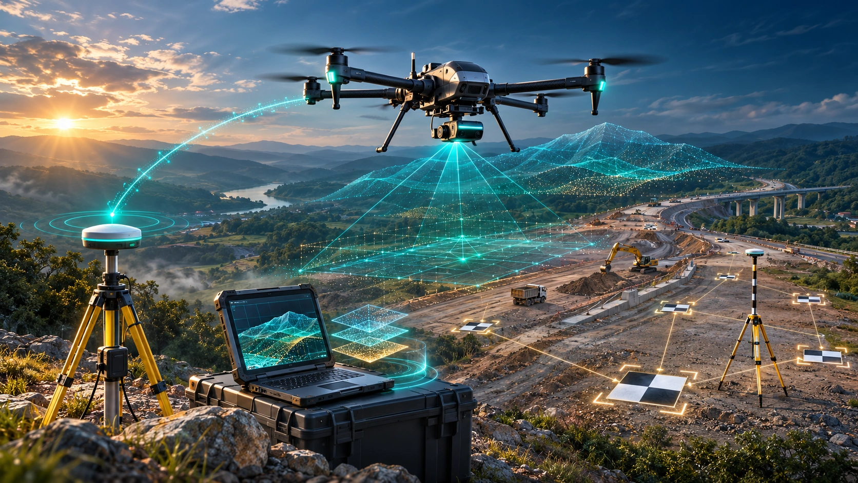
RTK, PPK and Ground Control Points are often presented as three competing ways to make drone surveys more accurate.
But that comparison can be misleading.
RTK and PPK primarily improve how the drone’s images are georeferenced, while GCPs provide surveyed points that can anchor the photogrammetric model to known ground coordinates.
The final absolute accuracy depends on much more than choosing one of these methods.
It is affected by:
- Quality of the positioning or ground control
- Coordinate reference system
- GCP distribution
- Image quality
- Camera calibration
- Flight height and geometry
- Image overlap
- Terrain
- Processing
- Independent checkpoints
- Overall quality-control procedures
Pix4D defines absolute accuracy as how closely a mapped feature corresponds to its true position in the chosen reference frame. It also notes that absolute accuracy is strongly dependent on image geolocation and/or GCP accuracy.
So, when comparing RTK vs PPK vs GCP drone survey workflows, the better question is not simply:
“Which one is most accurate?”
It is:
“Which combination gives the project the required accuracy and allows that accuracy to be independently verified?”
What Is Absolute Accuracy in Drone Surveying?
Absolute accuracy describes how closely the coordinates in the final survey match their true positions in the real world.
For example, suppose a building corner has a known surveyed coordinate.
If the drone-derived model places that corner very close to its known coordinate, the dataset has good absolute accuracy.
This is different from relative accuracy.
Relative accuracy concerns the relationship between features inside the model.
A model can have:
- Good internal geometry
- Correct distances between objects
- Detailed 3D surfaces
while still being shifted several centimetres or metres from its true geographic position.
That distinction is critical for applications such as:
- Topographic surveys
- Construction
- Infrastructure mapping
- Road surveys
- Volume calculations
- GIS
- Engineering
- As-built documentation
What Is RTK in Drone Surveying?
RTK stands for Real-Time Kinematic.
An RTK drone receives positioning corrections during the flight from a reference source such as an RTK base station or correction network.
Instead of relying only on the drone’s standard GNSS positioning, the system uses correction information to improve the position recorded for each image.
This can reduce the need for extensive GCP-based georeferencing in suitable projects.
However, RTK does not automatically make the final photogrammetric model survey-grade.
The positioning solution must be reliable, the camera system must be properly calibrated and the imagery still needs to provide strong photogrammetric geometry.
Pix4D notes that RTK/PPK image geolocation can significantly improve absolute accuracy, but the final result is still limited by the quality of the image reconstruction and positioning information.
When Is RTK Useful?
RTK can be particularly useful when:
- Real-time corrections are available
- The correction link is stable
- The project requires accurate image positioning
- Reducing the number of GCPs is desirable
- The survey area is suitable for RTK operation
However, obstructions or loss of the RTK-fixed solution can affect results. Comparative testing by Pix4D found cases where RTK performance was affected by correction-link interruptions, while PPK provided a more consistent post-processed solution.
What Is PPK in Drone Surveying?
PPK stands for Post-Processed Kinematic.
The principle is similar to RTK, but the positioning corrections are processed after the flight rather than being relied upon entirely in real time.
The drone records GNSS observations during the mission. These observations are later processed with data from a reference station or correction service.
The result is corrected image-position information that can be used during photogrammetric processing.
Why Can PPK Be Useful?
PPK can be advantageous when:
- Real-time correction links are unreliable
- The survey area has communication obstructions
- The aircraft cannot maintain a continuous correction connection
- Post-processing is acceptable
- A robust GNSS workflow is required
USGS describes PPK as a method in which rover and reference-receiver observations are collected simultaneously and processed after the survey.
The important point is that PPK is not inherently a guarantee of better final accuracy than RTK.
Both are positioning techniques.
The quality of the final survey depends on the complete workflow.
What Are GCPs in Drone Surveying?
Ground Control Points (GCPs) are clearly identifiable points on the ground whose coordinates have been accurately surveyed.
They are visible in the drone imagery and are introduced into the photogrammetric processing workflow.
The software can use these known coordinates to constrain and georeference the model.
GCPs can therefore directly connect the reconstructed model to known ground coordinates.
USGS guidance notes that the accuracy and spatial distribution of GCPs play an important role in UAS data accuracy.
Why Does GCP Distribution Matter?
Imagine a large survey area with all control points concentrated in one corner.
The model may be strongly constrained in that area but less effectively constrained elsewhere.
GCPs should therefore be distributed across the survey area and, where appropriate, across different elevations.
USGS guidance specifically recommends considering both horizontal and vertical distribution of GCPs.
This is why simply saying “we used 10 GCPs” does not tell you whether the survey was well controlled.
The important questions are:
Where were they placed?
How accurately were they surveyed?
How were they used?
Were independent checkpoints collected?
RTK vs PPK vs GCP: What Is the Actual Difference?
| Method | Main Function | When It Helps | Main Limitation |
|---|---|---|---|
| RTK | Provides corrected image positions in real time | Efficient georeferencing during flight | Can be affected by correction-link or positioning issues |
| PPK | Provides corrected image positions after processing | Useful when real-time correction is unreliable | Requires reliable post-processing and reference data |
| GCPs | Anchors the model to surveyed ground coordinates | Strong absolute control and validation | Requires field survey and target placement |
| Checkpoints | Independently tests final accuracy | Verifies actual model accuracy | Does not itself correct the model |
This last distinction is particularly important.
GCPs help control the model. Checkpoints help prove how accurate the model actually is.
Does RTK Make GCPs Unnecessary?
Not always.
RTK can reduce dependence on GCPs, particularly for well-designed projects where the positioning solution is reliable.
But removing GCPs does not remove the need for quality control.
A survey can use:
RTK/PPK + Independent Checkpoints
instead of a traditional workflow with many GCPs.
Alternatively, a higher-confidence project may use:
RTK/PPK + Selected GCPs + Independent Checkpoints
The right configuration depends on:
- Required accuracy
- Site size
- Terrain
- Drone system
- Camera
- Survey specification
- Risk level
- Project budget
- Ability to access the site
Pix4D recommends using checkpoints to assess the absolute accuracy of a model rather than relying only on the drone’s positioning information.
Why Can GCPs Still Be Valuable With an RTK or PPK Drone?
Because the aircraft’s position is only one part of the error budget.
A photogrammetric model can still be affected by:
- Camera calibration
- Lens characteristics
- Image blur
- Wind-induced movement
- Poor overlap
- Terrain geometry
- Processing errors
- Incorrect coordinate systems
- Weak image matching
Propeller Aero similarly notes that RTK/PPK improves positioning in the air but does not automatically guarantee equivalent ground accuracy, because other factors such as turbulence, vibration and camera calibration can affect the final model.
This is why GCPs can still be useful as a strong external constraint.
What Actually Drives Absolute Accuracy?
There are several layers.
1. The Accuracy of the Reference
Everything starts with the coordinate reference.
If the GCP coordinates or GNSS reference are inaccurate, the final model cannot magically become more accurate.
USGS notes that remote-sensing data cannot be more accurate than the ground control used to establish or validate it.
2. Control-Point Distribution
Correctly surveyed points need to be distributed appropriately.
A large site with poorly distributed control can have uneven accuracy even if the individual points are highly accurate.
3. Image Quality
Sharp images with sufficient detail produce better photogrammetric reconstruction.
Problems such as:
- Motion blur
- Poor lighting
- Reflections
- Low-texture surfaces
- Excessive shadows
can reduce reconstruction quality.
4. Flight Geometry
Flight altitude, overlap and camera geometry affect the quality of the 3D reconstruction.
USGS specifically identifies flight configuration, flying height, overlap and related acquisition parameters as important components of UAS data accuracy.
5. Camera Calibration
A highly accurate GNSS position does not compensate for a poorly calibrated camera model.
The photogrammetric software needs to correctly model how the camera forms the image.
6. Terrain and Surface Characteristics
Flat, textured ground may be relatively easy to reconstruct.
Complex environments can be more challenging:
- Tall vegetation
- Reflective surfaces
- Water
- Repetitive structures
- Steep terrain
- Vertical walls
7. Processing Quality
The final model depends on:
- Image alignment
- Tie points
- Camera optimisation
- GCP marking
- Point-cloud generation
- Surface filtering
- Coordinate transformation
Processing errors can affect the final result even when field data is excellent.
Why Are Checkpoints So Important?
A checkpoint is a surveyed point that is not used to control the model.
Instead, its known coordinate is compared against the coordinate produced by the drone survey.
This provides an independent accuracy test.
For example:
Known checkpoint position → Compare → Drone-derived position → Calculate error
This is much stronger evidence than simply reporting the expected accuracy of the drone’s GNSS receiver.
Recent USGS UAS datasets use independently surveyed checkpoints to evaluate the positional accuracy of orthomosaics and elevation products.
For projects where accuracy matters commercially or contractually, independent checkpoints should therefore be considered part of the QA/QC strategy.
Is GSD the Same as Survey Accuracy?
No.
Ground Sampling Distance, or GSD, describes the ground size represented by each image pixel.
A smaller GSD generally provides more image detail.
But a 2 cm GSD does not automatically mean that the final survey has 2 cm absolute accuracy.
USGS specifically cautions that UAS data accuracy is not simply determined by image GSD; control accuracy, calibration and data acquisition all matter.
A project can have:
Very high-resolution imagery + Poor georeferencing = Poor absolute accuracy
or:
Moderate-resolution imagery + Strong control + Good processing = Fit-for-purpose survey accuracy
The correct GSD should therefore be selected according to the project’s actual requirements.
What Is the Best Method: RTK, PPK or GCP?
There is no universal winner.
Choose RTK When:
- Real-time correction is available
- The project benefits from efficient field operations
- The RTK solution is reliable
- The site supports the correction workflow
Choose PPK When:
- Real-time corrections may be interrupted
- Post-processing is acceptable
- A reliable reference dataset is available
- Greater flexibility during flight is useful
Choose GCPs When:
- Strong external control is required
- The project has demanding absolute-accuracy requirements
- Existing survey control needs to be incorporated
- The site or environment makes onboard positioning less reliable
Consider Combining Methods When:
The project is high-value or requires stronger verification.
A practical high-confidence workflow can be:
RTK/PPK for image positioning + Selected GCPs for control + Independent checkpoints for validation
The exact configuration should be determined by the survey specification rather than by a generic rule.
Which Method Is Best for Construction Surveys?
Construction projects often need both accurate positioning and repeatability.
Applications can include:
- Site grading
- Topographic surveys
- Progress monitoring
- Cut-and-fill
- Stockpile measurement
- As-built documentation
- Earthwork calculations
For these projects, the ability to compare datasets from different dates can be as important as the accuracy of one individual flight.
A consistent coordinate reference system and repeatable control strategy therefore matter.
For projects requiring aerial topographic mapping and structured survey outputs, SkyGlimps’ 2D Surveying & Mapping service provides drone-based mapping workflows for generating orthomosaics, topographic maps and site plans.
What Should a Professional Drone Survey Accuracy Report Include?
A good accuracy report should explain how the accuracy was established, rather than simply stating a number.
It can include:
Survey Method
- Drone
- Camera
- RTK/PPK configuration
- GCP methodology
Reference Information
- Coordinate system
- Vertical datum
- GNSS reference
- Control survey method
Data Acquisition
- Flight altitude
- GSD
- Image overlap
- Survey area
- Date and conditions
Quality Control
- GCP residuals
- Checkpoint coordinates
- Horizontal RMSE
- Vertical RMSE
- Maximum observed errors
- Areas with known limitations
Processing
- Software
- Processing workflow
- Coordinate transformations
- Surface-generation methodology
This makes the final dataset more transparent and easier for another professional to evaluate.
What Errors Can Still Occur With RTK or PPK?
Even with an RTK or PPK drone, errors can come from:
- Incorrect base-station coordinates
- Poor correction data
- RTK float solutions
- Loss of correction link
- GNSS multipath
- Poor satellite geometry
- Camera calibration
- Image blur
- Wind
- Insufficient overlap
- Weak image matching
- Incorrect processing settings
Therefore, the statement:
“This is an RTK drone, so the survey is centimetre accurate.”
is incomplete.
The correct approach is to evaluate the entire measurement chain.
How Should You Choose an RTK, PPK or GCP Workflow?
Start with the project specification.
Ask:
What accuracy is actually required?
A preliminary site map and a construction staking dataset do not necessarily have the same requirements.
What coordinate system must the survey use?
The final dataset must be correctly tied to the required horizontal and vertical reference.
How accessible is the site?
If placing GCPs is difficult or hazardous, RTK/PPK may provide operational advantages.
What are the site conditions?
Tall structures, vegetation, obstructions and difficult GNSS environments may influence the preferred method.
How will accuracy be verified?
A method without independent validation can make it difficult to demonstrate the actual achieved accuracy.
What deliverables are required?
Orthomosaics, DSMs, contours, point clouds and CAD/GIS outputs may have different quality requirements.
Why Is There No Single “Most Accurate” Drone Survey Method?
Because accuracy is a system property, not a feature that belongs to one technology.
Consider two projects.
Project A
- Excellent RTK positioning
- Poor image overlap
- Strong wind
- Weak camera calibration
- No independent checkpoints
Project B
- Good PPK positioning
- Well-distributed control
- Strong image overlap
- Proper camera calibration
- Independent checkpoints
- Strong QA/QC
Project B could produce a more defensible survey even though it does not rely on the same positioning workflow.
That is the key lesson when comparing RTK vs PPK vs GCP drone survey methods.
The strongest workflow is the one that controls and verifies the major sources of error.
Frequently Asked Questions
RTK provides corrected drone positioning during flight, PPK corrects positioning after the flight, and GCPs are surveyed ground points used to constrain and georeference the photogrammetric model.
Neither is universally more accurate. Both can provide highly accurate image positioning when properly implemented. Site conditions, correction quality, reference data, camera quality and photogrammetric processing determine the final result.
Yes, depending on the project requirements and the reliability of the RTK workflow. However, independent checkpoints can still be used to verify the resulting absolute accuracy.
No. GCPs can strongly improve georeferencing, but their own accuracy, distribution, image quality, camera calibration, flight design and processing also affect the final result.
For demanding projects, a strong approach can be RTK or PPK positioning combined with appropriately surveyed control and independent checkpoints. The exact setup should be based on the project’s accuracy specification and site conditions.
What Actually Makes a Drone Survey Accurate?
The debate around RTK vs PPK vs GCP drone survey methods often focuses too heavily on which technology is the winner.
In reality, there is no single button that creates absolute accuracy.
A reliable survey is built through a chain:
Accurate Reference → Reliable Positioning → Good Control → Strong Flight Geometry → High-Quality Imagery → Correct Processing → Independent Validation
RTK can provide accurate image positions in real time.
PPK can provide corrected positions through post-processing.
GCPs can anchor the model to surveyed ground coordinates.
Checkpoints can then provide independent evidence of how accurately the final model matches reality.
The most important principle is therefore:
Do not confuse the accuracy of the drone’s positioning system with the accuracy of the final survey product.
For professional surveying, the final deliverable should be evaluated as a complete measurement system.
When the reference framework, control, flight planning, imagery, processing and QA/QC are properly designed, RTK, PPK and GCP-based workflows can all produce highly useful survey data.
The best method is ultimately the one that is appropriate for the site’s conditions, meets the project’s accuracy requirement and can demonstrate that accuracy through independent quality control.