
Measuring the volume of coal, fly ash, aggregates, minerals and other bulk materials is an important part of mining, power generation, construction and industrial operations.
Traditional stockpile surveys can require extensive ground measurements and physical access around or over material piles. Drone surveying provides an alternative by capturing aerial imagery and converting it into detailed three-dimensional surface data.
A professional drone stockpile volume measurement workflow generally follows:
Survey Planning → Ground Control/RTK/PPK → Drone Data Capture → Photogrammetry → 3D Surface Model → Boundary & Base Definition → Volume Calculation → QA/QC → Reporting
The same approach can be adapted for exposed fly-ash stockpiles and certain ash-pond surveying applications.
However, the accuracy of the final volume is not determined by the drone alone.
Factors such as GCP placement, positioning accuracy, image quality, flight planning, stockpile boundaries, surface modelling and the definition of the underlying base can all affect the result.
Research reviewing UAV-based stockpile surveys has found that many studies report volumetric errors in the range of approximately 0–3%, while some projects have reported considerably higher errors. These figures demonstrate that drone surveying can be accurate, but they should never be treated as a guaranteed accuracy level for every site.
What Is Drone Stockpile Volume Measurement?
Drone stockpile volume measurement is the process of using aerial data to create a three-dimensional representation of a stockpile and calculate the volume between its measured surface and an appropriate reference or base surface.
The drone normally captures overlapping images using an RGB camera.
Photogrammetry software then processes those images to generate:
- A point cloud
- Digital Surface Model (DSM)
- Orthomosaic
- 3D surface
- Contours
- Other survey outputs
The volume calculation can then be represented as:
Stockpile Surface − Reference/Base Surface = Calculated Volume
The accuracy of the final number depends heavily on how both surfaces are created and defined.
This is particularly important because the drone can observe the top of the stockpile, but it cannot directly see the original ground underneath the material.
Why Are Drones Used for Stockpile Surveys?
Drones can provide several practical advantages for large stockyards and material storage areas.
Faster Data Collection
A planned aerial survey can cover a large stockyard without requiring surveyors to manually measure hundreds of points.
Reduced Physical Access
Personnel can collect much of the surface information without climbing steep or unstable stockpiles.
Detailed 3D Information
Photogrammetry can create dense point clouds and surface models suitable for volumetric calculations.
Repeatable Monitoring
The same site can be surveyed periodically to compare stock levels and material movement.
Visual Documentation
The orthomosaic and 3D model provide visual evidence alongside the calculated volume.
A review of stockpile-survey research identifies drone photogrammetry as a faster and safer approach for many outdoor stockpile and earthwork applications.
In India, CMPDI has also documented UAV-based photogrammetric workflows for coal stock measurement, including PPK-enabled drones, DGPS control and defined GCP configurations.
How Does Drone Stockpile Volume Measurement Work?
A typical professional workflow can be divided into several stages.
Step 1: Define the Survey Area
The survey team first identifies:
- Stockpile boundaries
- Site limits
- Material types
- Required accuracy
- Required outputs
- Coordinate system
- Existing survey control
For multiple stockpiles, each pile should be clearly identified before processing.
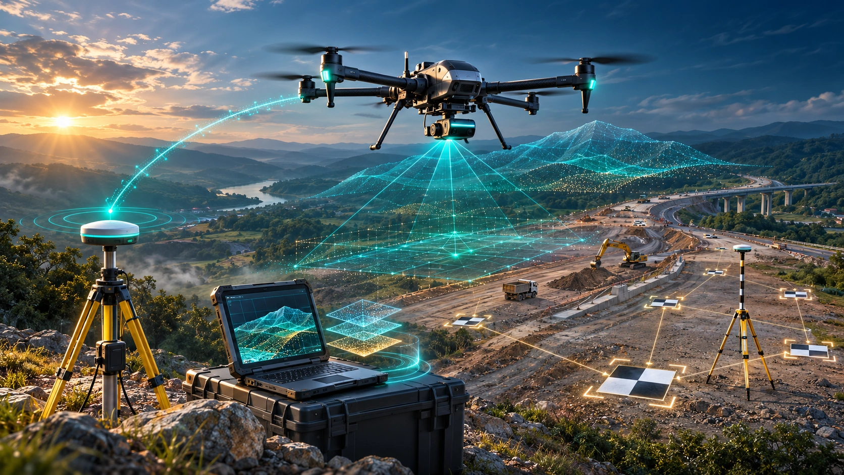
Step 2: Establish Ground Control
Ground Control Points can be positioned around and, where practical, on the stockpile area.
The points provide known spatial references that help align the photogrammetric model with the required coordinate system.
USGS guidance notes that the positioning and accuracy of GCPs play an important role in the overall accuracy of UAS data.
CMPDI’s current documented coal-stock workflow uses PPK-enabled drones and DGPS instruments and establishes GCPs around and on the coal heap according to its specified methodology.
Step 3: Plan the Flight
The flight plan should be designed around:
- Required GSD
- Stockpile height
- Site dimensions
- Image overlap
- Camera characteristics
- Wind conditions
- Obstructions
- Required accuracy
For complex piles, additional flight paths or suitable oblique imagery may help capture steep slopes and edges.
Step 4: Capture Aerial Images
The drone captures overlapping photographs covering:
- Stockpile top
- Slopes
- Toe
- Surrounding ground
- Relevant site features
Adequate image overlap is essential for reliable image matching and 3D reconstruction.
Step 5: Generate the Point Cloud
Photogrammetry software identifies common features between overlapping photographs and reconstructs their three-dimensional positions.
The workflow becomes:
Images → Alignment → Dense Point Cloud → Surface Model
Step 6: Define the Stockpile Boundary
The perimeter of the material pile is identified.
This is a critical step because even a small boundary error can affect the final volume.
Step 7: Define the Reference Surface
The survey team determines what surface represents the base of the stockpile.
Depending on the site, this could be:
- Existing ground
- A surveyed base
- Previous terrain data
- A fitted plane
- Another agreed reference surface
Step 8: Calculate the Volume
The software calculates the volume between the stockpile surface and the selected reference surface.
The final output can be provided for individual stockpiles or the complete site.
What Affects Drone Stockpile Survey Accuracy?
Accuracy is influenced by the entire survey workflow rather than one piece of equipment.
The main factors include:
- Drone positioning
- GCP accuracy
- RTK/PPK performance
- Flight altitude
- GSD
- Image overlap
- Camera quality
- Motion blur
- Lighting
- Surface texture
- Stockpile geometry
- Boundary definition
- Base-surface selection
- Processing settings
- QA/QC
A 2025 study on UAV-based coal stockpile volume estimation specifically identified image quality, grid size, GCP placement and flight altitude as factors affecting volume-estimation accuracy.
This is why a professional survey should be designed around the required accuracy before the drone takes off.
How Do GCPs Affect Volume Accuracy?
Ground Control Points provide known reference positions that help constrain the photogrammetric model.
Poorly distributed or inaccurately surveyed GCPs can create errors in the resulting surface.
For example, placing control points only on one side of a large stockpile may not provide the same level of control as distributing them appropriately around the survey area.
A published stockpile study found that major local errors were associated with non-uniform GCP distribution and recommended fixed targets distributed around the area and boundary.
The important principle is:
More GCPs are not automatically better. Correctly surveyed and appropriately distributed control is what matters.
The number and arrangement should be determined according to the project methodology and required accuracy.
Can RTK or PPK Replace GCPs?
RTK and PPK can significantly improve drone positioning, but they should not automatically be treated as a universal replacement for all ground control.
The appropriate workflow depends on:
- Drone system
- Survey specification
- Required accuracy
- Site conditions
- Existing control
- QA/QC requirements
A professional project may use:
RTK/PPK + GCPs + Independent Checkpoints
This can provide both strong positioning and independent verification.
For example, CMPDI’s documented coal-stock workflow uses PPK-enabled drones alongside DGPS-based control rather than relying on the drone positioning system alone.
How Does GSD Affect Stockpile Measurement?
GSD, or Ground Sampling Distance, represents the ground area covered by each image pixel.
A smaller GSD generally means finer spatial detail.
For stockpile surveys, GSD can influence the ability to represent:
- Small surface changes
- Stockpile edges
- Slopes
- Fine surface features
- Boundaries
However, simply choosing the smallest possible GSD is not always necessary.
The appropriate GSD depends on:
- Stockpile size
- Required accuracy
- Camera
- Flight altitude
- Processing requirements
- Project budget
The goal should be fit-for-purpose resolution, not maximum resolution regardless of cost.
How Does Image Overlap Affect Accuracy?
Photogrammetry requires common features to appear in multiple photographs.
If image overlap is insufficient, the software may struggle to reconstruct parts of the stockpile accurately.
Poor overlap can result in:
- Gaps
- Weak image matching
- Distorted areas
- Noisy point clouds
- Incomplete surfaces
Complex or steep stockpiles may require careful planning because the visible geometry can change significantly across the pile.
A research study on UAV stockpile measurement specifically used high image overlap to maintain sufficient stereo information across changing stockpile surfaces.
How Can Lighting and Shadows Create Errors?
Photogrammetry relies on identifying visual features in photographs.
Strong or changing shadows can make the same surface look different between images.
Potential problems include:
- Dark areas
- Overexposed surfaces
- Strong contrast
- Moving shadows
- Reflections
- Low-texture regions
Industrial sites can also create additional challenges through dust, haze and changing weather conditions.
Good flight planning should therefore consider the expected lighting conditions.
Why Can Stockpile Texture Affect the Result?
Photogrammetry works best when the surface contains enough identifiable visual features.
A stockpile with visible variation in:
- Colour
- Texture
- Shape
- Surface pattern
can provide useful features for image matching.
A very uniform surface may be more difficult to reconstruct.
For example, a completely smooth, featureless material surface can provide fewer matching points than a rough surface containing visible texture.
This is one reason why the survey team should review the material and site conditions before finalising the flight methodology.
Why Is Stockpile Boundary Definition a Major Error Source?
The volume calculation depends on where the stockpile begins and ends.
If the boundary is drawn too far outside the pile, the calculated volume can be overstated.
If it is drawn too far inside, the volume can be understated.
Boundary problems can occur around:
- Adjacent stockpiles
- Retaining walls
- Conveyor structures
- Roads
- Buildings
- Irregular toes
- Material spread around the main pile
Recent research into UAV coal-stockpile estimation has specifically investigated automated boundary detection because accurately defining the stockpile edge can improve volume estimation.
For professional reporting, the boundary methodology should therefore be documented rather than treated as an invisible processing step.
Why Is the Base Surface One of the Biggest Error Sources?
The drone measures the visible material surface.
It cannot see the ground underneath the stockpile.
This means the volume calculation depends on the assumed or measured base.
A poor base model can create a significant volume error even when the drone’s surface model is highly detailed.
Possible reference approaches include:
- Previous low-stock survey
- Surveyed ground surface
- Known design surface
- Fitted reference plane
- Existing terrain model
A published stockpile study concluded that careful definition of the reference base is one of the most important parts of volume computation and recommended obtaining a high-precision survey of stable areas where practical.
Therefore:
Good drone data + Poor base surface = Potentially poor volume result
How Do Stockpile Shape and Slope Affect Accuracy?
Stockpiles are rarely perfect geometric cones or pyramids.
They can have:
- Steep slopes
- Flat tops
- Irregular edges
- Multiple peaks
- Vehicle tracks
- Excavated sections
- Material spill
- Uneven surfaces
Steeper slopes can also be more difficult to capture consistently.
The survey plan should therefore consider the actual stockpile geometry rather than assuming a standard shape.
What Errors Can Occur During Data Processing?
Errors are not limited to fieldwork.
Processing can introduce issues through:
- Incorrect camera calibration
- Poor image alignment
- Incorrect point-cloud filtering
- Noise remaining in the surface
- Incorrect coordinate system
- Incorrect clipping
- Incorrect boundary
- Wrong reference surface
- Inappropriate interpolation
- Incorrect volume settings
The surveyor should review the generated point cloud and surface model before accepting the final volume.
A visually attractive 3D model is not enough.
The underlying data must also pass appropriate quality checks.
How Accurate Is Drone Stockpile Volume Measurement?
There is no universal accuracy figure for all drone stockpile surveys.
Published research provides a useful indication of what can be achieved under suitable conditions.
A review of outdoor UAV stockpile studies found that many reported volumetric errors of approximately 0–3%, although some studies reported errors of around 7–12%.
Another recent study reported approximately 2% error for a UAV-based coal stockpile workflow compared with LiDAR under its tested conditions.
These numbers should not be copied into a client proposal as a guaranteed accuracy.
The actual result depends on the specific:
- Sensor
- Control
- Site
- Material
- Flight
- Processing
- Base surface
- Boundary
- QA/QC
A professional survey should report the achieved accuracy using appropriate checkpoints or comparison data wherever required.
How Is Accuracy Verified After the Survey?
Quality control should happen after processing rather than assuming the model is correct.
The survey team can use:
- Independent checkpoints
- GNSS measurements
- Total station observations
- Existing survey control
- Previous validated surfaces
- LiDAR/TLS comparison
- Cross-section comparison
The purpose is to compare the drone-derived surface against an independent reference.
USGS guidance emphasises documenting data acquisition procedures and the role of GCPs in achieving accurate UAS data.
For high-value inventory surveys, independent verification becomes particularly important because a small percentage error can represent a significant material quantity.
How Are Ash Pond Volume Surveys Different?
Ash ponds are more complicated than conventional dry stockpiles because they may contain:
- Exposed ash
- Water
- Wet ash
- Embankments
- Slopes
- Drainage structures
- Vegetation
A drone can effectively map the visible surface.
However, optical photogrammetry cannot directly measure material beneath water.
Therefore, an ash pond survey needs to establish exactly what is being measured.
For example:
Visible exposed ash volume
is different from:
Total submerged ash volume
If the project requires submerged volume information, additional survey techniques may be necessary.
Can Drones Measure Fly Ash Stockpiles?
Yes.
Drone photogrammetry has been studied specifically for fly-ash stockpile quantity estimation.
One study generated a 3D point-cloud model from drone imagery and compared the calculated volume against a known reference volume to evaluate the method’s suitability.
For exposed fly ash, the workflow is broadly similar to other stockpiles:
Control → Flight → Imagery → 3D Model → Boundary → Base → Volume → QA/QC
However, the surface characteristics and surrounding environment should be assessed before the survey.
What Should a Professional Stockpile Survey Report Include?
A useful report should make the volume result traceable.
It can include:
Survey Information
- Survey date
- Site location
- Survey area
- Drone/sensor information
- Coordinate system
Control Information
- GCPs
- RTK/PPK
- Checkpoints
- Survey control
Stockpile Information
- Stockpile ID
- Material
- Boundary
- Reference/base surface
- Calculated volume
Mapping Outputs
- Orthomosaic
- DSM/DEM
- Point cloud
- Contours
- 3D model
QA/QC
- Checkpoint accuracy
- Surface validation
- Processing observations
- Limitations
Volume Results
A clear table can show:
| Stockpile | Material | Volume | Base Method | Survey Date |
|---|---|---|---|---|
| SP-01 | Coal | Calculated | Surveyed base | Current survey |
| SP-02 | Fly Ash | Calculated | Reference surface | Current survey |
The exact report structure should be adapted to the client’s requirements.
How Can Repeat Drone Surveys Reduce Inventory Uncertainty?
A single survey provides a snapshot of inventory.
Repeat surveys create a consistent historical record.
For example:
January → April → July → October
can show:
- Material additions
- Material consumption
- Stockpile relocation
- Changes in pile geometry
- Inventory trends
For meaningful comparisons, the survey methodology should remain consistent where practical.
This includes:
- Coordinate system
- Control
- Flight planning
- Resolution
- Boundary methodology
- Base methodology
- Processing approach
CMPDI’s documented coal-stock workflow includes permanent peripheral GCPs for repeated use, illustrating how consistent control can support recurring surveys.
When Should LiDAR Be Considered?
Photogrammetry is often an effective choice for open stockpiles with visible surfaces and sufficient texture.
LiDAR may be considered when the project involves:
- Complex terrain
- Vegetation
- Difficult surfaces
- Advanced 3D requirements
- Conditions where LiDAR’s measurement characteristics provide an advantage
The technology should be selected according to the project’s required accuracy and deliverables.
For many conventional stockpile surveys, high-quality photogrammetry with appropriate control can be sufficient.
How Does SkyGlimps Support Drone Stockpile Surveys?
SkyGlimps provides drone-based surveying and mapping services for industrial and infrastructure applications.
Its 2D Surveying & Mapping workflow can support aerial data capture, orthomosaics, topographic mapping and site documentation, while advanced 3D workflows can support point clouds, terrain models and spatial analysis.
For a stockpile or ash-related project, the survey methodology can be planned around:
- Site size
- Material type
- Stockpile geometry
- Required accuracy
- Control requirements
- Survey frequency
- Volume-reporting requirements
- Whether the material is exposed or submerged
Explore SkyGlimps 2D Surveying & Mapping
Frequently Asked Questions
Accuracy varies by project. Published studies commonly report volumetric errors around 0–3% under suitable conditions, but higher errors have also been reported. Actual accuracy depends on control, flight planning, imagery, processing, boundary and base-surface definition.
Major error sources include inaccurate GCPs, poor image overlap, unsuitable flight altitude, image quality, difficult surface texture, incorrect stockpile boundaries, poor processing and an incorrect reference/base surface.
Yes. RTK and PPK can improve the positioning of drone imagery and reduce dependence on purely onboard positioning. However, the appropriate use of GCPs and independent checkpoints still depends on the project’s accuracy requirements.
Drones can measure visible exposed surfaces and map ash ponds, embankments and surrounding terrain. They cannot directly measure submerged ash using ordinary optical photogrammetry. Additional bathymetric or other survey methods may be needed for underwater volume.
Yes. UAV photogrammetry is being used and documented for coal-stock measurement in India. CMPDI has published a UAV-based coal stock measurement methodology involving PPK-enabled drones, DGPS and GCPs.
Accurate Volume Measurement Starts Before the Drone Takes Off
A successful drone stockpile volume measurement project is not simply:
Fly → Process Images → Get Volume
The actual workflow is:
Plan → Establish Control → Capture → Process → Define Boundary → Define Base → Calculate → Verify → Report
Every stage can affect the final number.
The drone may capture millions of data points, but if the GCPs are poorly positioned, the stockpile boundary is incorrect or the reference surface does not represent the actual base, the final volume can still be wrong.
For this reason, professional stockpile surveying should focus on the complete measurement methodology rather than simply choosing a high-resolution drone.
For coal, fly ash, aggregates, minerals and construction materials, drone photogrammetry can provide a practical and repeatable way to create three-dimensional inventory data.
For ash ponds, the survey scope must be defined carefully because exposed ash and submerged material require different measurement approaches.
The most important question is therefore not:
“How accurate is the drone?”
It is:
“How accurate is the complete survey workflow?”
When flight planning, positioning, surface modelling, boundary definition, base selection and QA/QC are properly controlled, drone surveying can turn large and difficult stockpiles into measurable, repeatable and reportable digital inventory data.