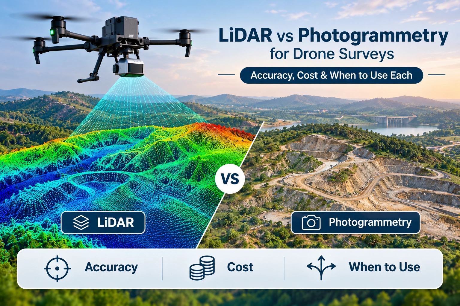
When planning a drone survey, one of the most important technical decisions is choosing the right data-capture technology.
Two of the most widely used approaches are LiDAR and photogrammetry.
Both can produce three-dimensional information, elevation data and mapping outputs, but they work in very different ways.
Photogrammetry uses overlapping photographs to reconstruct three-dimensional information from image geometry.
LiDAR uses laser pulses to measure distances and generate a three-dimensional point cloud.
So, which is better?
The answer depends on the project.
For open land, construction sites, visual mapping and projects where high-resolution imagery is important, photogrammetry can often provide a cost-effective solution.
For dense vegetation, complex terrain, infrastructure and projects requiring detailed 3D measurements, LiDAR can offer important advantages.
The choice should therefore be based on the required accuracy, terrain, vegetation, deliverables, budget and intended use of the survey data rather than simply choosing the more advanced technology. USGS describes both UAS LiDAR and photogrammetric point-cloud workflows as useful approaches for 3D mapping, with different strengths and limitations.
What Is the Difference Between LiDAR and Photogrammetry?
The fundamental difference is how the two technologies collect spatial information.
How LiDAR Works
LiDAR stands for Light Detection and Ranging.
A LiDAR sensor sends laser pulses toward the ground or surrounding objects and measures the time taken for those pulses to return.
The measurements are combined to create a three-dimensional point cloud.
USGS describes LiDAR as an active remote-sensing technology that produces 3D point-cloud data from emitted laser pulses.
A drone-mounted LiDAR system can therefore capture:
- Terrain
- Buildings
- Infrastructure
- Vegetation
- Slopes
- Roads
- Power corridors
- Other physical features
How Photogrammetry Works
Photogrammetry uses a series of overlapping photographs captured from different positions.
Software identifies common features between images and uses their geometry to reconstruct three-dimensional information.
A typical workflow is:
Drone Images → Image Alignment → Point Cloud → Surface Model → Orthomosaic / 3D Model
USGS describes Structure-from-Motion photogrammetry as a method that uses overlapping imagery and pixel matching to generate 3D point clouds and other spatial products.
This makes photogrammetry particularly useful when the project requires both visual information and spatial mapping.
LiDAR vs Photogrammetry: Quick Comparison
| Factor | LiDAR | Photogrammetry |
|---|---|---|
| Data source | Laser measurements | Overlapping photographs |
| Main output | 3D point cloud | Orthomosaic, point cloud and 3D models |
| Terrain mapping | Excellent | Excellent in suitable conditions |
| Dense vegetation | Generally stronger | Can struggle |
| Visual texture | Limited compared with RGB imagery | Excellent |
| Lighting dependency | Lower | Higher |
| Equipment cost | Generally higher | Generally lower |
| Processing | Specialised | Widely available workflows |
| Best for | Complex terrain, vegetation, infrastructure | Open land, visual mapping, construction |
| 3D data | Strong | Strong |
| Colour information | Requires additional imagery for RGB context | Naturally captured through imagery |
The table provides a general comparison. Actual performance depends on the sensor, drone platform, flight planning, control, processing workflow and project requirements.
Which Is More Accurate: LiDAR or Photogrammetry?
This is one of the most common questions when comparing LiDAR vs photogrammetry.
There is no universal answer that LiDAR is always more accurate.
The accuracy of either method depends on the complete survey workflow.
Important factors include:
- Sensor quality
- GNSS/RTK or PPK positioning
- Ground control
- Checkpoints
- Flight altitude
- Ground sampling distance
- Image overlap
- Terrain
- Vegetation
- Processing
- Calibration
- Coordinate systems
- Quality control
ASPRS currently maintains separate best-practice guidance for photogrammetry, LiDAR, UAS and field surveying as part of its positional accuracy standards.
For LiDAR, the quality of the final point cloud depends on more than the laser sensor itself. GNSS positioning, inertial measurement, trajectory quality and other system factors contribute to overall positional accuracy.
The same principle applies to photogrammetry.
A high-resolution camera does not automatically create a highly accurate survey.
Accuracy is a workflow outcome, not simply a sensor specification.
When Is LiDAR Better for Drone Surveys?
LiDAR becomes particularly attractive when the project involves conditions where image-based reconstruction has limitations.
Dense Vegetation
One of LiDAR’s major advantages is its ability to record multiple returns from laser pulses.
Some laser energy can reach the ground through gaps in vegetation, allowing the resulting point cloud to contain information about both vegetation and ground surfaces.
USGS notes that LiDAR-derived terrain models can reveal ground features beneath vegetation that may be difficult to identify using aerial imagery alone.
This can make LiDAR particularly useful for:
- Forests
- Vegetated corridors
- Riverbanks
- Slopes
- Large infrastructure corridors
- Areas with dense vegetation
Photogrammetry can still work in vegetation, but extracting reliable bare-earth terrain beneath dense vegetation can be more challenging.
Complex Terrain
LiDAR can be useful for:
- Steep slopes
- Uneven terrain
- Large elevation changes
- Difficult-to-access areas
The dense 3D point cloud can provide detailed information about terrain structure.
Infrastructure Mapping
LiDAR can be useful for:
- Roads
- Rail corridors
- Bridges
- Transmission corridors
- Industrial facilities
- Urban infrastructure
It can capture the geometry of complex environments in three dimensions.
Forestry and Environmental Projects
LiDAR is particularly useful when understanding the structure of vegetation and the underlying terrain is important.
Advanced 3D Workflows
Projects involving:
- Detailed point clouds
- Terrain models
- Digital twins
- Corridor modelling
- Complex 3D environments
may benefit from LiDAR.
SkyGlimps’ current 3D LiDAR & GIS service uses aerial and terrestrial LiDAR capture to create point clouds, terrain maps, elevation models, 3D models and GIS-ready datasets for engineering, infrastructure, urban planning, forestry and other applications.
When Is Photogrammetry Better for Drone Surveys?
Photogrammetry remains one of the most practical approaches for many drone mapping projects.
Open Land
For relatively open terrain without dense vegetation, photogrammetry can produce highly detailed mapping outputs from overlapping images.
Construction Sites
Construction teams may need:
- Orthomosaics
- Site plans
- 3D models
- Progress documentation
- Volume calculations
- Visual records
Photogrammetry can provide both visual and spatial information.
Real Estate and Land Mapping
When visual detail is important, RGB imagery provides useful context alongside the mapping outputs.
Stockpile and Earthwork Surveys
Photogrammetric point clouds and surface models can be used for:
- Stockpile volumes
- Excavation
- Cut-and-fill analysis
- Site measurements
The suitability depends on the required accuracy and site conditions.
Projects Where Visual Texture Matters
Photogrammetry naturally captures colour and visual texture because the underlying data comes from photographs.
This can be valuable when users need to understand not only the shape of an object but also its visible condition.
SkyGlimps’ 2D Surveying & Mapping workflow uses drone imagery to produce outputs such as orthomosaics, topographic maps and site plans that can be integrated with CAD and GIS workflows.
Is LiDAR More Expensive Than Photogrammetry?
In many projects, LiDAR has a higher equipment and operational cost than conventional drone photogrammetry.
The reason is the specialised laser sensor, positioning system, processing requirements and technical expertise involved.
Photogrammetry can often use a drone equipped with a high-quality RGB camera, making it more accessible for many mapping projects.
However, cost should not be judged only by the price of the drone or sensor.
Consider the complete project cost:
- Equipment
- Survey crew
- Flight time
- Ground control
- Processing
- Data analysis
- Travel
- Terrain access
- Safety requirements
- Deliverables
- Post-processing
- Quality control
A more expensive LiDAR survey can sometimes be more efficient if it significantly reduces fieldwork or provides information that photogrammetry cannot reliably capture.
Similarly, using LiDAR for a simple open-land orthomosaic can be unnecessary expenditure.
The cheapest sensor is not always the cheapest complete solution.
What About Survey Speed?
Both technologies can provide efficient aerial data collection compared with some traditional ground-based workflows.
The actual speed depends on:
- Site size
- Drone flight time
- Sensor
- Required resolution
- Terrain
- Weather
- Battery changes
- Flight permissions
- Ground control
- Processing requirements
LiDAR can be especially useful where terrain or vegetation makes ground access difficult.
Photogrammetry can be extremely efficient across open sites where image capture and processing can be completed quickly.
Therefore, project efficiency should be measured from planning through final deliverable, not simply from how quickly the drone flies.
Which Technology Works Better Under Vegetation?
For dense vegetation, LiDAR generally has an important advantage.
Photogrammetry reconstructs surfaces from visible features in overlapping images. Dense vegetation can obscure the ground, making it difficult for image-based methods to produce a reliable bare-earth model.
LiDAR can record multiple returns and can capture information through gaps in vegetation.
USGS research notes that SfM photogrammetry can produce accurate elevation models, but dense vegetation can reduce the accuracy of terrain models compared with LiDAR-derived DTMs.
This makes LiDAR particularly relevant for:
- Forest surveys
- Vegetation-heavy corridors
- Terrain beneath tree cover
- Environmental mapping
- Infrastructure passing through vegetation
However, the amount of penetration and resulting ground information depends on vegetation density, sensor characteristics, flight parameters and point density.
Which Technology Provides Better Visual Information?
For visual information, photogrammetry has a natural advantage.
The source data is made up of photographs, so the resulting outputs can contain detailed colour and surface texture.
This makes photogrammetry useful when the project requires:
- Orthomosaic imagery
- High-resolution site photographs
- Colour-based interpretation
- Surface condition documentation
- Visual inspection
- 3D textured models
LiDAR primarily provides geometric measurements.
A LiDAR point cloud tells you where surfaces are in three-dimensional space, but it does not provide the same level of natural photographic texture unless RGB imagery is captured alongside it.
For this reason, some advanced projects use LiDAR and RGB imagery together.
Can LiDAR and Photogrammetry Be Used Together?
Yes.
In some professional projects, using both technologies can provide a more complete dataset.
For example:
LiDAR → Detailed 3D Geometry
RGB Photogrammetry → Visual Texture and Colour
Together, they can support:
- Detailed 3D modelling
- Infrastructure mapping
- Digital twins
- Terrain analysis
- Asset documentation
- Engineering workflows
- GIS analysis
This approach can be particularly useful when both geometric accuracy and visual context are important.
The correct combination depends on the project objectives and required deliverables.
LiDAR vs Photogrammetry for Different Projects
The following general guide can help with initial technology selection.
| Project Type | Preferred Approach |
|---|---|
| Open agricultural land | Photogrammetry |
| Construction site mapping | Photogrammetry |
| Orthomosaic mapping | Photogrammetry |
| Visual site documentation | Photogrammetry |
| Stockpile measurement | Photogrammetry or LiDAR |
| Dense forest | LiDAR |
| Vegetated corridor | LiDAR |
| Complex terrain | LiDAR |
| Infrastructure 3D mapping | LiDAR or hybrid |
| Digital twin | LiDAR or hybrid |
| Detailed terrain under vegetation | LiDAR |
| Visual + 3D requirements | Hybrid |
This is a starting point, not a substitute for project-specific survey planning.
What Factors Should You Consider Before Choosing LiDAR or Photogrammetry?
Before selecting the technology, define the final decision the survey needs to support.
1. What Is the Required Deliverable?
Do you need:
- Orthomosaic
- DEM
- DSM
- DTM
- Contours
- Point cloud
- 3D model
- Volume report
- GIS layers
- CAD files
- Digital twin
The deliverable often determines the appropriate technology.
2. What Is the Terrain Like?
Consider:
- Flat land
- Slopes
- Forest
- Vegetation
- Buildings
- Water
- Industrial structures
3. What Accuracy Is Required?
Define the required horizontal and vertical accuracy before selecting the sensor.
4. Is Ground Penetration Important?
If the project requires information about terrain beneath vegetation, LiDAR may be more appropriate.
5. Is Visual Detail Important?
If colour, texture and visual documentation are important, photogrammetry may have an advantage.
6. What Is the Budget?
Consider the complete project cost rather than only equipment cost.
7. What Processing Capability Is Available?
Both methods require appropriate processing and quality-control workflows.
How Important Are GCPs, RTK and PPK?
Choosing LiDAR or photogrammetry does not eliminate the need to think about positioning and accuracy control.
Depending on the project, workflows can include:
- Ground Control Points
- Checkpoints
- RTK
- PPK
- GNSS
- Survey control
These methods help establish or verify the spatial accuracy of the final product.
The appropriate combination depends on:
- Required accuracy
- Drone system
- Sensor
- Site conditions
- Coordinate system
- Project methodology
SkyGlimps’ drone mapping workflow specifically covers GCPs, coordinate systems, accuracy, RTK drones and professional mapping workflows.
A professional survey should therefore be designed around accuracy requirements first, rather than selecting a sensor simply because it is marketed as “survey grade.”
How Should You Compare the Cost of LiDAR and Photogrammetry?
A useful cost comparison should consider the entire workflow.
Photogrammetry Cost Components
Potential costs include:
- Drone and camera
- Batteries
- Ground control
- Survey crew
- Photogrammetry software
- Processing
- QA/QC
- Reporting
LiDAR Cost Components
Potential costs include:
- LiDAR sensor
- Drone platform
- GNSS/IMU system
- Base or correction infrastructure
- Survey crew
- Point-cloud processing
- GIS
- QA/QC
- Reporting
LiDAR may have higher equipment costs, but its value can increase when the site is difficult to access or heavily vegetated.
Photogrammetry may provide better overall value when the site is open and the project mainly requires visual mapping and conventional 3D outputs.
The right question is therefore not:
“Which technology costs less?”
It is:
“Which technology provides the required information at the lowest suitable total project cost?”
Where Can You Get Professional Drone Surveying and LiDAR Services in India?
SkyGlimps provides both 2D Surveying & Mapping and 3D LiDAR & GIS Solutions, allowing projects to be planned around the actual data requirements rather than forcing every project into one technology.
Its 2D mapping workflow uses aerial imagery to create orthomosaics, topographic maps and site plans, while its LiDAR and GIS workflow focuses on dense 3D data, point clouds, elevation models, terrain analysis and GIS-ready outputs.
For projects where the appropriate technology is not obvious, the first step should be to define:
- Site conditions
- Required accuracy
- Final deliverables
- Terrain
- Vegetation
- Project budget
- Intended engineering or planning use
Explore SkyGlimps 2D Surveying & Mapping
Explore SkyGlimps 3D LiDAR & GIS Solutions
Frequently Asked Questions
Neither is universally better. Photogrammetry is often well suited to open sites, visual mapping and cost-sensitive projects, while LiDAR can be advantageous for dense vegetation, complex terrain and detailed 3D mapping.
LiDAR can provide highly accurate 3D data, but accuracy depends on the complete survey system and workflow. Photogrammetry can also achieve strong positional accuracy when properly planned, controlled and processed. Accuracy should be assessed against the project’s required standards and checkpoints.
LiDAR generally involves higher sensor and equipment costs, although the total project cost depends on site conditions, fieldwork, processing and deliverables. Photogrammetry is often more economical for open sites and conventional mapping requirements.
LiDAR generally performs better than photogrammetry when the project requires information about ground surfaces beneath vegetation because laser returns can provide information through gaps in vegetation. Dense vegetation can make image-based terrain reconstruction more difficult.
Yes. Combining LiDAR with RGB imagery can provide both detailed 3D geometry and visual information. This hybrid approach can be useful for complex infrastructure, terrain modelling, digital twins and other advanced mapping projects.
Choose the Survey Technology Based on the Project
The LiDAR vs photogrammetry debate should not be reduced to choosing the technology with the highest specifications.
Both methods have an important role in modern drone surveying.
Photogrammetry can be an excellent choice when you need:
High-resolution imagery + Orthomosaic + 3D reconstruction + Cost efficiency
LiDAR can be a stronger choice when you need:
Dense 3D data + Complex terrain + Vegetation mapping + Detailed spatial information
And for some advanced projects, the best solution may be:
LiDAR + RGB Photogrammetry + RTK/PPK + Ground Control + QA/QC
The final choice should be based on the project’s accuracy requirement, terrain, vegetation, deliverables, budget and intended use of the data.
SkyGlimps supports both conventional drone mapping and advanced LiDAR/GIS workflows, with services covering 2D mapping, 3D point clouds, elevation models, terrain analysis and GIS-ready outputs.
The most effective drone survey is not necessarily the one using the most expensive sensor.
It is the one that collects the right data, at the required accuracy, in the most practical and defensible way for the project’s purpose.