
Civil engineering and surveying are becoming increasingly data-driven. From construction sites and land development to roads, mining and infrastructure projects, project teams need accurate information about what is happening on the ground.
Drones can add another layer of information by capturing aerial imagery and spatial data quickly across large or difficult-to-access areas.
For civil engineers and surveyors, the value of drone technology is not simply being able to fly a drone. The real advantage comes from understanding how to plan a flight, capture useful data, process the information and apply the resulting outputs to engineering and surveying workflows.
This is why a drone course for civil engineers can be useful for professionals who want to add aerial mapping capabilities to their existing technical skills.
Drone-based workflows can support applications such as:
- Topographic mapping
- Site surveys
- Construction progress monitoring
- Earthwork measurement
- Stockpile volume calculation
- Road and corridor mapping
- Land development
- Infrastructure documentation
- Orthomosaic generation
- 3D modelling
- GIS-based analysis
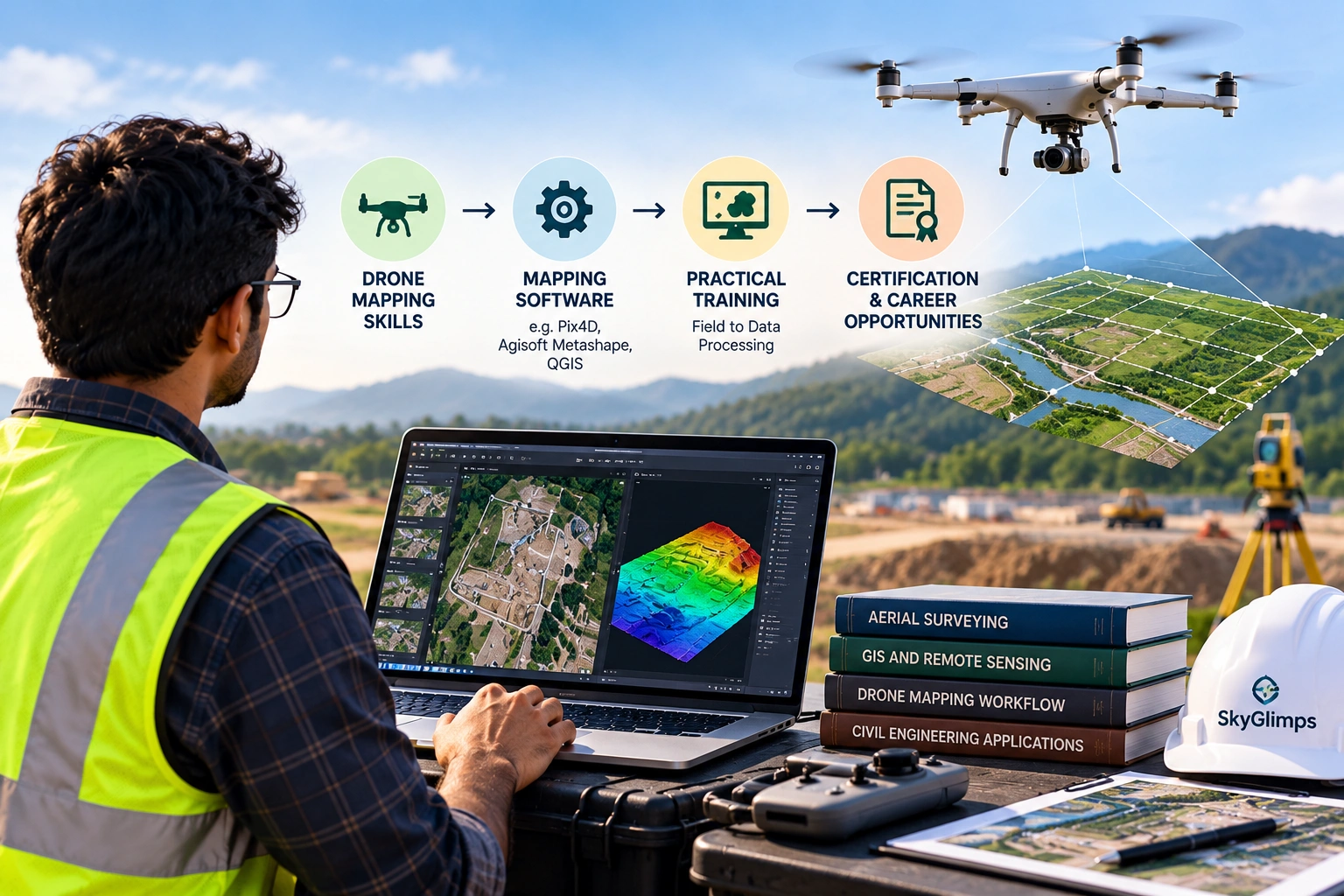
SkyGlimps’ Drone Mapping & Surveying Course is specifically designed around survey-grade drone operations and covers mission planning, data capture, accuracy, GCPs, coordinate systems, RTK drones, sensors and real-world mapping workflows.
Why Should Civil Engineers Learn Drone Technology?
Civil engineers already work with drawings, measurements, site plans, elevations, quantities and project documentation.
Drone technology can complement these existing skills by providing a faster way to capture an aerial view of the project area.
Instead of relying only on ground-level observations, an engineer can use drone data to understand:
- Site conditions
- Terrain
- Construction progress
- Earthwork areas
- Stockpiles
- Road alignments
- Drainage features
- Land-use patterns
- Project changes over time
The important point is that drone technology does not replace engineering knowledge.
It adds another data-capture method that engineers can integrate into their existing workflows.
For a civil engineer, learning drones can therefore mean moving from:
Ground observations → Aerial data → Processed maps → Engineering decisions
That broader workflow is what makes drone training relevant to civil engineering.
What Is a Drone Course for Civil Engineers?
A drone course for civil engineers is training that teaches professionals how drones can be used for surveying, mapping, site documentation and other engineering-related applications.
The course does not necessarily need to focus only on drone flying.
A useful engineering-focused programme should cover areas such as:
- Drone mission planning
- Survey flight planning
- Data capture
- Image overlap
- Ground control points
- Coordinate systems
- Accuracy considerations
- Orthomosaic mapping
- Elevation data
- Photogrammetry
- RTK drone concepts
- Mapping sensors
- Data processing
- Survey deliverables
- Field workflows
The goal is to help engineers understand the complete process rather than simply operate the aircraft.
Do Civil Engineers Need a DGCA Drone Pilot Certificate?
This depends on what the engineer intends to do.
If a civil engineer wants to personally operate a drone in circumstances where an RPC is required, the applicable DGCA remote pilot training and certification pathway needs to be followed.
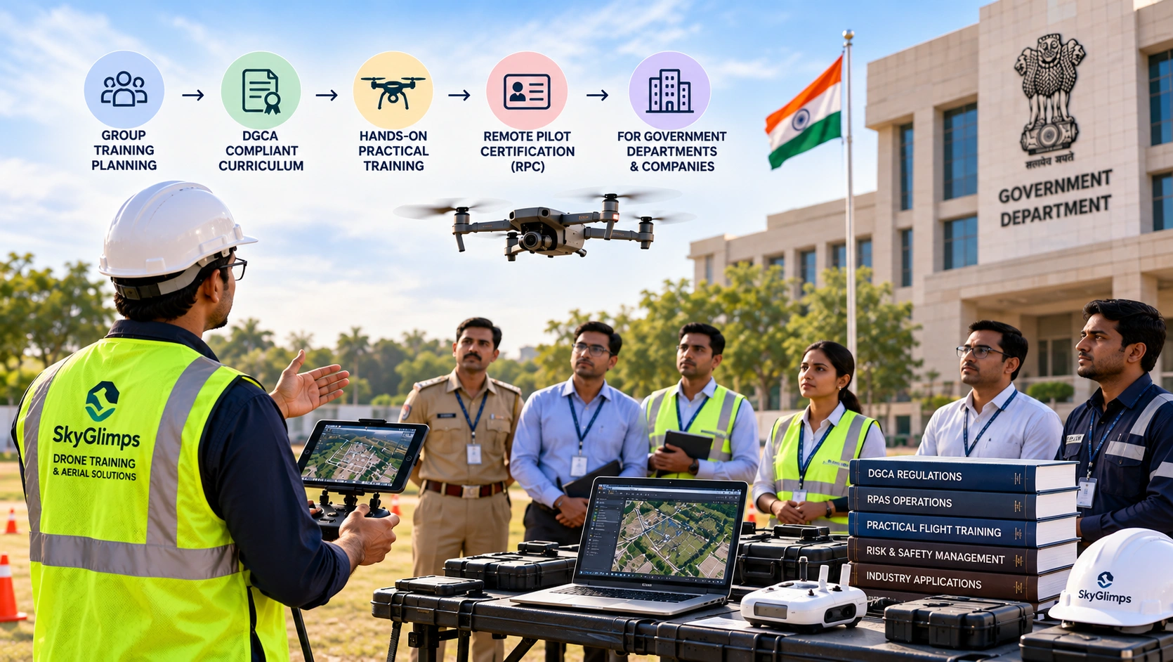
DGCA’s training framework provides for Remote Pilot Certificate training through authorised Remote Pilot Training Organisations (RPTOs). The syllabus covers regulatory knowledge, airspace, flight principles, weather, maintenance, safety, risk assessment, payload operations and an introduction to drone data and analysis.
However, DGCA pilot certification and drone mapping training are not the same thing.
A professional may need to develop two different skill sets:
Pilot competency: How to safely and professionally operate the drone.
Mapping competency: How to plan a survey mission, capture suitable data and turn it into useful mapping outputs.
For civil engineers and surveyors, understanding both can be particularly valuable.
DGCA Drone Training vs Drone Mapping Training
These two types of training are often confused.
| Training | Main Purpose |
|---|---|
| DGCA-certified drone pilot training | Develops remote pilot knowledge and practical flying skills |
| Drone mapping & surveying training | Teaches aerial data capture and mapping workflows |
| Surveying/GIS training | Develops spatial data interpretation and engineering applications |
| Combined skill set | Helps professionals connect drone operations with real project deliverables |
A civil engineer who only learns to fly a drone may still need additional training before independently handling mapping workflows.
Similarly, someone who understands GIS and surveying but cannot operate the aircraft may need a qualified pilot for data capture.
The strongest combination is understanding both the flight and the data workflow.
How Can Drones Be Used in Civil Engineering?
Drones can support several stages of a civil engineering project.
1. Site Surveying
Before construction begins, teams need information about the existing site.
Drone mapping can help capture aerial data across:
- Land parcels
- Construction sites
- Open areas
- Earthwork zones
- Existing infrastructure
- Roads
- Drainage areas
The resulting imagery can provide a current visual record of the site and support mapping workflows.
2. Topographic Mapping
Topographic information is important for understanding terrain and elevation.
Drone photogrammetry can be used to create outputs such as:
- Orthomosaic maps
- Point clouds
- Digital elevation models
- Digital surface models
- Contour maps
- 3D models
The exact output depends on the project requirements and processing workflow.
3. Construction Progress Monitoring
Construction projects change continuously.
Drone surveys can be repeated at planned intervals to document changes over time.
Teams can compare:
Previous survey → Current survey → Progress
This can help project managers understand:
- Completed work
- Remaining work
- Site changes
- Material movement
- Earthwork progress
- Overall site conditions
SkyGlimps provides Documentation & Progress Tracking as one of its drone service areas, supporting recurring aerial documentation of construction and infrastructure projects.
4. Earthwork Measurement
Civil engineering projects often involve excavation and filling.
Drone mapping can provide terrain data that can be used for:
- Cut calculations
- Fill calculations
- Excavation measurement
- Stockpile measurement
- Material volume estimation
This can provide project teams with a spatial record of the site rather than relying only on isolated ground measurements.
5. Road and Highway Mapping
Road projects often cover long corridors.
Drone-based mapping can support:
- Route documentation
- Corridor mapping
- Terrain analysis
- Construction progress
- Roadside documentation
- Drainage assessment
The ability to capture a corridor from above can make it easier to understand how different sections of a project relate spatially.
6. Infrastructure Documentation
Drones can also document infrastructure assets and construction environments.
Depending on the project, applications can include:
- Bridges
- Buildings
- Industrial sites
- Utility infrastructure
- Roads
- Drainage structures
- Construction structures
Drone imagery can provide a visual record that can be compared over time.
What Skills Should a Civil Engineer Learn in a Drone Course?
A useful drone course for civil engineers should go beyond basic flight controls.
Drone Fundamentals
Understand:
- Drone components
- Flight controls
- Sensors
- Batteries
- Payloads
- Flight limitations
This creates the foundation for operating and selecting suitable equipment.
Mission Planning
Mission planning is one of the most important skills for mapping.
You should understand:
- Survey boundaries
- Flight altitude
- Image overlap
- Flight direction
- Ground coverage
- Battery requirements
- Site conditions
- Safety considerations
A poorly planned flight can produce unusable data even if the drone itself performs correctly.
Ground Control Points
Ground Control Points, or GCPs, can be used to improve the positional reliability of mapping outputs.
A civil engineer should understand:
- What GCPs are
- Why they are used
- Where they should be placed
- How coordinates are collected
- How checkpoints differ from GCPs
SkyGlimps’ mapping course specifically covers GCPs, coordinate systems and accuracy considerations.
Coordinate Systems
Drone mapping is not only about photographs.
The data needs to exist within an appropriate spatial reference framework.
Engineers working with drone mapping should understand basic concepts such as:
- Coordinates
- Projection
- Datum
- Georeferencing
- Local coordinate systems
- Geographic coordinate systems
This becomes particularly important when drone outputs need to be integrated with existing engineering or GIS datasets.
Photogrammetry
Photogrammetry is the process of extracting spatial information from overlapping images.
A civil engineer should understand the basic workflow:
Drone images → Image alignment → Point cloud → Surface model → Orthomosaic/other outputs
You do not necessarily need to become a photogrammetry software specialist immediately, but understanding the workflow helps you evaluate the quality and limitations of the resulting data.
What Drone Mapping Outputs Are Useful for Civil Engineers?
Drone mapping can generate several types of outputs.
Orthomosaic Maps
An orthomosaic combines multiple aerial photographs into a geometrically corrected map.
It can provide a detailed top-down view of the project area.
Civil engineers can use orthomosaics for:
- Site documentation
- Planning
- Measurements
- Progress comparison
- Visual inspection
Point Clouds
A point cloud represents the surveyed environment as a collection of spatial points.
It can help create three-dimensional representations of:
- Terrain
- Buildings
- Structures
- Stockpiles
- Construction areas
Digital Elevation Models
Elevation models provide information about the vertical characteristics of an area.
They can support:
- Terrain analysis
- Contour generation
- Drainage studies
- Site planning
- Earthwork workflows
Digital Surface Models
A Digital Surface Model can represent the elevation of the Earth’s surface together with features such as buildings and vegetation, depending on the dataset and processing workflow.
Contour Maps
Contour maps represent changes in elevation using lines of equal elevation.
They can help engineers understand:
- Slopes
- Terrain patterns
- Elevation differences
- Drainage direction
- Site grading
3D Models
Drone imagery can also be processed into 3D models.
These models can provide a visual representation of:
- Buildings
- Terrain
- Construction sites
- Industrial structures
- Other surveyed environments
The appropriate output depends on what the project actually requires.
How Can Drone Mapping Improve Construction Site Monitoring?
Construction teams need regular information about project progress.
Traditional site inspections provide valuable ground-level information, but aerial documentation can add another perspective.
A drone can capture the overall site from above and create a consistent record across different dates.
For example:
Week 1: Site preparation
Week 2: Excavation
Week 3: Foundation work
Week 4: Structural progress
The images and mapping outputs can then be compared to understand how the site changed.
This can support:
- Progress reporting
- Stakeholder communication
- Site documentation
- Quantity monitoring
- Project records
- Issue identification
However, drone imagery should be interpreted alongside project drawings, engineering measurements and other relevant site information.
Can Civil Engineers Use Drones for Quantity Estimation?
Yes, drone-based mapping can support quantity and volume estimation workflows.
Applications can include:
- Stockpile volumes
- Excavated material
- Fill material
- Earthwork
- Quarry material
- Construction materials
A typical workflow can be:
Drone survey → 3D surface generation → Define measurement area → Calculate volume → Review results
The reliability of the calculation depends on factors such as:
- Flight planning
- Image quality
- Ground control
- Terrain
- Surface visibility
- Processing method
- Coordinate system
- Data quality
Therefore, engineers should not assume that every drone survey automatically produces engineering-grade quantity measurements.
The survey methodology must match the accuracy requirements of the project.
Can Drones Replace Traditional Land Surveying?
Not in every situation.
Drone mapping and traditional surveying are different tools that can complement one another.
Traditional surveying can provide precise measurements at specific points, while drone mapping can provide broader spatial coverage.
A project may use:
Ground survey + Drone survey + GIS/engineering data
For example, ground control or checkpoints may be established using conventional survey methods and then incorporated into the drone mapping workflow.
The appropriate combination depends on:
- Required accuracy
- Project size
- Terrain
- Deliverables
- Site conditions
- Regulatory requirements
- Engineering requirements
A civil engineer should therefore think of drones as an additional data-collection tool rather than a universal replacement for surveying methods.
Why Is Accuracy Important in Drone Mapping?
A visually impressive aerial image is not automatically an accurate survey product.
For engineering applications, accuracy matters.
Factors that can influence mapping accuracy include:
- Flight altitude
- Ground sampling distance
- Camera quality
- Image overlap
- Ground control
- RTK/PPK positioning
- Weather
- Wind
- Terrain
- Processing settings
- Coordinate systems
- Data quality
This is why civil engineers learning drone mapping should understand how data quality is created, not just how to operate the aircraft.
SkyGlimps’ mapping training specifically includes accuracy, GCPs and coordinate systems as part of its course content.
What Is RTK Drone Mapping?
RTK stands for Real-Time Kinematic.
RTK-enabled drones can use positioning corrections to improve the positional information associated with captured data.
For civil engineers and surveyors, RTK technology can be relevant when projects require higher positional reliability.
A drone mapping course should help professionals understand:
- What RTK is
- How RTK positioning works at a basic level
- When RTK may be useful
- How RTK differs from standard GNSS positioning
- Why ground control may still be relevant depending on the project
SkyGlimps’ Drone Mapping & Surveying Course includes an overview of RTK drones and mapping sensors.
What Is the Role of GCPs in Drone Surveys?
Ground Control Points are identifiable locations on the ground whose coordinates are known or measured.
They can be used to help align the drone dataset to the required coordinate framework and improve positional accuracy.
For civil engineering projects, understanding GCPs is important because the final map may need to align with:
- Existing survey data
- Engineering drawings
- GIS layers
- Property boundaries
- Infrastructure datasets
However, the number and placement of GCPs should be determined according to the project’s accuracy requirements and survey methodology.
A professional drone course should teach engineers when and why GCPs are used, rather than simply instructing them to place markers on the ground.
What Is the Role of GIS in Drone Mapping?
GIS helps professionals organise, analyse and visualise spatial data.
For civil engineers and surveyors, GIS can help connect drone-derived information with other datasets.
For example:
Drone orthomosaic + Road network + Land parcel + Drainage + Infrastructure
can provide a more complete picture of the project environment.
GIS can be used to:
- Manage spatial layers
- Analyse locations
- Measure areas
- Compare datasets
- Visualise infrastructure
- Create maps
- Export project data
This is why drone mapping training can be particularly valuable for professionals who already work with GIS or want to develop spatial-data skills.
What Software Skills Should Civil Engineers Develop?
The exact software depends on the project and employer, but professionals working with drone mapping should understand several broad software categories.
Mission Planning Software
Used to:
- Define survey boundaries
- Plan flight paths
- Set altitude
- Configure overlap
- Manage missions
Photogrammetry Software
Used to process images into:
- Point clouds
- Orthomosaics
- Elevation models
- 3D outputs
GIS Software
Used to:
- View spatial data
- Manage layers
- Analyse maps
- Combine datasets
- Export GIS outputs
CAD Software
Civil engineers may also need to work with CAD-based drawings and design information.
Understanding how drone-derived data can fit into engineering workflows is more important than becoming an expert in every software platform.
What Does a Drone Mapping Workflow Look Like?
A professional drone mapping project can be understood as a sequence of stages.
Step 1: Define the Objective
First determine what the project actually needs.
For example:
- Topographic map
- Orthomosaic
- Volume calculation
- Progress documentation
- 3D model
- Terrain model
Step 2: Assess the Site
Review:
- Site boundaries
- Terrain
- Obstacles
- Access
- Weather
- Airspace
- Safety conditions
Step 3: Plan the Mission
Set:
- Flight area
- Altitude
- Image overlap
- Flight path
- Ground control strategy
- Battery requirements
Step 4: Capture the Data
Conduct the planned drone mission and collect the required imagery or sensor data.
Step 5: Check the Data
Before leaving the site, check:
- Coverage
- Image quality
- Missing areas
- Flight logs
- Ground control information
- Obvious data gaps
Step 6: Process the Data
Process the captured information using the appropriate photogrammetry or mapping workflow.
Step 7: Perform Quality Checks
Review:
- Completeness
- Accuracy
- Alignment
- Data consistency
- Output quality
Step 8: Create the Deliverables
Depending on the project, outputs can include:
- Orthomosaic
- Point cloud
- DEM
- DSM
- Contours
- 3D model
- GIS data
- Reports
This workflow demonstrates why drone mapping is more than simply flying an aircraft over a site.
What Are the Benefits of Drone Training for Surveyors?
Surveyors already understand measurements, coordinates, terrain and spatial relationships.
Drone training can help them add another data-collection method to their existing expertise.
Potential benefits include:
Faster Site Coverage
A drone can capture aerial imagery across large areas efficiently.
Better Visual Context
Aerial imagery provides a broader view of the site.
Repeatable Data Collection
The same area can be surveyed repeatedly for progress monitoring.
3D Data
Photogrammetry can produce point clouds and 3D outputs.
Integration With GIS
Drone data can be incorporated into broader spatial workflows.
Additional Professional Skills
Surveyors can combine traditional surveying knowledge with:
- Drone operations
- Photogrammetry
- GIS
- RTK
- Data processing
- Aerial mapping
This combination can be valuable for professionals working in modern infrastructure and geospatial projects.
What Are the Benefits of Drone Training for Civil Engineers?
For civil engineers, drone training can extend the way project information is collected and reviewed.
It can help engineers understand:
- Aerial site documentation
- Construction progress
- Terrain
- Earthwork
- Volumes
- Mapping
- Spatial data
- Project monitoring
It can also improve communication between engineering, surveying, construction and GIS teams because the engineer understands where the aerial data comes from and what its limitations are.
The biggest benefit is therefore not simply “knowing how to fly a drone.”
It is knowing how to use aerial data as part of an engineering workflow.
Should a Civil Engineer Take a DGCA Course or a Mapping Course?
This depends on the professional goal.
If You Want to Operate the Drone
Consider the applicable DGCA-certified Remote Pilot training pathway.
SkyGlimps currently offers DGCA-Certified Small Category Drone Pilot Training, including regulatory knowledge, simulator training, supervised practical flying, night flying and final flying assessment. The programme specifically lists surveyors and civil engineers among its intended participants.
If You Already Have a Pilot
A Drone Mapping & Surveying Course may be more relevant if your primary goal is learning how to plan surveys, capture mapping data and understand spatial outputs.
SkyGlimps’ mapping course covers mission planning, data capture, accuracy, GCPs, coordinate systems, RTK drones, mapping sensors and real-world survey workflows.
If You Want Both
For professionals who want to independently handle drone-based mapping projects, developing both pilot and mapping skills can provide a more complete understanding of the workflow.
The ideal learning path can therefore be:
DGCA Pilot Training → Drone Mapping Training → GIS/Photogrammetry Skills → Real Project Experience
What Does SkyGlimps’ Drone Mapping & Surveying Course Cover?
SkyGlimps currently offers a dedicated Drone Mapping & Surveying Course designed around survey-grade drone operations.
The programme covers:
- Mission planning
- Flight strategies
- Data capture principles
- Accuracy
- Ground Control Points
- Coordinate systems
- Indian drone regulations for survey operations
- Camera fundamentals
- RTK drones
- Mapping sensors
- Real-world mapping project workflows
- Practical exposure to mapping workflows
- Field equipment used in professional drone surveys
The course is currently listed as a 5-to-7-day programme in New Town, Kolkata and is specifically described as suitable for civil engineers, surveyors, GIS professionals and drone pilots entering the mapping and infrastructure sector.
This makes it relevant for professionals who want to understand how drone data fits into surveying and engineering work rather than focusing only on recreational drone flying.
What Does SkyGlimps’ DGCA Drone Pilot Training Cover?
For professionals who also want formal remote pilot training, SkyGlimps offers a DGCA-Certified Small Category Drone Pilot Training programme.
The current six-day programme includes:
Day 1: Drone regulations, flight fundamentals, ATC procedures, Radio Telephony and aircraft overview
Day 2: Weather, maintenance, risk assessment, safety, Threat & Error Management, payload operations and introduction to drone data processing
Day 3: Theory assessment, flight simulator training and basic assembly and maintenance
Day 4–5: Instructor-supervised practical flying progressing toward solo flight
Day 6: Night flying operations and final flying test
The programme is conducted with classroom training in New Town, Kolkata and practical flying at the Singur, West Bengal flying ground.
SkyGlimps currently lists surveyors and civil engineers among the professionals who can enrol in the programme.
How Can Civil Engineers Add Drone Mapping to Their Existing Work?
The easiest way to start is by identifying where aerial data can improve an existing workflow.
Existing Work: Site Inspection
Add: Regular drone documentation
Existing Work: Land Survey
Add: Drone-based aerial mapping
Existing Work: Earthwork
Add: Drone-derived surface and volume calculations
Existing Work: Construction Monitoring
Add: Repeat aerial progress surveys
Existing Work: Road Projects
Add: Corridor mapping and aerial documentation
Existing Work: Site Planning
Add: Orthomosaic and terrain information
Existing Work: GIS
Add: Drone-derived spatial datasets
The idea is not to completely change your profession.
It is to add drone-based data collection to the work you already understand.
What Career Opportunities Can Drone Skills Add for Civil Engineers?
Civil engineers with drone and mapping skills can explore roles and responsibilities related to:
- Drone surveying
- Aerial mapping
- Construction monitoring
- GIS support
- Photogrammetry
- Infrastructure documentation
- Earthwork measurement
- Site data collection
- Survey project coordination
- Drone operations
The actual role depends on the employer, qualifications, project requirements and level of technical expertise.
A civil engineering degree combined with drone skills can be particularly useful where engineering knowledge and spatial data need to work together.
What Should a Civil Engineer Learn Before Taking a Drone Course?
You do not need to become a drone expert before joining a course.
However, basic knowledge of the following can help:
- Surveying fundamentals
- Basic coordinate concepts
- Site measurements
- Construction drawings
- Elevation
- Contours
- GIS fundamentals
- Construction project workflows
Your existing engineering knowledge can then be connected to drone-specific concepts.
For example, if you already understand contours, a drone mapping course can show you how aerial data can be processed into contour information.
If you understand earthwork, the course can show how drone-derived terrain data can support volume calculations.
This makes the learning more practical.
What Mistakes Should Civil Engineers Avoid When Starting With Drone Mapping?
Mistake 1: Treating the Drone Like a Camera
Drone mapping is not simply about taking attractive aerial photographs.
The flight needs to be planned around the required data.
Mistake 2: Ignoring Accuracy Requirements
Before flying, determine what accuracy the project actually needs.
Mistake 3: Flying Without a Defined Deliverable
Know whether the project requires:
- Orthomosaic
- DEM
- DSM
- Contours
- Point cloud
- 3D model
- Volume
- GIS data
Mistake 4: Ignoring Ground Control
Understand when GCPs or checkpoints may be required.
Mistake 5: Leaving the Site Without Checking Data
A missing section of imagery can force an expensive site revisit.
Mistake 6: Assuming RTK Solves Everything
RTK can improve positioning, but the complete mapping workflow still depends on flight planning, data quality, processing and project requirements.
Mistake 7: Overpromising Survey Accuracy
Never promise an accuracy level simply because a drone has a particular camera or positioning system.
Accuracy needs to be demonstrated and assessed according to the project methodology.
Drone Course for Civil Engineers: A Practical Learning Path
If you are a civil engineer or surveyor starting from the beginning, a structured learning path can look like this:
Stage 1: Understand Drone Fundamentals
Learn:
- Drone components
- Flight controls
- Sensors
- Batteries
- Payloads
- Safety
Stage 2: Learn Regulatory Requirements
Understand the applicable Indian drone regulations and professional operating requirements.
Stage 3: Learn Professional Flight Planning
Understand:
- Survey boundaries
- Altitude
- Overlap
- Flight paths
- Safety
- Site conditions
Stage 4: Learn Mapping
Study:
- Photogrammetry
- Orthomosaics
- Point clouds
- DEMs
- DSMs
- Contours
Stage 5: Learn Accuracy
Understand:
- GCPs
- Checkpoints
- RTK
- Coordinate systems
- GSD
- Quality control
Stage 6: Learn GIS and Data Processing
Understand how drone outputs are integrated into engineering and spatial workflows.
Stage 7: Practise on Real Projects
Finally, learn how to apply the complete workflow to:
- Construction
- Roads
- Land development
- Mining
- Infrastructure
- Irrigation
This is where classroom knowledge becomes professional capability.
Frequently Asked Questions
The right course depends on your goal. If you need professional pilot certification, look for the applicable DGCA-certified training pathway. If your goal is aerial mapping and surveying, a dedicated drone mapping course can be more relevant.
Drone training is not mandatory for every civil engineer, but it can be useful for professionals involved in surveying, construction, infrastructure, mapping, earthwork, GIS and site monitoring.
Yes. Civil engineers can pursue the applicable remote pilot training and certification pathway and can also develop specialised skills in mapping and surveying.
Yes. Surveyors can use drone training to add aerial data capture, photogrammetry, mapping and GIS workflows to their existing surveying skills.
Applications include site surveys, topographic mapping, construction progress monitoring, earthwork measurement, stockpile volumes, road mapping, infrastructure documentation and GIS-based analysis.
Not necessarily. DGCA pilot certification develops remote pilot skills, while professional surveying also requires knowledge of mission planning, mapping, accuracy, photogrammetry, GCPs, GIS and survey deliverables.
Add Aerial Mapping to Your Engineering Skill Set
Drone technology is becoming increasingly useful across surveying, construction, infrastructure and geospatial projects.
For civil engineers and surveyors, the biggest opportunity is not simply learning how to fly a drone.
It is learning how to connect:
Drone → Data Capture → Mapping → Analysis → Engineering Application
A drone course for civil engineers can help professionals understand this workflow and add aerial data capabilities to the skills they already use.
For someone starting from scratch, the learning path can include:
DGCA Pilot Training → Drone Mapping → Photogrammetry → GIS → Field Experience
For professionals who already work with surveying or engineering data, drone mapping can provide an additional method for capturing and visualising site information.
SkyGlimps currently offers both DGCA-Certified Small Category Drone Pilot Training and a dedicated Drone Mapping & Surveying Course in Kolkata. Its mapping programme is specifically designed for civil engineers, surveyors, GIS professionals and drone pilots and covers mission planning, data capture, GCPs, coordinate systems, accuracy, RTK drones and professional mapping workflows.
The objective should not be to replace your existing engineering or surveying expertise.
It should be to combine that expertise with drone-based aerial data and make your existing work more informed, visual and data-driven.