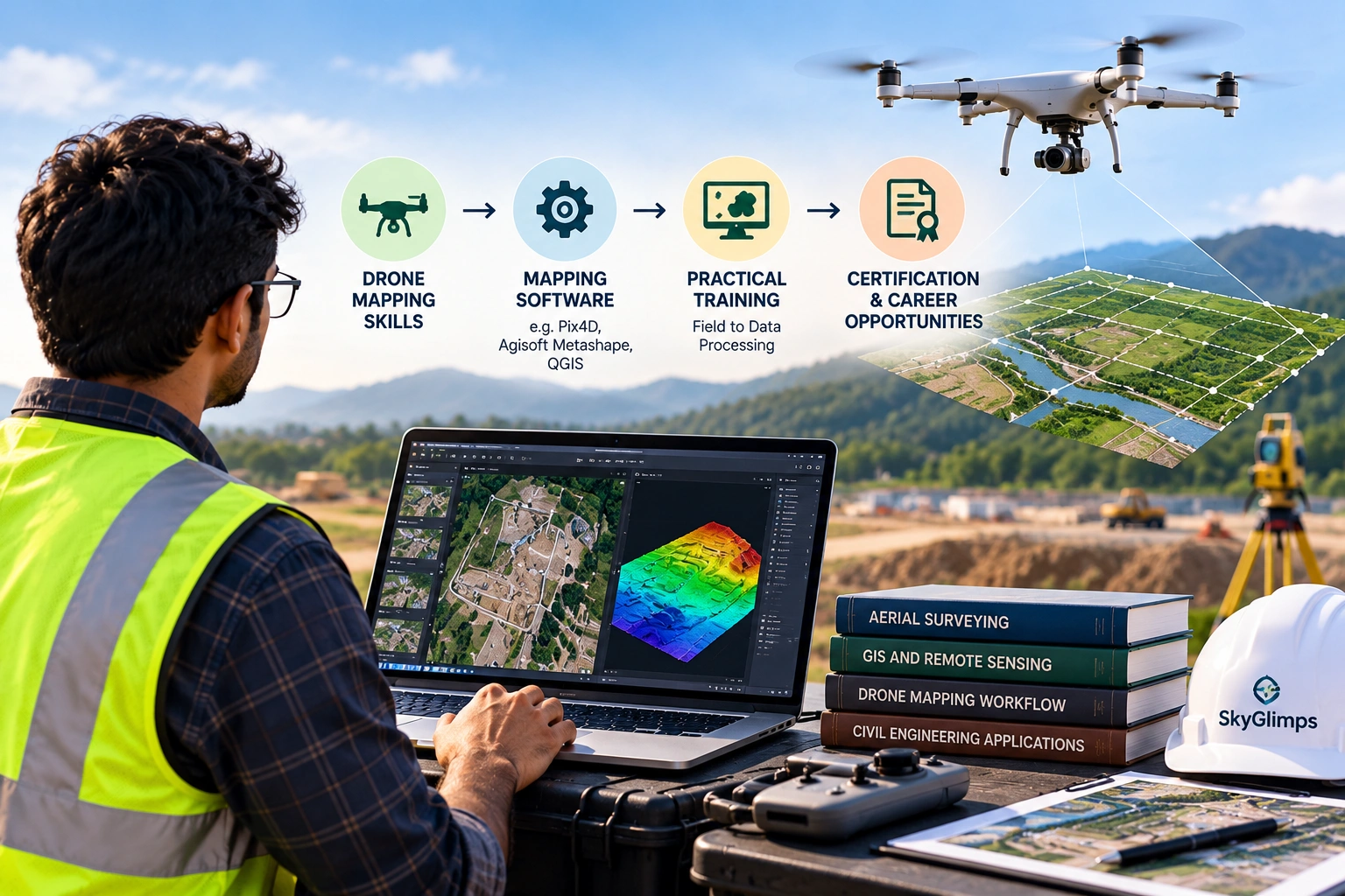
Learning to fly a drone is only the beginning of professional drone mapping.
If you want to learn drone mapping for surveying, construction, infrastructure, mining, land development or GIS projects, you need to understand the complete workflow—from planning the flight to producing usable spatial data.
A professional drone mapping workflow can involve:
- Mission planning
- Drone and sensor selection
- Flight planning
- Image capture
- Ground Control Points (GCPs)
- RTK/PPK positioning
- Photogrammetry
- Orthomosaic generation
- Point cloud processing
- DEM and DSM creation
- Contour generation
- GIS analysis
- Quality control
- Final survey deliverables
The goal is not simply to capture aerial photographs.
The goal is to turn aerial data into accurate, useful and project-ready information.
For beginners, the learning path can initially look complicated. However, when divided into practical stages, it becomes much easier to understand.
What Is Drone Mapping?
Drone mapping is the process of using drones and specialised sensors to capture aerial data and convert it into maps, measurements, 3D models and other spatial outputs.
A typical photogrammetry-based workflow looks like:
Drone Flight → Aerial Images → Image Processing → Point Cloud → Surface Model → Orthomosaic/3D Output
Depending on the project, drone mapping can produce:
- Orthomosaic maps
- Point clouds
- Digital Elevation Models (DEM)
- Digital Surface Models (DSM)
- Contour maps
- 3D models
- Digital terrain information
- Volume calculations
- GIS-ready spatial data
Drone mapping is therefore different from aerial photography.
Aerial photography focuses primarily on capturing images.
Drone mapping focuses on capturing images or sensor data in a structured way so that spatial information can be extracted from it.
Can Beginners Learn Drone Mapping?
Yes. Beginners can learn drone mapping by progressing from basic drone knowledge to flight planning, data capture, processing and spatial analysis.
You do not need to master every technical concept on your first day.
A practical learning sequence is:
Drone Fundamentals → Flight Planning → Data Capture → Photogrammetry → Mapping Outputs → GIS → Accuracy & QA/QC → Real Projects
This approach allows you to develop each skill in the order in which it is used.
If you already have experience in surveying, civil engineering, GIS or construction, some concepts may be easier to understand because you already know how spatial data is used.
What Skills Do You Need to Learn Drone Mapping?
A professional drone mapping skill set combines flying, surveying, data processing and spatial analysis.
1. Drone Fundamentals
Start by understanding the aircraft itself.
Learn:
- Drone components
- Flight controls
- Batteries
- Sensors
- Payloads
- Flight modes
- Positioning systems
- Basic maintenance
- Safety procedures
You should understand what the drone is doing before you start using it for mapping.
A mapping project can fail even when the drone flies successfully if the wrong settings or flight strategy are used.
2. Mission Planning
Mission planning is one of the most important skills to develop.
Before flying, you need to determine:
- Survey boundary
- Required coverage
- Flight altitude
- Image overlap
- Flight direction
- Ground speed
- Battery requirements
- Take-off and landing area
- Obstacles
- Weather conditions
- Operational restrictions
The flight should be designed around the required final output, not simply around how much area the drone can cover.
For example, a site requiring detailed mapping may need a different flight plan from a project requiring only general aerial documentation.
3. Image Acquisition
Good mapping starts with good data.
When collecting aerial imagery, learn how factors such as the following affect the final dataset:
- Camera settings
- Lighting
- Flight altitude
- Image overlap
- Motion
- Wind
- Terrain
- Surface characteristics
If the images do not provide sufficient coverage or quality, processing software cannot completely fix the underlying data problem.
4. Ground Control Points
Ground Control Points, or GCPs, are known or measured points on the ground that can be incorporated into a mapping workflow.
You should learn:
- What GCPs are
- Why they are used
- How their coordinates are obtained
- How they are distributed across a site
- How GCPs differ from checkpoints
- When ground control may be required
GCPs become particularly important when project accuracy and alignment requirements are higher.
SkyGlimps’ current Drone Mapping & Surveying Course specifically includes accuracy, GCPs and coordinate systems as part of its training.
5. RTK and PPK
If you want to work professionally in drone surveying, you should understand positioning technologies such as RTK and PPK.
At a basic level, learn:
- What RTK means
- What PPK means
- How positioning corrections work
- How RTK/PPK can improve positioning information
- How RTK/PPK differs from conventional GNSS positioning
- When ground control may still be relevant
Do not treat RTK or PPK as a replacement for understanding the complete survey methodology.
The technology is one part of the workflow.
6. Photogrammetry
Photogrammetry is at the centre of many drone mapping workflows.
It uses overlapping images to derive spatial information.
A simplified process is:
Images → Alignment → Tie Points → Point Cloud → Surface Model → Mapping Outputs
You should understand what happens at each stage.
This helps you troubleshoot problems instead of simply clicking through processing software.
7. GIS
GIS, or Geographic Information System technology, helps professionals manage, analyse and visualise spatial information.
For drone mapping, basic GIS skills can help you:
- View orthomosaics
- Manage spatial layers
- Measure areas
- Analyse terrain
- Overlay datasets
- Work with coordinates
- Export spatial files
- Create maps
For professionals working in surveying, civil engineering and infrastructure, GIS can be particularly valuable because drone outputs often need to be combined with existing spatial datasets.
8. CAD
Civil engineering and infrastructure projects often use CAD-based drawings.
Learning basic CAD workflows can help you understand how drone-derived information can be incorporated into engineering environments.
Depending on the role, you may work with:
- Site plans
- Topographic information
- Survey drawings
- Alignment drawings
- Surface information
- Engineering layouts
You do not necessarily need to become a CAD specialist to start learning drone mapping.
However, understanding how spatial data connects with engineering drawings is useful.
9. Accuracy and Quality Control
Professional mapping requires more than a visually attractive map.
You should learn how to evaluate:
- Data coverage
- Image quality
- Ground control
- Positional accuracy
- Coordinate reference systems
- Processing quality
- Gaps
- Distortions
- Final deliverables
A good drone mapping professional should be able to answer:
“How reliable is this dataset for the intended purpose?”
That question is more important than simply asking whether the map looks correct.
What Software Do You Need to Learn for Drone Mapping?
There is no single software package that every drone mapping professional must use.
The software you learn will depend on:
- Employer requirements
- Drone platform
- Project type
- Survey workflow
- Deliverables
- Budget
- Data formats
Instead of memorising software names, first understand the four major software categories involved in a drone mapping workflow.
1. Flight Planning Software
Flight planning software is used to create and manage drone missions.
Typical functions include:
- Drawing survey boundaries
- Setting flight altitude
- Setting image overlap
- Creating flight paths
- Managing waypoints
- Planning battery usage
- Reviewing mission coverage
Examples of commonly encountered platforms include DJI flight-planning tools, DroneDeploy and other mission-planning applications.
The important skill is understanding why a particular flight plan is appropriate for the project.
2. Photogrammetry Processing Software
Photogrammetry software converts aerial images into spatial outputs.
Commonly used software categories include platforms such as:
- Pix4D
- Agisoft Metashape
- RealityCapture
- Other professional photogrammetry platforms
These tools can be used for workflows involving:
- Image alignment
- Point clouds
- Orthomosaics
- Elevation models
- 3D reconstruction
- Measurements
You do not need to learn every platform.
Start with one processing workflow and understand what each stage does.
3. GIS Software
GIS software is used to analyse and manage spatial data.
Popular GIS platforms include:
- QGIS
- ArcGIS Pro
Depending on the project, GIS can help with:
- Layer management
- Coordinate systems
- Spatial analysis
- Map creation
- Area measurements
- Data conversion
- Visualisation
For someone planning a career in drone surveying, basic GIS knowledge can significantly improve your ability to work with mapping deliverables.
4. Point Cloud and 3D Data Software
Point clouds and 3D datasets may require dedicated viewing, editing or processing tools.
Professionals may encounter software such as:
- CloudCompare
- Autodesk tools
- Other point-cloud processing platforms
The exact software depends on the project and required deliverables.
The important thing is to understand how point-cloud data is created and how it can be inspected and used.
What Software Should a Beginner Learn First?
If you are starting from zero, trying to learn five or six software platforms simultaneously can become confusing.
A better approach is:
First: Learn Mission Planning
Understand:
Boundary → Altitude → Overlap → Flight Path → Data Capture
Second: Learn One Photogrammetry Platform
Understand:
Images → Alignment → Point Cloud → Orthomosaic → Elevation Output
Third: Learn Basic GIS
Understand:
Import → Coordinate System → Layers → Analysis → Export
Fourth: Learn Basic Point Cloud Handling
Understand:
Point Cloud → Visualisation → Classification/Filtering → Measurement → Export
Once you understand these workflows, learning another software platform becomes much easier.
The software interface may change, but the underlying process remains similar.
What Is the Best Way to Learn Drone Mapping?
The best way to learn drone mapping is through a combination of theory, practical fieldwork, software training and real project exercises.
A useful learning path can be divided into seven stages.
Stage 1: Learn Drone Fundamentals
Start with:
- Drone components
- Sensors
- Batteries
- Flight controls
- Flight modes
- Payloads
- Basic maintenance
- Safety
At this stage, focus on understanding the aircraft rather than mapping.
Stage 2: Learn Drone Regulations and Safety
If you intend to operate drones professionally in India, understand the applicable regulatory framework.
Learn about:
- Drone categories
- Airspace
- Operational restrictions
- Safety
- Pre-flight checks
- Risk assessment
- Applicable pilot requirements
If you intend to personally operate a drone where Remote Pilot Certificate requirements apply, follow the applicable DGCA training and certification pathway through an authorised RPTO.
DGCA’s training syllabus includes regulatory knowledge, airspace, flight principles, weather, maintenance, risk assessment, safety, payloads and an introduction to drone data and analysis.
Stage 3: Learn Survey Flight Planning
This is where drone flying becomes drone mapping.
Learn how to plan:
- Survey boundaries
- Altitude
- Ground coverage
- Image overlap
- Flight direction
- Battery requirements
- GCP placement
- Data requirements
Always begin with the question:
“What final deliverable does the client need?”
Then work backwards to determine how the flight should be conducted.
Stage 4: Learn Data Processing
Once you can collect suitable imagery, learn how to process it.
Start with:
- Image organisation
- Image quality checks
- Image alignment
- Point-cloud generation
- Orthomosaic generation
- Elevation models
- 3D reconstruction
Do not simply learn which buttons to press.
Understand why each processing stage exists.
Stage 5: Learn GIS and Spatial Data
After producing mapping outputs, learn how to work with them.
Practise:
- Coordinate systems
- Georeferencing
- Layer management
- Measurements
- Spatial analysis
- Map creation
- Data export
This is where drone mapping starts becoming useful to engineering and infrastructure professionals.
Stage 6: Learn Quality Control
Before delivering a project, check:
- Complete coverage
- Image quality
- Alignment
- Ground control
- Accuracy
- Coordinate system
- Data gaps
- Output format
Create a habit of checking your data before leaving the field and again after processing.
Stage 7: Practise Real Projects
Finally, work through realistic project scenarios.
For example:
Project 1: Small Land Parcel
Create:
- Flight plan
- Aerial dataset
- Orthomosaic
- Basic measurements
Project 2: Construction Site
Create:
- Repeat survey
- Orthomosaic
- Progress comparison
- Site documentation
Project 3: Earthwork Site
Create:
- Terrain model
- Contours
- Volume calculation
Project 4: Road Corridor
Create:
- Corridor flight
- Orthomosaic
- Elevation information
- GIS layers
This type of practice helps connect individual skills into a complete workflow.
How Long Does It Take to Learn Drone Mapping?
The time required depends on your background, learning goals and the level of technical expertise you want to develop.
Someone who only wants to understand basic drone mapping concepts can learn the fundamentals relatively quickly.
Someone preparing for professional survey projects needs more extensive training in:
- Flight planning
- Data capture
- Photogrammetry
- GCPs
- RTK/PPK
- GIS
- Accuracy
- Quality control
- Reporting
A structured course can accelerate the learning process because it combines multiple skills into one workflow.
SkyGlimps currently lists its Drone Mapping & Surveying Course as a 5-to-7-day programme in New Town, Kolkata. The course focuses on survey-grade drone operations and includes mission planning, data capture, accuracy, GCPs, coordinate systems, Indian drone regulations for survey operations, camera and sensor basics, RTK drones and real-world mapping workflows.
The course also includes practical exposure to mapping workflows and field equipment used in professional drone surveys.
However, a short course should be viewed as a structured foundation.
Professional proficiency develops through continued practice and real project exposure.
Do You Need to Know Surveying to Learn Drone Mapping?
No, but surveying knowledge can be highly useful for professional drone mapping.
Beginners can learn the technical workflow without being qualified land surveyors.
However, professionals working on engineering and surveying projects should understand concepts such as:
- Coordinates
- Elevation
- Scale
- Accuracy
- GCPs
- Checkpoints
- Contours
- Coordinate systems
- Measurements
- Survey deliverables
If you already work as a civil engineer or surveyor, drone mapping can complement your existing expertise.
You already understand the problem.
Drone mapping gives you another method of collecting the data required to solve it.
Do You Need to Be a Drone Pilot to Learn Drone Mapping?
Not necessarily.
There are two separate skills:
Drone operation: Flying and operating the aircraft safely.
Drone mapping: Planning the survey, collecting suitable data and converting it into mapping outputs.
A company may have:
- A certified drone pilot
- A surveyor
- A GIS professional
- A photogrammetry specialist
working together on one project.
However, learning both flying and mapping can provide a stronger understanding of the complete workflow.
If you intend to personally operate the aircraft for professional work, make sure you follow the applicable Indian regulatory and certification requirements.
What Is the Difference Between Drone Flying and Drone Mapping?
This is one of the most important distinctions for beginners.
| Drone Flying | Drone Mapping |
|---|---|
| Focuses on aircraft operation | Focuses on spatial data |
| Take-off and landing | Survey mission planning |
| Basic manoeuvres | Image acquisition strategy |
| Flight control | Ground control |
| Camera operation | Photogrammetry |
| Aircraft safety | Accuracy and QA/QC |
| General aerial imagery | Maps and 3D outputs |
A good drone pilot may be able to fly an aircraft extremely well.
But that does not automatically mean they can produce a reliable survey dataset.
Similarly, a survey professional may understand mapping but require a qualified pilot to collect the aerial data.
The strongest professional skill set combines the two.
What Can You Create After Learning Drone Mapping?
Once you understand the complete workflow, you can produce different types of mapping outputs.
Orthomosaic Maps
An orthomosaic combines multiple aerial images into a corrected top-down map.
It can be used for:
- Site documentation
- Measurements
- Planning
- Progress monitoring
- Mapping
Digital Elevation Models
DEMs represent elevation information and can support terrain analysis and other mapping workflows.
Digital Surface Models
DSMs represent surface elevation, including visible features such as buildings and vegetation depending on the dataset.
Point Clouds
Point clouds provide three-dimensional spatial information.
They can be used to analyse:
- Terrain
- Buildings
- Structures
- Stockpiles
- Construction sites
Contour Maps
Contour maps represent elevation using lines of equal elevation.
They can support:
- Terrain analysis
- Site planning
- Drainage studies
- Grading
- Engineering workflows
3D Models
Drone imagery can also be processed into three-dimensional representations of surveyed areas and structures.
Volume Calculations
Drone-derived surface data can support calculations involving:
- Stockpiles
- Excavation
- Fill
- Earthwork
- Quarry materials
The reliability of these outputs depends on the survey methodology, data quality and project requirements.
What Industries Use Drone Mapping?
Drone mapping is used across industries where spatial data, site documentation and measurements are important.
Applications include:
Construction
- Site surveys
- Progress monitoring
- Earthwork
- Documentation
Mining
- Stockpile measurement
- Quarry mapping
- Terrain monitoring
- Volume calculations
Roads and Highways
- Corridor mapping
- Construction monitoring
- Route documentation
- Terrain analysis
Real Estate
- Site planning
- Land documentation
- Development monitoring
Agriculture
- Field mapping
- Crop-related spatial analysis
- Land documentation
Infrastructure
- Asset documentation
- Site mapping
- Project monitoring
Irrigation and Water Resources
- Canal mapping
- Embankment documentation
- Waterway mapping
- Infrastructure monitoring
Urban Planning
- Site mapping
- Land-use documentation
- Infrastructure planning
- Spatial analysis
The specific drone, sensor, flight plan and processing workflow should always be selected according to the project.
Can You Learn Drone Mapping Without Buying a Drone?
Yes.
You can learn many parts of the workflow without owning your own aircraft.
You can start with:
- Drone theory
- Mission planning
- Photogrammetry
- GIS
- Coordinate systems
- GCP concepts
- Data processing
- Existing datasets
- Simulator practice
However, practical field experience becomes important when you want to understand:
- Weather
- Battery management
- Take-off and landing
- Site safety
- Obstacle management
- Data capture
- Equipment handling
- GCP placement
- Real-world mission planning
A combination of classroom learning and field exposure is therefore useful for professional development.
SkyGlimps’ current mapping programme includes practical exposure to mapping workflows and field equipment used in professional drone surveys.
What Should You Look for in a Drone Mapping Course?
If you are comparing training providers, do not select a course based only on the words “drone mapping certification.”
Check what you will actually learn.
1. Mission Planning
Does the course teach actual survey mission planning?
2. Practical Data Capture
Will you get hands-on exposure to collecting mapping data?
3. GCPs and Accuracy
Does the course explain GCPs, checkpoints and accuracy?
4. RTK/PPK
Does it introduce modern positioning workflows?
5. Photogrammetry
Will you learn how raw images become usable mapping outputs?
6. GIS
Does the course explain how spatial data is analysed and delivered?
7. Field Equipment
Will you see or use professional mapping equipment?
8. Real-World Projects
Does the training explain how mapping projects are planned and executed outside a classroom?
9. Regulations
Does the course address the applicable Indian drone regulations for survey operations?
SkyGlimps’ current Drone Mapping & Surveying Course covers these core areas, including mission planning, flight strategies, data capture, accuracy, GCPs, coordinate systems, regulations, cameras, RTK drones, mapping sensors and real-world project workflows.
Is Online Training Enough to Learn Drone Mapping?
Online learning can help with theory, but practical field training is valuable if your goal is professional drone mapping.
Online resources can help you understand:
- Photogrammetry
- GIS
- GCPs
- RTK/PPK
- Coordinate systems
- Mapping software
- Drone technology
But field training teaches things that are difficult to understand from videos alone.
For example:
- How to choose a take-off location
- How to handle changing weather
- How to check image coverage
- How to place GCPs
- How to manage batteries
- How to identify site risks
- How to troubleshoot field problems
For professional work, the strongest approach is:
Theory + Software + Practical Field Training + Project Experience
How Can You Build a Drone Mapping Portfolio?
If you want to use drone mapping professionally, create a portfolio while learning.
Your portfolio can include:
Sample 1: Orthomosaic
Show the original aerial imagery and final orthomosaic.
Sample 2: Terrain Model
Show how elevation data was converted into a terrain output.
Sample 3: Contour Map
Demonstrate contour generation from drone-derived elevation data.
Sample 4: Construction Progress
Compare two or more survey dates.
Sample 5: Volume Calculation
Demonstrate a simple stockpile or earthwork workflow.
Sample 6: GIS Project
Show how drone data was integrated with other spatial layers.
Sample 7: Survey Report
Create a sample report containing:
- Project objective
- Survey area
- Equipment
- Flight information
- Data processing
- Accuracy information
- Outputs
- Limitations
A portfolio helps demonstrate that you understand the complete workflow, not just drone controls.
What Mistakes Should Beginners Avoid When Learning Drone Mapping?
Mistake 1: Learning Only How to Fly
Flying is only one part of mapping.
Better approach: Learn flight + data + processing + analysis.
Mistake 2: Focusing Only on Software
Knowing which buttons to press does not mean you understand mapping.
Better approach: Understand what each processing stage is doing.
Mistake 3: Ignoring Accuracy
A beautiful orthomosaic is not automatically an accurate survey.
Better approach: Learn GCPs, RTK/PPK, coordinate systems and quality control.
Mistake 4: Using the Same Flight Plan for Every Project
Different deliverables require different data.
Better approach: Start with the required output and design the mission accordingly.
Mistake 5: Ignoring Data Checks in the Field
Discovering missing imagery after leaving the site can mean another field visit.
Better approach: Review coverage and image quality before leaving.
Mistake 6: Trying to Learn Every Software Platform
This can slow down your learning.
Better approach: Master one workflow before adding another software platform.
Mistake 7: Assuming a Drone Automatically Produces Survey-Grade Data
The drone is only one component of the workflow.
Better approach: Understand the entire methodology from planning to QA/QC.
Learn Drone Mapping: A Step-by-Step Career Path
If your goal is to develop professional skills, follow this sequence.
Step 1: Learn Drone Fundamentals
Understand the aircraft, sensors, batteries and basic operations.
Step 2: Learn Applicable Regulations
Understand the Indian regulatory environment and applicable pilot requirements.
Step 3: Learn Survey Planning
Learn how to design flights around the required deliverables.
Step 4: Learn Data Capture
Understand image overlap, altitude, camera settings and field conditions.
Step 5: Learn GCPs and Positioning
Study:
- GCPs
- Checkpoints
- RTK
- PPK
- Coordinate systems
Step 6: Learn Photogrammetry
Process aerial imagery into:
- Point clouds
- Orthomosaics
- Elevation models
- 3D outputs
Step 7: Learn GIS
Learn how to manage and analyse spatial data.
Step 8: Learn Quality Control
Check accuracy, completeness, alignment and output quality.
Step 9: Learn Reporting
Understand how to turn technical outputs into client-ready deliverables.
Step 10: Build Real Project Experience
Practise with construction, land, mining, roads or infrastructure datasets.
This progression helps turn a beginner into someone who can understand the full drone mapping lifecycle.
How Does SkyGlimps Help You Learn Drone Mapping?
SkyGlimps currently offers a dedicated Drone Mapping & Surveying Course focused on survey-grade drone operations. The programme is designed for civil engineers, surveyors, GIS professionals, drone pilots and students who want to enter the drone mapping and infrastructure sector.
The current course covers:
- Mission planning
- Flight strategies
- Data capture principles
- Accuracy
- Ground Control Points
- Coordinate systems
- Indian drone regulations for survey operations
- Camera fundamentals
- RTK drones
- Mapping sensors
- Real-world mapping project workflows
- Practical mapping exposure
- Professional survey field equipment
The course is currently listed as a 5-to-7-day programme at SkyGlimps’ New Town, Kolkata location.
SkyGlimps also offers a separate DGCA-Certified Small Category Drone Pilot Training programme for candidates who want to develop professional remote-pilot skills. Its training includes regulatory knowledge, simulator practice, hands-on flying, safety, maintenance and final flying assessment.
For someone who wants to understand both drone operation and mapping, a combined learning path can therefore be:
DGCA Pilot Training → Drone Mapping & Surveying → GIS/Photogrammetry → Field Experience
You can explore the current SkyGlimps Drone Mapping & Surveying Course for details about the programme, duration and curriculum.
Frequently Asked Questions
Start with drone fundamentals, mission planning, aerial data capture, GCPs, RTK/PPK, photogrammetry, GIS and quality control. Then practise the complete workflow on real or training datasets.
The basics can be learned progressively, but professional drone mapping requires several connected skills, including flight planning, data processing, surveying concepts, GIS and accuracy assessment.
No. Beginners can learn drone mapping without being surveyors. However, surveying knowledge becomes valuable when working on professional engineering, construction and infrastructure projects.
Software varies by workflow. Common categories include flight-planning software, photogrammetry platforms, GIS software and point-cloud tools. Examples include Pix4D, Agisoft Metashape, QGIS, ArcGIS Pro and CloudCompare.
GIS is not required for every basic mapping task, but it is highly useful for professionals who need to manage, analyse, measure and combine drone-derived spatial data.
There is no single best software for every project. The right choice depends on the drone, dataset, processing requirements, deliverables, budget and employer workflow.
Build the Complete Drone Mapping Skill Set
If you want to learn drone mapping, do not think of it as simply learning how to fly a drone or operate a photogrammetry software package.
Professional drone mapping connects several skills:
Drone Operations → Mission Planning → Data Capture → GCP/RTK → Photogrammetry → GIS → QA/QC → Final Deliverables
Each stage affects the next.
A poorly planned flight can create poor imagery. Poor imagery can produce weak processing results. Weak processing can affect the final map. And an inaccurate or incomplete map can reduce the usefulness of the entire project.
That is why the most effective learning approach is to understand the complete workflow rather than isolated tools.
For beginners, the recommended progression is:
Drone Fundamentals → Regulations → Flight Planning → Mapping → Photogrammetry → GIS → Accuracy → Practical Projects
For professionals such as civil engineers, surveyors and GIS specialists, drone mapping can become a valuable extension of existing technical skills.
SkyGlimps’ current Drone Mapping & Surveying Course provides structured training around survey-grade drone operations, including mission planning, data capture, GCPs, coordinate systems, accuracy, RTK drones, mapping sensors and real-world mapping workflows, with practical exposure included in the programme.
The objective is not simply to learn how to make a map.
It is to understand how reliable aerial data is collected, processed and transformed into information that can support real-world surveying, engineering and infrastructure decisions.