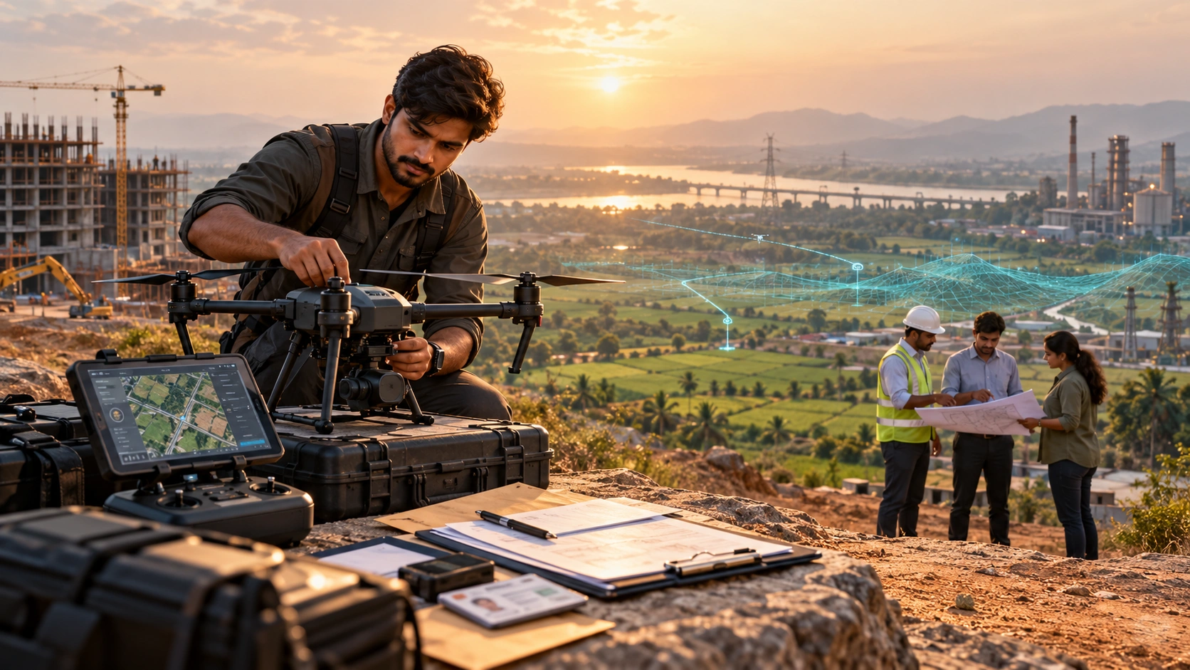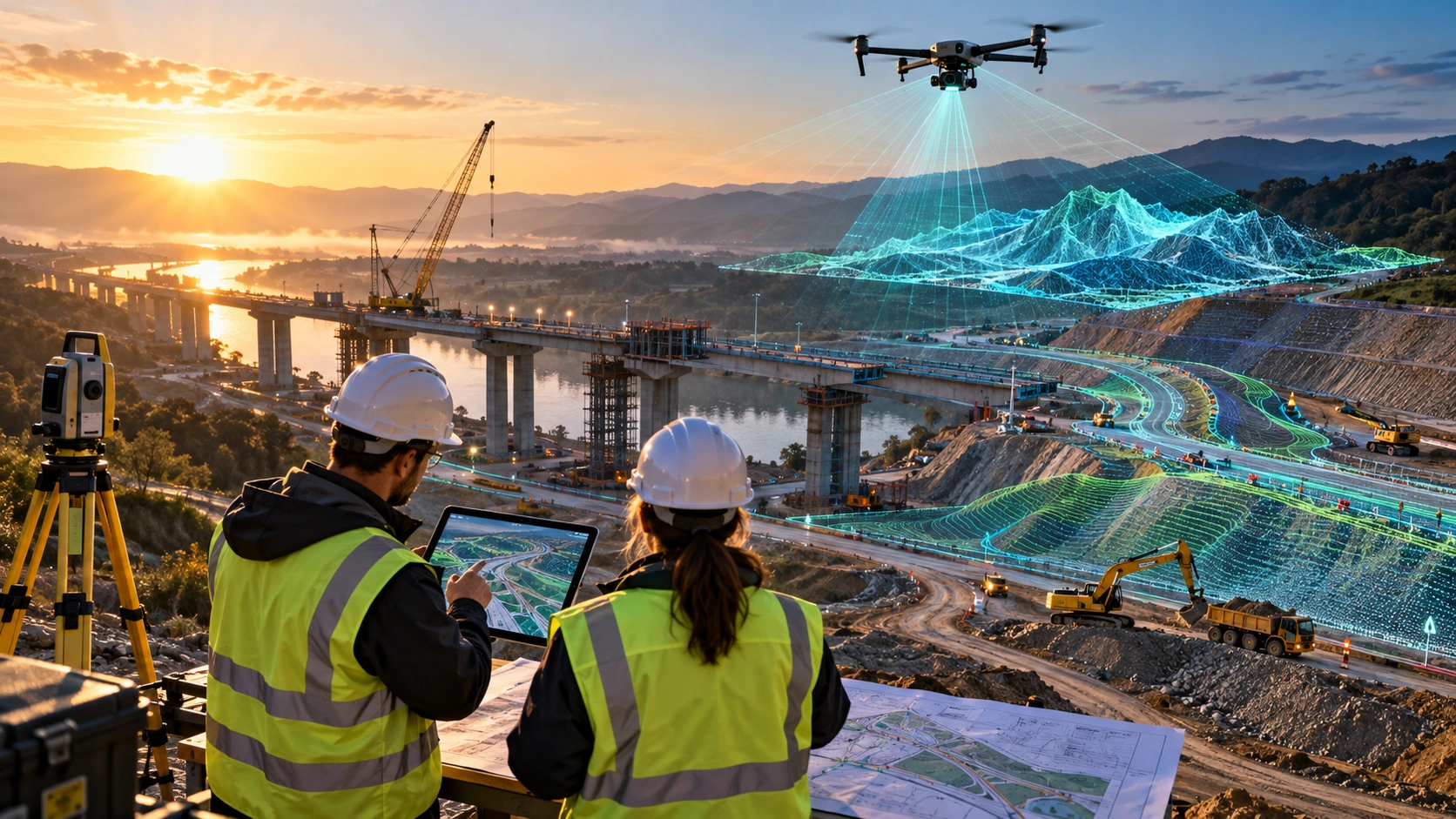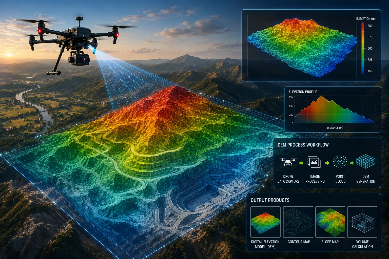
A digital elevation model drone survey helps project teams understand the shape, height, slope, and terrain condition of a site using aerial mapping data. Instead of relying only on manual ground measurements, drones can capture high-resolution images or LiDAR data that can be processed into elevation models, contour maps, terrain surfaces, and GIS-ready outputs.
For infrastructure, mining, road, irrigation, construction, urban planning, and flood-risk projects in India, elevation data is critical. A small change in ground level can affect drainage, road design, embankment stability, excavation planning, stockpile volume, and flood behaviour.
This guide explains what a digital elevation model is, how drones help create DEMs, and what businesses should know before using drone-based elevation data for planning or engineering decisions.
What is a Digital Elevation Model?
A Digital Elevation Model, or DEM, is a digital representation of ground elevation. It shows the height of the terrain surface across an area and helps teams understand slope, drainage, landform, and elevation changes.
In simple terms, a DEM answers the question: “How high or low is the ground at each location?”
A DEM can be used to study:
- Terrain levels
- Slope direction
- Drainage flow
- Low-lying areas
- Road alignment
- Flood-prone zones
- Embankment height
- Cut-fill requirements
- Quarry and mining surfaces
- Land development suitability
A DEM is usually displayed as a raster surface, where each cell or pixel stores an elevation value. It can also be used to create contour lines, slope maps, cross-sections, and 3D terrain views.
For project teams, a DEM is not just a visual output. It is a technical surface that supports planning, measurement, and decision-making.
How is a DEM different from DSM and DTM?
A DEM usually refers to elevation data, but the terms DSM and DTM explain what kind of surface is being represented. A DSM includes surface objects, while a DTM or bare-earth DEM focuses on the ground after removing objects such as trees and buildings.
This distinction matters because different projects need different elevation surfaces.
| Model type | What it represents | Common use |
|---|---|---|
| DEM | General elevation model, often used for ground elevation | Terrain analysis and planning |
| DSM | Surface model including buildings, trees, and objects | Urban modelling and surface analysis |
| DTM | Bare-earth terrain model with surface objects removed | Engineering, drainage, and terrain planning |
For example, a drone survey of a construction site may first create a DSM because it captures the visible surface, including buildings, equipment, stockpiles, and vegetation. If the project needs bare-earth terrain, the data must be processed and classified to remove non-ground features where possible.
For flood modelling, road design, embankment review, and drainage planning, a bare-earth terrain model is usually more useful than a surface model that includes trees or buildings.
How do drones create digital elevation models?
Drones create digital elevation models by capturing aerial imagery or LiDAR data and processing it into a 3D surface. The survey team then converts that surface into an elevation model, contour map, or GIS-ready terrain output.
There are two common drone-based methods:
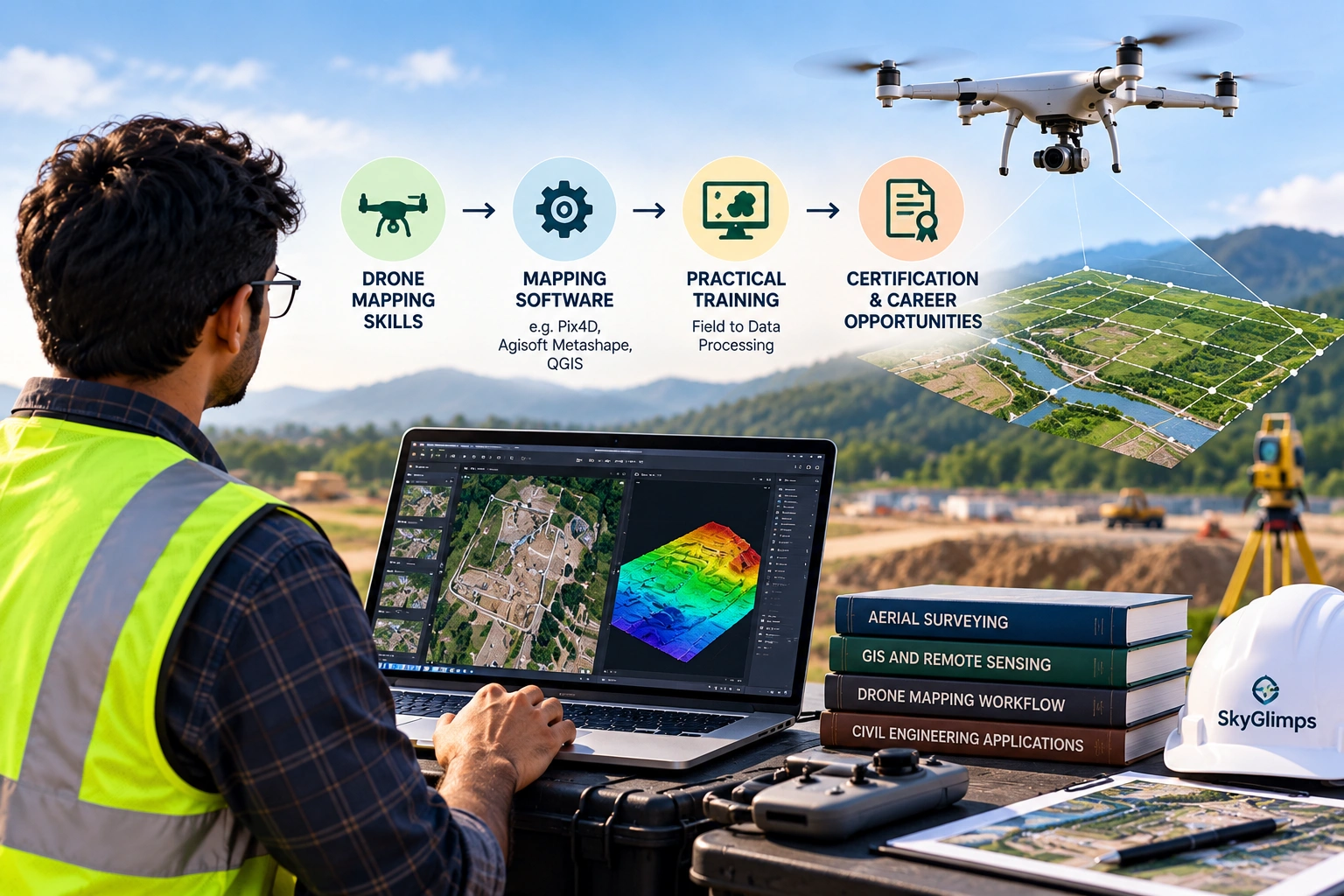
- Photogrammetry: The drone captures many overlapping RGB images. Software matches common points between images and creates a 3D model, orthomosaic, point cloud, and elevation surface.
- LiDAR: The drone uses a laser scanner to measure distances to the ground and objects. These measurements create a dense 3D point cloud that can be processed into terrain and surface models.
A typical digital elevation model drone workflow includes:
- Define the survey boundary.
- Review project requirements.
- Plan the drone flight.
- Check airspace and site safety.
- Capture aerial images or LiDAR data.
- Process the data into a point cloud or surface.
- Classify ground and non-ground points where required.
- Generate DEM, DSM, contours, or GIS files.
- Perform quality checks.
- Deliver maps, models, and reports.
For advanced terrain and 3D workflows, Skyglimps Technologies LLP provides 3D LiDAR & GIS Solutions for organisations that need elevation models, point clouds, and GIS-ready data.
What equipment is used to create a drone DEM?
A drone DEM workflow may use a UAV platform, RGB camera, LiDAR sensor, GNSS receiver, RTK or PPK positioning, ground control points, and processing software. The equipment depends on the required accuracy, site condition, and deliverables.
A professional setup may include:
| Equipment | Purpose |
| Drone platform | Carries the camera or LiDAR payload |
| RGB camera | Captures images for photogrammetry |
| LiDAR sensor | Captures 3D laser measurements |
| GNSS receiver | Supports location accuracy |
| RTK / PPK workflow | Improves positioning reliability |
| Ground control points | Helps align and verify survey data |
| Checkpoints | Used for accuracy validation |
| Processing software | Converts raw data into DEMs and maps |
| GIS software | Organises and analyses final spatial outputs |
The equipment should match the project. A simple land documentation project may need photogrammetry. A floodplain, forested terrain, embankment, or infrastructure corridor may need LiDAR and stronger control methods.
Skyglimps does not need to mention exact drone or sensor models unless those details are approved internally. For client-facing content, it is safer to explain the professional workflow clearly.
What is the role of ground control in DEM accuracy?
Ground control improves DEM accuracy by linking drone data to known survey points on the ground. These points help align the drone model with real-world coordinates and reduce positional errors.
Ground control is especially important when the DEM will be used for measurement, engineering review, volume calculation, drainage analysis, or government project documentation.
Common control methods include:
- Ground Control Points
- Independent checkpoints
- RTK drone positioning
- PPK post-processing
- GNSS base and rover workflow
- Known project control points
Checkpoints are valuable because they help verify the final output independently. A survey may look visually correct, but checkpoints help confirm whether the model is accurate enough for the intended use.
For terrain and elevation projects, vertical accuracy is especially important. A small elevation error can affect drainage direction, flood-risk interpretation, cut-fill quantities, or slope analysis.
What deliverables come from a drone DEM survey?
A drone DEM survey can produce elevation models, contour maps, slope maps, drainage analysis layers, cross-sections, 3D terrain models, point clouds, and GIS-ready files. The final deliverables should be selected based on the project objective.
Common deliverables include:
| Deliverable | Best use |
| DEM | Terrain elevation analysis |
| DSM | Surface height including objects |
| DTM | Bare-earth terrain modelling |
| Contour map | Elevation planning and level review |
| Slope map | Terrain steepness analysis |
| Drainage map | Water-flow and low-lying area review |
| Point cloud | 3D spatial analysis |
| Cross-sections | Roads, drains, embankments, and corridors |
| Orthomosaic map | Top-down visual site reference |
| GIS layers | Planning and spatial workflows |
| PDF report | Stakeholder review and documentation |
A good drone survey partner should define the deliverable before the flight. “DEM” is not always enough. The client should know whether they are receiving a bare-earth DEM, DSM, contours, point cloud, GIS files, or a report.
Where are drone DEMs used in real projects?
Drone DEMs are used in projects where elevation, slope, drainage, terrain, earthwork, or surface change matters. They are especially useful for infrastructure, mining, water resources, construction, and urban planning.
A digital elevation model drone survey can support:
- Road and highway planning
- Drainage design
- Flood-risk assessment
- Embankment monitoring
- Mining volume calculation
- Quarry surface mapping
- Construction site grading
- Cut-fill analysis
- Irrigation and canal planning
- Smart city mapping
- Real estate site development
- Industrial land planning
For example, a road project may use a DEM to review slope and drainage. A mining site may use it for stockpile and excavation review. A water-resource project may use it to identify low-lying areas and embankment levels. A real estate developer may use it to understand land grading before construction.
For recurring project records, drone-based documentation and progress tracking can help teams compare terrain and site changes over time.
How do DEMs support drainage and flood-risk planning?
DEMs support drainage and flood-risk planning by showing how land slopes and where water may collect or flow. This is useful for cities, roads, embankments, irrigation projects, and low-lying areas.
Drainage problems are often elevation problems. A small difference in road level, canal edge, outfall, or site grading can affect water movement.
DEMs can help identify:
- Low-lying zones
- Natural drainage paths
- Slope direction
- Embankment levels
- Canal and riverbank terrain
- Waterlogging-prone areas
- Roadside drainage constraints
- Floodplain surface variation
- Surface flow patterns
For Eastern India, where monsoon rainfall, rivers, wetlands, canals, and low-lying terrain can create water-management challenges, drone DEMs can support better site-level planning.
For water-related applications, drone data can also support irrigation and water resources projects involving canals, embankments, drainage routes, and flood-prone areas.
How do DEMs help mining and quarry volume calculation?
DEMs help mining and quarry volume calculation by creating terrain surfaces that can be compared across time or against a reference surface. This helps calculate stockpiles, excavation areas, overburden, and cut-fill quantities.
Mining and quarry sites change frequently. A DEM or DSM can help show what material has been added, removed, or reshaped.
A volume workflow may include:
- Capture current drone data.
- Create a surface model.
- Define stockpile or excavation boundaries.
- Select a base surface.
- Compare surfaces.
- Calculate volume.
- Generate tables and maps.
- Repeat surveys for comparison.
DEMs and surface models are also useful for haul road planning, bench review, slope observation, and site documentation.
For mining and quarry workflows, drone data can support mining and infrastructure projects where aerial mapping and terrain visibility are useful for operational planning.
How does LiDAR improve DEM creation?
LiDAR improves DEM creation by capturing dense 3D point cloud data using laser measurements. It can be especially useful where terrain is complex, vegetation is present, or higher-quality 3D data is required.
Photogrammetry depends on visible surface features in images. LiDAR directly measures distances using laser pulses and can provide strong 3D datasets for terrain and surface modelling.
LiDAR is useful for:
- Forested or vegetated terrain
- Urban planning projects
- Floodplain modelling
- Road corridors
- Power corridors
- Embankments
- Mining and quarry sites
- Infrastructure assets
- Complex slopes
- 3D city and digital twin workflows
LiDAR does not automatically solve every survey problem. It still needs good flight planning, positioning, calibration, processing, classification, and quality checks. But for many terrain-heavy projects, it gives stronger point cloud data than visual imagery alone.
What affects the quality of a drone DEM?
The quality of a drone DEM depends on flight planning, ground control, sensor quality, image overlap, LiDAR density, weather, surface visibility, processing method, and quality checks. A poor workflow can produce weak elevation data even if the drone equipment is good.
Important quality factors include:
- Flight altitude
- Image overlap
- Ground sampling distance
- RTK or PPK workflow
- GCP and checkpoint quality
- Camera calibration
- LiDAR point density
- Vegetation cover
- Surface texture
- Wind and weather
- Lighting and shadows
- Processing settings
- Ground classification method
- Coordinate system
- Vertical datum
A DEM should always be created based on its intended use. A basic planning map does not need the same controls as an engineering-grade elevation model. A flood-risk study may need stronger terrain processing than a visual site documentation project.
The survey team should explain assumptions, limitations, and accuracy checks clearly in the final report.
How should businesses choose a drone DEM survey partner?
Businesses should choose a drone DEM survey partner by checking survey workflow, LiDAR or photogrammetry capability, ground control process, GIS output quality, reporting clarity, and industry experience. The partner should understand the final use of the elevation data.
Ask these questions before hiring:
- Will the DEM be created using photogrammetry, LiDAR, or both?
- Will you use RTK, PPK, GCPs, or checkpoints?
- What accuracy checks will be performed?
- Will the output be a DEM, DSM, DTM, or all required models?
- Can you provide contour maps and GIS files?
- What coordinate system and vertical reference will be used?
- Can you deliver CAD or GIS-compatible outputs?
- What are the limitations of the survey?
- Can repeat surveys be compared over time?
- What report format will be delivered?
A good partner will not only fly the drone. It will help define the deliverables and processing workflow before data capture begins.
Why choose Skyglimps Technologies for drone DEM and elevation mapping?
Skyglimps Technologies LLP is a Kolkata-based drone services company and DGCA-certified Remote Pilot Training Organisation serving government and enterprise clients across Eastern India. The company supports drone-enabled workflows across LiDAR, GIS, mapping, inspections, documentation, surveillance, and training.
Skyglimps Technologies, a DGCA-certified RPTO in Kolkata, is positioned for organisations that need structured 3D spatial data for infrastructure, mining, water resources, urban planning, real estate, and construction projects.
For projects in Kolkata, West Bengal, Jharkhand, Odisha, and Eastern India, local coordination can help improve site scoping, field execution, repeat monitoring, and reporting.
A digital elevation model drone workflow is most valuable when the output is tied to a clear project decision: drainage planning, road design, flood-risk review, quarry measurement, earthwork analysis, or site documentation.
FAQ: Digital Elevation Model Drone
A digital elevation model is a digital representation of ground elevation. It shows terrain height and supports slope, drainage, contour, flood-risk, and planning analysis.
Drones create DEMs by capturing overlapping images or LiDAR data. The data is processed into point clouds, surfaces, elevation models, contours, and GIS-ready outputs.
A DEM usually represents ground elevation, while a DSM includes surface objects such as trees, buildings, stockpiles, and structures.
LiDAR is often better for complex terrain, vegetation, and detailed 3D capture. Photogrammetry can be suitable for open, visible surfaces and standard mapping.
Ground control points help align drone data with real-world coordinates. They improve confidence in DEM accuracy, especially for engineering and planning uses.
Deliverables may include DEMs, DSMs, DTMs, contour maps, slope maps, drainage layers, point clouds, orthomosaics, cross-sections, GIS files, and PDF reports.
Drone DEM data is used by surveyors, engineers, mining teams, road agencies, water resource departments, urban planners, construction teams, and infrastructure consultants.
Use drone elevation data for better project decisions
A digital elevation model drone survey helps organisations understand terrain, slope, drainage, earthwork, flood risk, and site changes with better visual and spatial clarity. It turns drone data into elevation outputs that can support planning, design, monitoring, and reporting.
For infrastructure, mining, road, irrigation, construction, urban planning, and real estate projects, drone-based DEMs can reduce information gaps and improve site-level decision-making.
If your organisation needs digital elevation models, LiDAR point clouds, contour maps, terrain analysis, GIS-ready files, or drone-based elevation mapping in Kolkata, West Bengal, or Eastern India, connect with Skyglimps Technologies LLP through the 3D LiDAR & GIS Solutions service page and share your project location, survey objective, and required deliverables.