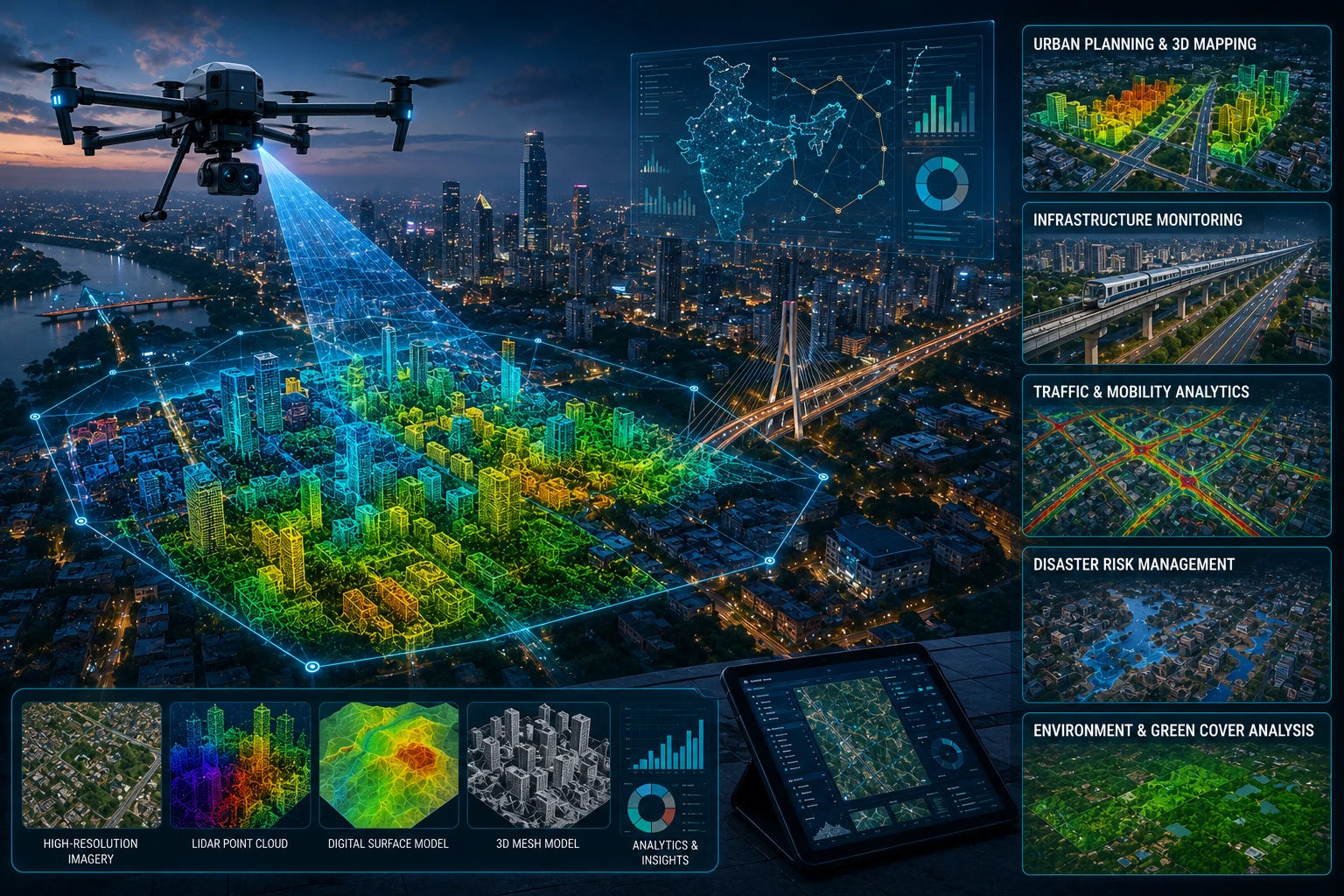
Drone geospatial smart city data is changing how Indian cities plan, monitor, and manage urban infrastructure. By combining drone imagery, LiDAR point clouds, orthomosaic maps, 3D models, GIS layers, and location-tagged inspection records, city teams can understand roads, buildings, utilities, drains, trees, flood-prone areas, and public assets with better spatial clarity.
Smart city projects need more than attractive dashboards. They need current, accurate, and usable data about what exists on the ground. Drones help capture this data quickly across urban blocks, road corridors, water bodies, construction zones, industrial areas, and public infrastructure sites.
For cities in Kolkata, West Bengal, and Eastern India, drone-enabled geospatial data can support urban planning, digital twins, asset management, mobility planning, flood-risk review, construction monitoring, and better civic decision-making.
What is drone geospatial smart city data?
Drone geospatial smart city data is location-based urban data captured by drones and processed into maps, models, GIS layers, or digital records for city planning and management. It connects aerial visibility with measurable spatial information.
A drone can capture images, video, LiDAR, thermal data, or inspection visuals. When this information is processed geospatially, it can be used inside GIS, CAD, BIM, digital twin, or urban planning workflows.
Common drone geospatial outputs include:
- Orthomosaic maps
- 3D point clouds
- 3D city models
- Digital elevation models
- Digital surface models
- Contour maps
- Road corridor maps
- Utility corridor records
- Asset inventory layers
- Inspection reports
- Flood-risk and drainage layers
- Construction progress documentation
The value is not only in capturing images from the air. The value is in turning those images into location-based information that planners, engineers, departments, contractors, and decision-makers can use.
Why do smart city projects need drone geospatial data?
Smart city projects need drone geospatial data because urban decisions depend on current, accurate, and location-aware information. Roads, drains, buildings, trees, streetlights, bridges, utilities, and public spaces must be mapped and monitored in relation to each other.
Many urban datasets become outdated quickly. A road may be widened, a drain may be blocked, a building may be extended, trees may be removed, a new flyover may be built, or a waterlogging issue may appear after development. Drone surveys help update the ground reality.
Drone geospatial data can support:
| Smart city need | How drone data helps |
|---|---|
| Urban planning | Creates current maps and 3D site views |
| Asset management | Maps civic assets and infrastructure |
| Mobility planning | Reviews roads, junctions, parking, and corridors |
| Drainage planning | Identifies slopes, waterlogging, and outfalls |
| Digital twins | Provides 3D and GIS-ready base data |
| Construction monitoring | Tracks progress across public works |
| Disaster planning | Maps flood-prone and high-risk areas |
| Utility coordination | Shows visible utility corridors and conflicts |
For government agencies and urban consultants, drone data improves visibility before decisions are made. It helps reduce dependence on outdated maps, scattered field photos, and incomplete site records.
How are drones used for 3D city mapping?
Drones are used for 3D city mapping by capturing overlapping images or LiDAR scans that can be processed into point clouds, surface models, and 3D urban representations. These outputs help planners visualise and measure the city in three dimensions.
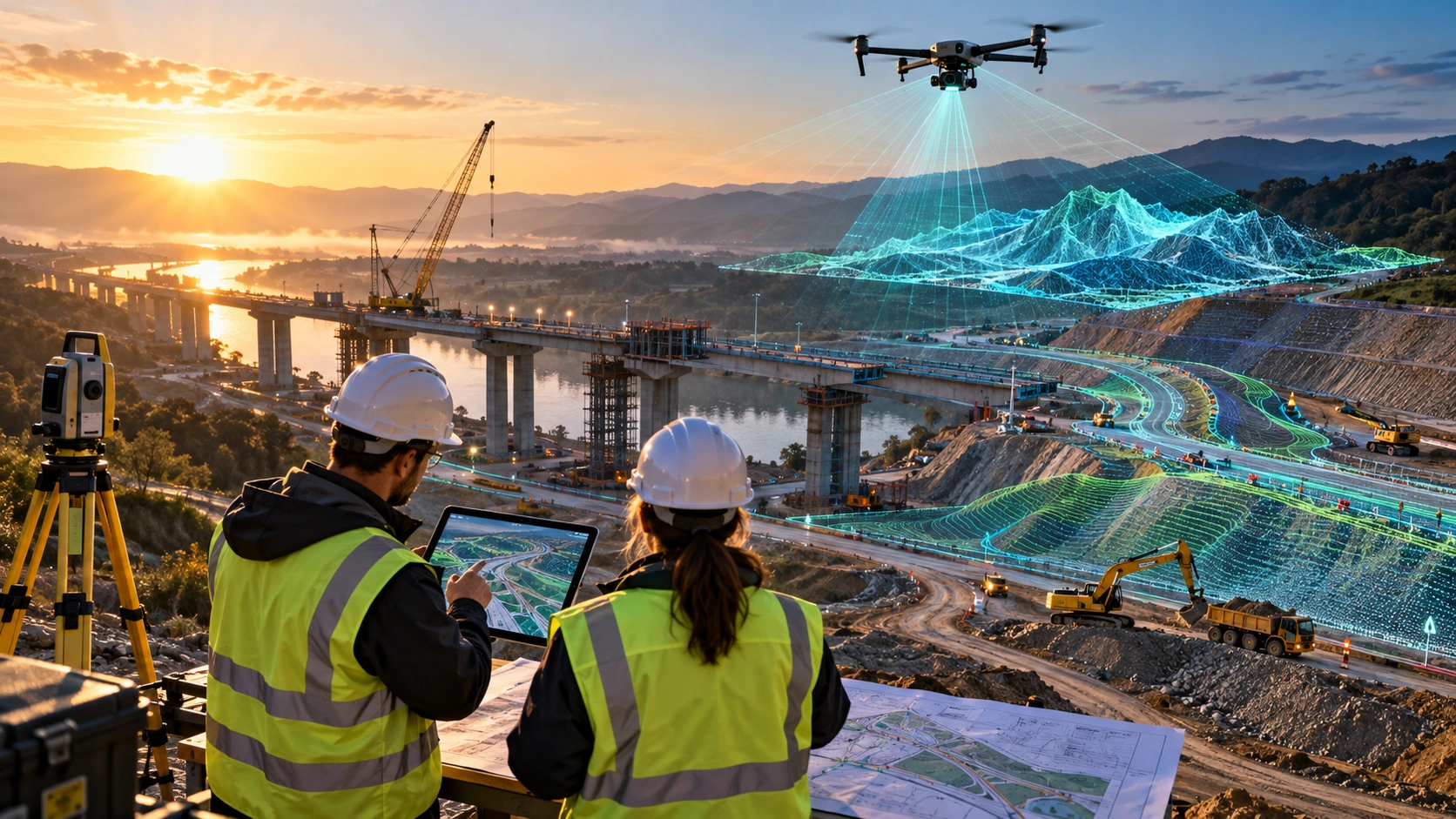
A 3D city map can show building heights, road levels, flyovers, bridges, trees, open spaces, drainage channels, and urban structures. This is useful because cities are not flat. Height, slope, clearance, shadow, and vertical density all affect planning.
Drone-based 3D city mapping can support:
- Building-height analysis
- Road and flyover modelling
- Urban redevelopment planning
- Public asset mapping
- Smart city digital twin workflows
- Utility corridor planning
- Tree canopy review
- Drainage and flood-risk modelling
- Infrastructure project monitoring
For advanced 3D and GIS workflows, Skyglimps Technologies LLP provides 3D LiDAR & GIS Solutions for organisations that need LiDAR point clouds, terrain models, spatial layers, and planning-ready outputs.
How does drone data support urban asset management?
Drone data supports urban asset management by creating location-tagged records of roads, drains, poles, streetlights, trees, buildings, bridges, culverts, signs, and other public assets. These records help departments plan maintenance and reduce information gaps.
Cities manage thousands of visible assets. Without a structured inventory, maintenance becomes reactive. Drone surveys can help create a mapped record of what exists and where it is located.
Drone geospatial data can support asset records for:
- Roads and lanes
- Footpaths
- Streetlights
- Electric poles
- Telecom poles
- Trees and green cover
- Bridges and flyovers
- Culverts
- Stormwater drains
- Public buildings
- Parks and open spaces
- Road signs and medians
- Water bodies and canals
Once assets are mapped in GIS, departments can add maintenance status, ownership, condition notes, inspection dates, and priority levels. This makes civic management more structured.
A drone survey does not replace every ground inspection. It helps build the first layer of visibility and shows where detailed verification is needed.
How can drones improve road, traffic, and mobility planning?
Drones can improve mobility planning by giving planners an aerial view of road geometry, traffic conflict points, junction layout, parking pressure, pedestrian movement, and corridor constraints. This helps cities review movement patterns with better spatial context.
Urban mobility decisions need clear site understanding. A road may look wide in a plan but may have encroachments, poor turning radius, unmanaged parking, broken footpaths, or blocked service lanes on the ground.
Drone mapping can help review:
- Road width and alignment
- Junction layout
- Median and service road conditions
- Parking patterns
- Pedestrian crossing areas
- Bus stop locations
- Flyover and bridge approaches
- Construction diversions
- Roadside obstructions
- Drainage along roads
- Encroachment indicators
For smart cities, this data can support redesign discussions, traffic-flow planning, public safety reviews, corridor improvement, and infrastructure monitoring.
For road and corridor projects, Skyglimps also supports 2D Surveying & Mapping to create aerial maps and site documentation for planning and project review.
How does drone geospatial data support drainage and flood planning?
Drone geospatial data supports drainage and flood planning by mapping terrain, slopes, low-lying areas, drains, outfalls, water bodies, embankments, and visible waterlogging zones. This is especially important for cities affected by monsoon pressure.
Urban flooding is often highly local. A blocked drain, low road section, unplanned construction, or poorly graded outfall can create waterlogging even when the larger drainage network exists on paper.
Drone data can help identify:
- Low-lying roads
- Waterlogging-prone locations
- Blocked or narrowed drainage paths
- Canal and outfall conditions
- Encroachment near drains
- Floodplain constraints
- Roadside slope problems
- Embankment and riverbank changes
- Access routes for emergency response
In Kolkata, West Bengal, and Eastern India, monsoon rainfall, river systems, wetlands, canals, and dense urban growth make drainage visibility essential. Drone-based terrain and GIS layers can help water-resource and urban teams plan maintenance more effectively.
For water-related urban work, drone data can also support irrigation and water resources projects involving canals, embankments, flood zones, and drainage systems.
How are drones used for smart city construction monitoring?
Drones are used for smart city construction monitoring by capturing dated aerial records of public works, roads, bridges, drainage projects, parks, buildings, and infrastructure upgrades. This helps departments compare progress over time.
Smart city projects often involve multiple contractors and public agencies. Progress may be happening across several locations at once. Drone surveys create consistent visual records that can be reviewed in meetings and reports.
Drone construction monitoring can track:
- Road construction
- Drainage upgrades
- Public building work
- Bridge and flyover progress
- Park development
- Utility corridor work
- Smart pole installation
- Riverfront or waterfront development
- Urban redevelopment activity
- Site clearance and earthwork
For recurring project records, drone-based documentation and progress tracking can help teams maintain stage-wise visual evidence across the project lifecycle.
This is useful for contractor coordination, management updates, public reporting, and milestone verification.
How does drone data support digital twins for smart cities?
Drone data supports digital twins by providing current 2D and 3D spatial information that can be integrated with GIS, BIM, IoT, asset databases, and planning systems. A digital twin becomes useful when it reflects real site conditions, not only design intent.
A smart city digital twin may include:
- 3D buildings
- Terrain models
- Road networks
- Utility layers
- Asset records
- Drainage systems
- Land-use layers
- Inspection data
- Construction progress
- Sensor or IoT inputs
- Emergency response layers
Drones help update the physical layer of the digital twin. They can capture what exists, what changed, and what needs attention.
A digital twin is not built from drone data alone. It needs data governance, GIS structure, department coordination, standards, updates, and clear use cases. Drone data becomes one important input in that larger system.
What deliverables should smart city teams expect?
Smart city teams should expect drone deliverables that are usable in planning, GIS, reporting, and asset-management workflows. The deliverables should be defined before the survey begins.
Common deliverables include:
| Deliverable | Smart city use |
| Orthomosaic map | Top-down city or project-area view |
| Drone video | Site overview and stakeholder communication |
| 3D point cloud | Measurable urban geometry |
| 3D city model | Visual planning and digital twin workflows |
| DEM / DSM | Terrain, drainage, and built-surface analysis |
| Contour map | Elevation and slope review |
| Asset inventory layer | Civic asset management |
| GIS files | Planning and department workflows |
| Inspection report | Maintenance and risk prioritisation |
| Progress report | Public works monitoring |
| Before-after comparison | Change detection and project review |
The output should match the user. Engineers may need GIS and CAD files. Administrators may need reports. Smart city teams may need dashboard-ready layers. Contractors may need progress documentation. Public communication teams may need clear visual content.
How should Indian agencies plan a drone geospatial smart city project?
Indian agencies should plan a drone geospatial smart city project by defining the use case, survey boundary, data accuracy, deliverables, update frequency, permissions, and department users before capture begins. A clear plan prevents unusable data.
Before commissioning a drone survey, answer these questions:
- What city problem should the drone data solve?
- Which area or corridor needs mapping?
- Is the goal asset mapping, planning, drainage, mobility, or monitoring?
- Is 2D mapping enough, or is 3D data required?
- Are LiDAR, GIS, or digital twin-ready outputs needed?
- What accuracy level is required?
- Which file formats are needed?
- Who will use the final data?
- Will the data be updated regularly?
- Are airspace and site permissions clear?
- How will the data be stored and shared?
- What reporting format is required?
Smart city drone projects work best when they begin with the final decision. Capturing data without a defined use case can create large files that no department knows how to use.
Why choose Skyglimps Technologies for smart city geospatial projects?
Skyglimps Technologies LLP is a Kolkata-based drone services company and DGCA-certified Remote Pilot Training Organisation serving government and enterprise clients across Eastern India. The company supports drone-enabled workflows across LiDAR, GIS, mapping, inspections, surveillance, documentation, and training.
Skyglimps Technologies, a DGCA-certified RPTO in Kolkata, is positioned for organisations that need structured geospatial data for urban planning, smart city projects, public infrastructure, utilities, drainage, road corridors, and digital twin-ready workflows.
For projects in Kolkata, West Bengal, and Eastern India, local coordination can help improve site scoping, field execution, repeat data capture, department communication, and reporting.
A drone geospatial smart city workflow is most valuable when it turns aerial data into usable planning intelligence.
FAQ: Drone Geospatial Smart City
Drone geospatial smart city data is location-based urban data captured by drones and processed into maps, 3D models, point clouds, GIS layers, or reports for planning and management.
Drones help smart city projects by mapping roads, buildings, drains, utilities, trees, assets, flood-prone zones, construction sites, and public infrastructure from above.
Yes. Drones can create 3D city models using photogrammetry or LiDAR data. These models support planning, digital twins, asset mapping, and infrastructure review.
Yes. Drones can help create mapped records of roads, poles, streetlights, drains, trees, buildings, bridges, and other civic assets for maintenance planning.
Yes. Drone data can map low-lying areas, drainage routes, waterlogging zones, embankments, canals, outfalls, and terrain conditions that affect urban flood risk.
Deliverables may include orthomosaic maps, drone videos, 3D point clouds, DEMs, DSMs, contours, GIS layers, asset maps, inspection reports, and progress reports.
Urban planners, municipal bodies, smart city teams, GIS departments, water resource teams, road agencies, utility companies, contractors, and consultants can use drone geospatial data.
Build smarter cities with better spatial visibility
Drone geospatial smart city data helps urban teams understand what exists, where it exists, and how it is changing. It supports 3D mapping, asset management, drainage planning, mobility studies, construction monitoring, digital twins, and better public infrastructure decisions.
For Indian cities, especially fast-changing regions in Kolkata, West Bengal, and Eastern India, drone-enabled spatial data can improve planning quality and project visibility.
If your organisation needs drone mapping, LiDAR point clouds, GIS layers, 3D city models, asset inventories, or digital twin-ready outputs for smart city projects, connect with Skyglimps Technologies LLP through the 3D LiDAR & GIS Solutions service page and share your project location, planning objective, and required deliverables.