
Drone cut fill calculation helps project teams measure earthwork volumes by comparing existing ground levels with a reference surface, design surface, or previous survey surface. It is used in construction, mining, roads, canals, land development, infrastructure, and site grading projects where teams need to understand how much material has been removed, added, or moved.
In simple terms, “cut” means material removed from the ground, while “fill” means material added to raise a surface. Drone surveys support this process by capturing aerial data, creating elevation models, and generating volume reports from mapped surfaces.
This guide explains how cut and fill calculation works with drone surveys, what data is needed, what affects accuracy, and what clients should define before starting an earthwork volume project.
What is drone cut fill calculation?
Drone cut fill calculation is the process of using drone survey data to estimate how much earth or material has been cut from one area and filled into another. It is based on comparing elevation surfaces across a defined project area.
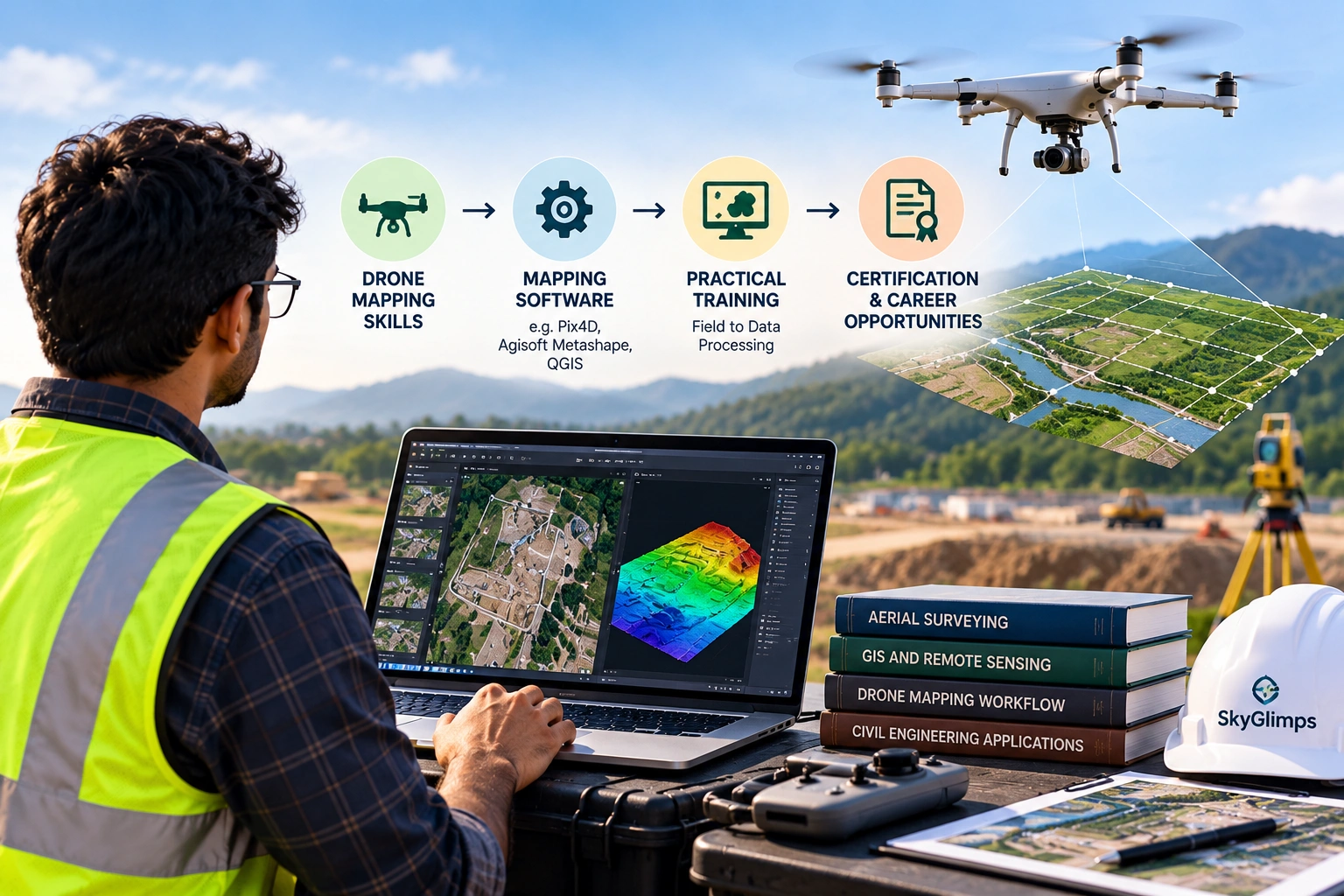
A drone survey captures images or LiDAR data from above. This data is processed into elevation outputs such as a DSM, DTM, point cloud, or terrain model. The software then compares the surveyed surface with a base surface, design level, previous survey, or reference plane.
Drone cut fill calculation is useful for:
- Construction earthwork
- Road and highway projects
- Canal and embankment work
- Mining and quarry surveys
- Stockyard measurement
- Land grading
- Site development
- Excavation tracking
- Contractor progress review
- Quantity estimation support
Skyglimps Technologies LLP provides 2D Surveying & Mapping for organisations that need aerial maps, site documentation, orthomosaic outputs, and survey-ready visual data for professional projects.
What is cut and fill in earthwork?
Cut and fill refers to the movement of earth material during site development. Cut is the volume of material removed from higher areas, and fill is the volume of material added to lower areas.
For example, if a construction site needs to be levelled, soil may be cut from elevated portions and filled into low-lying portions. In road construction, material may be cut from slopes and filled into embankments. In mining or quarrying, excavation surfaces may be compared over time to estimate removed material.
A simple comparison:
| Term | Meaning | Example |
|---|---|---|
| Cut | Material removed from an existing surface | Excavation, quarry removal, road cutting |
| Fill | Material added above an existing or design surface | Embankment, land raising, backfilling |
| Net volume | Difference between cut and fill | Total balance of earth movement |
| Base surface | Reference surface used for comparison | Design level, previous survey, or defined plane |
The result helps teams understand material movement, billing quantities, progress, and site planning needs.
How do drone surveys measure earthwork volumes?
Drone surveys measure earthwork volumes by creating a digital surface of the site and comparing it with another surface or reference level. The difference between the two surfaces becomes the cut or fill volume.
A typical workflow includes:
- Define the project boundary.
- Confirm the earthwork objective.
- Plan the drone flight.
- Capture aerial images or LiDAR data.
- Use GCP, RTK, or PPK where required.
- Process the data into an orthomosaic and elevation model.
- Define the base surface or comparison surface.
- Draw or import the calculation boundary.
- Calculate cut, fill, and net volume.
- Review accuracy, assumptions, and limitations.
- Export the volume report.
The drone does not directly “measure volume” in the air. It captures data that is processed into a measurable surface. The volume calculation depends on the quality of that surface and the reference used for comparison.
What drone outputs are used for cut-fill calculation?
Cut-fill calculation uses elevation-based drone outputs such as DSMs, DTMs, point clouds, and terrain models. These outputs represent the site surface and allow software to calculate height differences across a defined area.
Common supporting outputs include:
| Output | Role in cut-fill calculation |
|---|---|
| Orthomosaic map | Provides top-down visual context |
| DSM | Represents visible surface, including objects |
| DTM | Represents bare-earth terrain where processed properly |
| Point cloud | Provides 3D spatial points for surface modelling |
| Contour map | Helps visualise levels and terrain changes |
| Cross-sections | Shows surface profile across selected lines |
| Volume table | Summarises cut, fill, and net quantity |
| PDF report | Presents findings for project teams |
The correct output depends on the project. For a stockpile, a DSM or point cloud may be useful because the visible surface matters. For road grading, canal work, or land development, a DTM or design surface comparison may be more suitable.
What is a base surface in volume calculation?
A base surface is the reference surface used to compare against the surveyed drone surface. It is one of the most important decisions in drone cut fill calculation because the final volume depends on it.
A base surface may be:
- A previous drone survey surface
- A design surface
- A fixed elevation plane
- A ground-surveyed reference
- A manually defined boundary surface
- An imported CAD or LandXML surface
- A DTM or terrain model
- A stockpile base estimate
For example, if a pile is measured against a wrong base surface, the volume result may be misleading. If an excavation is compared with the wrong previous survey date, the cut quantity may not match actual progress.
Before calculation begins, the client and survey team should agree on the base surface.
How are cut and fill shown in a drone survey report?
Cut and fill are usually shown through volume tables, colour-coded maps, elevation difference maps, boundaries, cross-sections, and summary reports. This helps both technical and non-technical stakeholders understand the result.
A drone cut-fill report may include:
- Site location
- Survey date
- Project boundary
- Orthomosaic preview
- Surface model preview
- Cut area
- Fill area
- Net volume
- Calculation boundary
- Base surface description
- GCP, RTK, or PPK notes
- Coordinate system
- Accuracy notes
- Assumptions and limitations
- File-format list
Cut areas are often shown separately from fill areas. Some software also displays positive and negative volume values or colour gradients to show where material has been added or removed.
Which projects need drone cut fill calculation?
Drone cut fill calculation is useful for projects where earthwork, excavation, grading, or material movement must be measured over a defined area. It is especially valuable when the site is large, active, uneven, or changing regularly.
Common project types include:
- Construction sites
- Road projects
- Highway corridors
- Canal projects
- Land development
- Real estate projects
- Industrial site grading
- Mining and quarry operations
- Stockpile yards
- Irrigation projects
- Embankment work
- Infrastructure projects
For recurring project records, Skyglimps also supports Documentation & Progress Tracking for organisations that need dated aerial reports and stage-wise site comparison.
How does drone cut-fill calculation help construction teams?
Construction teams use drone cut-fill calculation to understand excavation progress, site grading, backfilling, material movement, and earthwork quantities. It helps teams compare planned levels with actual site conditions.
Construction use cases include:
- Excavation volume measurement
- Site grading review
- Cut-fill balance checking
- Road and access preparation
- Foundation-area preparation
- Drainage and slope review
- Contractor progress documentation
- Earthwork billing support
- Monthly progress comparison
A drone survey can capture the whole site more quickly than many manual visual checks. It also provides a visual record through orthomosaic maps and elevation outputs.
However, earthwork quantities should be linked to a clearly defined methodology, surface model, and validation process.
How does drone cut-fill calculation help mining and quarry projects?
Mining and quarry projects use drone cut-fill calculation to measure excavation, overburden movement, quarry surfaces, stockpiles, and site progress. It helps teams review quantities without relying only on manual ground observation.
Mining use cases include:
- Stockpile volume calculation
- Excavation quantity review
- Quarry bench monitoring
- Overburden tracking
- Haul road documentation
- Pit surface comparison
- Cut-fill analysis
- Monthly production support
For mining and quarry projects, surface definition is critical. A small elevation error across a large area can affect the final quantity. This is why ground control, checkpoints, and repeatable methodology are important.
How does cut-fill calculation support road and canal projects?
Road and canal projects use cut-fill calculation to compare existing terrain with design or required levels across long corridors. This supports earthwork planning, embankment review, excavation tracking, and progress reporting.
Road and canal applications include:
- Embankment volume estimation
- Canal excavation tracking
- Road cutting and filling review
- Corridor grading
- Side-slope documentation
- Drainage planning
- Cross-section comparison
- Stage-wise progress monitoring
For corridor projects, the survey scope should define chainage, corridor width, coordinate system, vertical reference, contour interval, and required deliverables before the flight.
Long corridors may also require strong flight planning, RTK or PPK workflow, and strategic checkpoints.
What affects cut-fill calculation accuracy?
Cut-fill calculation accuracy depends on drone data quality, ground control, surface model quality, base surface definition, processing workflow, and validation checks. The final number is only as reliable as the workflow behind it.
Important accuracy factors include:
- Flight altitude
- Ground sampling distance
- Image overlap
- Camera quality
- GCP placement
- RTK or PPK workflow
- Checkpoints
- Terrain complexity
- Vegetation
- Water or reflective surfaces
- Surface model type
- Base surface definition
- Coordinate system
- Vertical datum
- Processing method
- Calculation boundary
For professional earthwork calculation, clients should ask how the data will be checked, not only what software will be used.
Why are GCP, RTK, PPK, and checkpoints important?
GCP, RTK, PPK, and checkpoints are important because cut-fill calculation depends heavily on correct positioning and elevation. If the surface is shifted or vertically inaccurate, the volume number may be unreliable.
A simple comparison:
| Method | Role in cut-fill calculation |
|---|---|
| GCP | Helps align drone data to measured ground points |
| RTK | Improves drone positioning during the flight |
| PPK | Improves drone positioning after the flight |
| Checkpoints | Test final output accuracy independently |
Ground Control Points help control the model. Checkpoints help validate the model. RTK and PPK help improve drone positioning, but validation is still important when outputs are used for measurement, billing, or engineering review.
How often should cut-fill drone surveys be done?
Cut-fill drone survey frequency depends on project speed, reporting needs, billing cycle, excavation activity, and management requirements. Active sites may need repeated surveys at fixed intervals.
Common schedules include:
- Before earthwork begins
- After major excavation
- After backfilling
- Weekly for active construction
- Monthly for progress reports
- Before contractor billing
- After design changes
- At project handover
Repeat surveys should follow a consistent methodology. If each survey uses different boundaries, control methods, surface assumptions, or coordinate systems, the comparison may become unreliable.
Consistency is important for month-on-month or stage-wise earthwork tracking.
What should clients define before volume measurement?
Clients should define the area, objective, base surface, deliverables, accuracy requirement, file formats, and reporting method before drone cut-fill calculation begins. This prevents confusion after delivery.
Clients should clarify:
- What area needs measurement?
- Is the goal cut, fill, net volume, or all three?
- What base surface should be used?
- Is a design surface available?
- Is a previous survey available?
- What coordinate system is required?
- Is vertical accuracy important?
- Are GCPs, RTK, PPK, or checkpoints needed?
- What file formats are required?
- Who will use the final report?
- Will the quantity support billing?
- What assumptions should be documented?
A clear brief improves the reliability and usability of the final report.
What file formats are used for cut-fill deliverables?
Cut-fill deliverables may be shared as reports, maps, GIS layers, CAD files, elevation models, point clouds, and volume tables. The file format should match the client’s workflow.
Common file formats include:
- PDF reports
- GeoTIFF orthomosaics
- GeoTIFF DEM, DSM, or DTM files
- DXF or DWG CAD files
- SHP GIS layers
- KML or KMZ files
- CSV volume tables
- LAS or LAZ point clouds
- Cross-section drawings
- Contour files
Managers may need a PDF summary. Engineers may need CAD and elevation files. GIS teams may need spatial layers. These requirements should be confirmed before processing.
For advanced elevation and 3D workflows, Skyglimps Technologies LLP also provides 3D LiDAR & GIS Solutions for point clouds, elevation models, and GIS-ready outputs.
What mistakes should clients avoid?
Clients should avoid treating drone cut-fill calculation as a simple photo-based estimate. Earthwork volume depends on surfaces, boundaries, control, processing, and assumptions.
Common mistakes include:
- Not defining the measurement boundary
- Not agreeing on the base surface
- Ignoring vertical accuracy
- Not using checkpoints where needed
- Comparing surveys with different methods
- Not sharing design surfaces
- Not confirming coordinate system
- Expecting billing-ready quantities without validation
- Measuring vegetation instead of ground
- Using poor-quality drone imagery
- Not defining file formats
- Not documenting assumptions
The most common disputes happen when the base surface, boundary, or accuracy expectation was not defined before measurement.
Why choose Skyglimps Technologies for drone cut-fill calculation?
Skyglimps Technologies LLP is a Kolkata-based drone services company and DGCA-certified Remote Pilot Training Organisation serving government and enterprise clients across Eastern India. The company supports drone-enabled workflows across surveying, mapping, LiDAR, GIS, inspections, documentation, surveillance, and training.
Skyglimps Technologies, a DGCA-certified RPTO in Kolkata, is positioned for organisations that need aerial maps, terrain outputs, site documentation, earthwork quantity support, GIS-ready data, CAD-ready files, and professional survey deliverables.
For projects in Kolkata, West Bengal, Jharkhand, Odisha, and Eastern India, local coordination can help improve site scoping, field execution, flight planning, base-surface definition, repeat survey consistency, and reporting clarity.
Drone cut fill calculation should be planned around the project decision, not treated as an automatic output.
FAQ: Drone Cut Fill Calculation
Drone cut fill calculation uses drone survey data to estimate how much material has been removed from one area and added to another by comparing elevation surfaces.
Cut means material removed from the existing ground or surface, such as excavation, quarry removal, road cutting, or site lowering.
Fill means material added to raise or level an area, such as embankment creation, backfilling, land raising, or site grading.
Volume calculation uses elevation data such as DSMs, DTMs, DEMs, point clouds, contour maps, and orthomosaic context from drone surveys.
Drone cut-fill volume accuracy depends on flight planning, ground control, RTK or PPK, checkpoints, surface quality, base surface, processing, and validation.
A base surface is the reference surface used for comparison. It may be a design surface, previous survey, ground reference, fixed plane, or imported terrain model.
Drone surveys can support earthwork quantity review and billing discussions when the scope, accuracy method, base surface, validation, and assumptions are clearly defined.
Measure earthwork volumes with a clear survey workflow
Drone cut fill calculation helps project teams measure excavation, filling, grading, stockpile movement, embankment work, and site progress using aerial survey data. It turns drone mapping outputs into practical volume information that can support construction, mining, road, canal, real estate, and infrastructure decisions.
The most reliable results come from a clear scope: define the boundary, base surface, accuracy workflow, deliverables, file formats, and reporting method before the drone flight.
If your organisation needs cut-fill calculation, earthwork volume reports, orthomosaic maps, DEMs, DSMs, DTMs, contours, GIS-ready files, CAD-ready outputs, or professional drone mapping in Kolkata, West Bengal, or Eastern India, connect with Skyglimps Technologies LLP through the 2D Surveying & Mapping service page and share your site location, earthwork objective, base surface details, accuracy needs, and required deliverables.