Drone survey quality control is the process of checking aerial mapping data before final delivery so that clients receive usable, accurate, complete, and project-ready outputs. A drone survey does not end when the drone lands. The real value comes from how the captured data is processed, reviewed, validated, and reported.
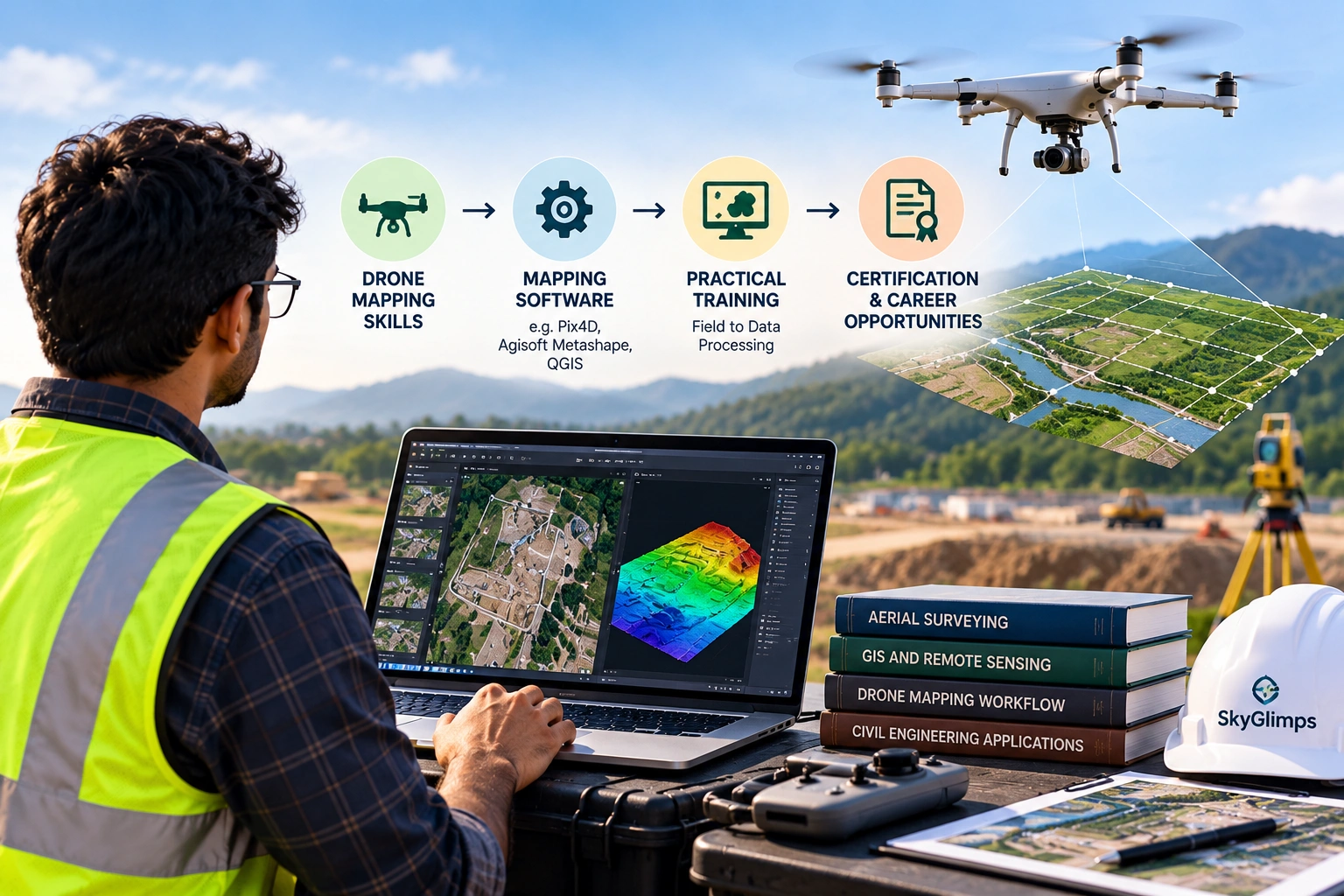
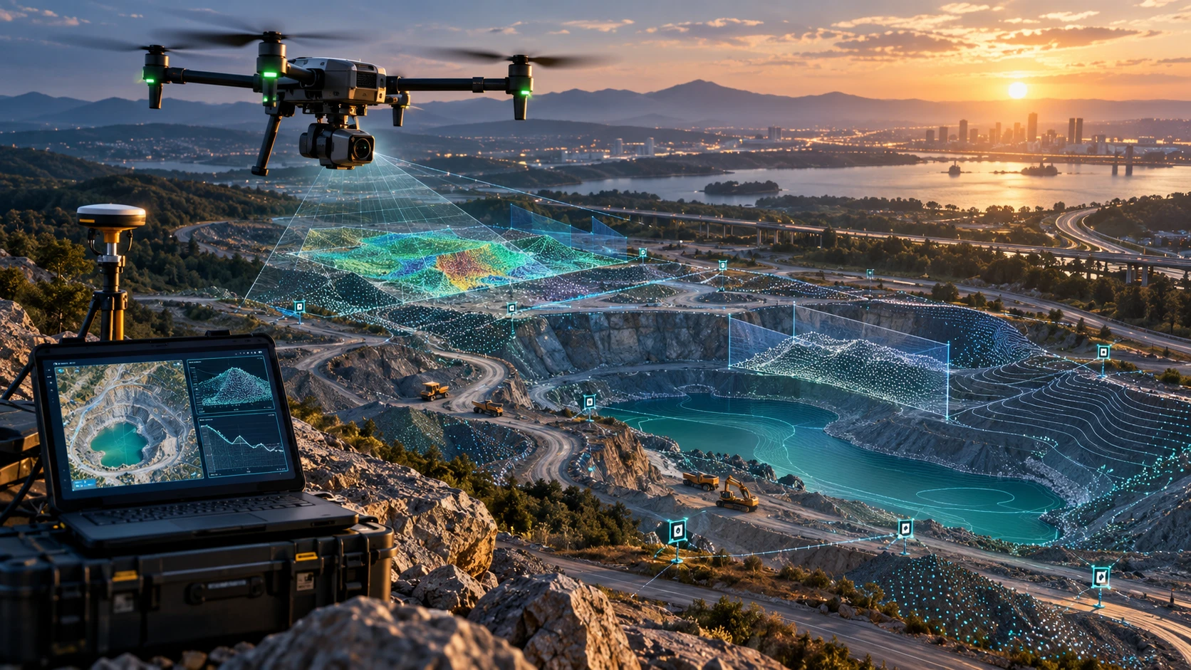
For construction, mining, roads, canals, real estate, utilities, irrigation, and infrastructure projects, drone survey outputs may include orthomosaic maps, DEMs, DSMs, DTMs, contours, point clouds, volume reports, CAD files, GIS layers, and PDF reports. Each output must be checked before it is shared with the client.
This guide explains how drone survey QA/QC works, what mapping data is checked, and what clients should expect before final delivery.
What is drone survey QA/QC?
Drone survey QA/QC is the quality assurance and quality control process used to check drone mapping data before it is delivered to the client. It confirms whether the data is complete, properly processed, correctly georeferenced, and suitable for the intended project use.
QA/QC usually includes:
- Flight data review
- Image quality check
- Coverage check
- Ground Control Point review
- Checkpoint validation
- RTK or PPK review
- Orthomosaic inspection
- DEM, DSM, or DTM check
- Contour review
- Point cloud quality check
- Volume calculation review
- GIS and CAD export check
- File-format verification
- Final report review
Skyglimps Technologies LLP provides 2D Surveying & Mapping for organisations that need aerial maps, site documentation, orthomosaic outputs, and survey-ready visual data for professional projects.
Why is quality control important in drone surveys?
Quality control is important because drone mapping outputs are often used for planning, measurement, progress review, billing support, GIS analysis, and engineering coordination. If the data has errors, the final decision may also be affected.
Drone survey quality control helps avoid:
- Missing site coverage
- Blurred images
- Poor image overlap
- Weak georeferencing
- Incorrect coordinate system
- Poor GCP marking
- Checkpoint errors
- Orthomosaic gaps
- Elevation model noise
- Misleading contours
- Wrong volume boundaries
- Incorrect file formats
- Incomplete reports
A drone map may look visually impressive, but visual appearance alone is not enough. For professional mapping, the data must be checked against the project objective and deliverable requirements.
What is the difference between QA and QC?
QA focuses on the process used to produce reliable survey data, while QC focuses on checking the final outputs before delivery. Both are needed in professional drone mapping.
A simple comparison:
| Term | Full form | What it checks |
|---|---|---|
| QA | Quality Assurance | Planning, workflow, standards, field procedure, processing method |
| QC | Quality Control | Final images, maps, models, reports, files, and accuracy checks |
For example, quality assurance includes planning the right flight height, overlap, GCP layout, and coordinate system before fieldwork. Quality control includes checking whether the orthomosaic, DEM, contours, and final report are correct after processing.
QA prevents errors. QC catches errors before delivery.
What is checked before drone fieldwork?
Before fieldwork, the survey team should check the project scope, boundary, deliverables, accuracy requirement, flight plan, safety conditions, and control method. Good QA begins before the drone takes off.
Pre-fieldwork checks include:
- Site location
- Survey boundary
- Project objective
- Required deliverables
- Coordinate system
- Accuracy requirement
- GCP, RTK, or PPK plan
- Checkpoint requirement
- Flight altitude
- Image overlap
- Weather window
- Take-off and landing location
- Airspace and site permission
- Safety risks
- File-format requirements
If these items are not defined early, the data may not support the client’s final requirement. For example, a visual site survey and a cut-fill volume survey need different planning.
What is checked during drone data capture?
During drone data capture, the team checks whether the flight is safe, complete, stable, and suitable for processing. Field-level quality checks reduce the risk of returning to the site for missing data.
Field checks include:
- Drone health
- Battery status
- Camera settings
- Image sharpness
- Flight path coverage
- Image overlap
- Weather conditions
- Wind changes
- Ground Control Point visibility
- Obstacle clearance
- Data storage
- Flight logs
- Site safety
- Emergency landing options
The team should also review sample images before leaving the site. If images are blurred, overexposed, underexposed, or missing important areas, the issue should be caught immediately.
A simple field mistake can create major processing problems later.
How is image quality checked?
Image quality is checked by reviewing sharpness, exposure, motion blur, coverage, overlap, camera angle, and feature visibility. Poor images can reduce the quality of orthomosaics, elevation models, point clouds, and reports.
Important image checks include:
| Image check | Why it matters |
|---|---|
| Sharpness | Blurred images reduce processing quality |
| Exposure | Overexposed or underexposed images hide features |
| Overlap | Weak overlap can create gaps or distortions |
| Coverage | Missing areas may make the survey incomplete |
| Camera angle | Incorrect angle can affect mapping geometry |
| Shadows | Heavy shadows may hide ground features |
| Reflections | Water or shiny surfaces can affect reconstruction |
| Feature visibility | Low-texture areas can be difficult to process |
High image count alone does not guarantee quality. The images must be clear, consistent, and suitable for the required output.
How is survey coverage checked?
Survey coverage is checked by confirming whether the entire project boundary and required surrounding context were captured. Missing coverage is one of the most common drone survey delivery problems.
Coverage checks should confirm:
- Full site boundary captured
- Buffer area included where needed
- Corridor width covered
- Corners and edges captured
- No image gaps
- No major shadowed missing zones
- GCPs visible in images
- Important assets included
- Access roads included if required
- Stockpiles or excavation areas fully captured
For roads, canals, power corridors, and long infrastructure projects, the coverage review should also check chainage limits and corridor width.
A drone survey is incomplete if the final map does not cover the full project area.
How are GCPs checked in drone survey QA/QC?
GCPs are checked by reviewing whether they were measured correctly, distributed properly, clearly visible in images, and marked accurately during processing. Ground Control Points help align drone data with real-world coordinates.
GCP QA/QC includes:
- Confirming GCP locations
- Checking coordinate records
- Reviewing coordinate system
- Checking vertical reference
- Confirming GCP visibility
- Reviewing GCP distribution
- Checking marking accuracy in images
- Reviewing GCP error values
- Avoiding clustered GCP placement
- Checking whether enough control points were used
GCPs should not be treated as simple ground stickers. Their measurement, placement, and processing directly affect map alignment and accuracy.
For large, uneven, or measurement-heavy sites, GCP planning should be done carefully before fieldwork.
How are checkpoints used for quality control?
Checkpoints are independent measured points used to test the accuracy of the final drone mapping output. Unlike GCPs, checkpoints are not used to control the model. They are used to check it.
A simple difference:
| Point type | Used for processing? | Used for validation? |
|---|---|---|
| GCP | Yes | Sometimes |
| Checkpoint | No | Yes |
Checkpoints help answer an important question: “How close is the final map or model to independently measured ground positions?”
Checkpoint review may include:
- Horizontal error
- Vertical error
- RMSE values
- Point-by-point differences
- Outlier review
- Accuracy summary
- Report notes
For professional drone surveys, checkpoints are especially useful when outputs support measurements, contours, cut-fill calculation, volume reports, GIS files, or CAD coordination.
How is georeferencing checked?
Georeferencing is checked by confirming whether the drone outputs align correctly with real-world coordinates, site boundaries, GCPs, checkpoints, GIS layers, or CAD files. This is essential for project-ready mapping.
Georeferencing checks include:
- Coordinate system verification
- EPSG code check, where applicable
- Horizontal alignment review
- Vertical reference review
- GCP and checkpoint comparison
- CAD or GIS overlay check
- Boundary alignment check
- Repeat survey alignment check
- Export coordinate validation
Poor georeferencing can cause the orthomosaic, contours, point cloud, or CAD files to appear shifted, rotated, or misaligned.
For more advanced coordinate and terrain workflows, Skyglimps also provides 3D LiDAR & GIS Solutions for point clouds, elevation models, terrain layers, and GIS-ready outputs.
How is an orthomosaic checked before delivery?
An orthomosaic is checked for coverage, sharpness, alignment, seams, gaps, distortions, colour consistency, and georeferencing quality. The orthomosaic is often the most visible drone survey deliverable, so it needs careful review.
Orthomosaic QC should check:
- Full area coverage
- Clear image detail
- No major gaps
- No heavy distortion
- Clean stitching
- Correct site orientation
- Proper georeferencing
- Boundary alignment
- Visible GCPs where relevant
- Consistent colour and exposure
- Usability in GIS or CAD workflows
A visually clean orthomosaic helps stakeholders understand the site, but it must also be spatially reliable if used for planning or measurement.
How are DEM, DSM, and DTM outputs checked?
DEM, DSM, and DTM outputs are checked by reviewing elevation consistency, surface quality, noise, holes, spikes, coordinate system, vertical reference, and suitability for the project objective. These outputs are important for terrain and engineering-related decisions.
Elevation model checks include:
- Surface completeness
- Noise or spikes
- Holes or voids
- Edge distortion
- Vegetation effects
- Water surface issues
- Ground classification quality
- Vertical alignment
- Comparison with checkpoints
- Contour suitability
- Export resolution
- File compatibility
The team should also confirm which model is being delivered. A DSM includes visible surfaces such as buildings, trees, and objects. A DTM represents bare-earth terrain after non-ground features are removed. A DEM should be clearly defined in the project scope.
How are contour maps checked?
Contour maps are checked by reviewing the elevation model, contour interval, smoothness, terrain representation, coordinate system, and whether the output matches the project objective. Contours should be useful, not just generated automatically.
Contour QC includes:
- Correct contour interval
- Logical contour flow
- No excessive noise
- No misleading object-based contours
- Proper clipping to boundary
- Correct elevation labels
- Alignment with terrain model
- Suitability for drainage or slope review
- CAD or GIS export check
- PDF map readability
Contours generated from a poor surface model can be misleading. Very small contour intervals on noisy data may create a map that looks detailed but is not reliable.
For contour-related projects, the client should confirm whether contours are generated from a DEM, DSM, DTM, or another processed elevation surface.
How are cut-fill and volume reports checked?
Cut-fill and volume reports are checked by reviewing the calculation boundary, surface model, base surface, coordinate system, vertical reference, assumptions, and final quantity values. Volume results depend heavily on how surfaces are defined.
Volume QC should check:
- Calculation boundary
- Base surface definition
- Design surface or previous survey reference
- DSM, DTM, or point cloud used
- Cut volume
- Fill volume
- Net volume
- Unit of measurement
- Surface comparison method
- Outlier areas
- Vegetation or object interference
- Accuracy notes
- Report assumptions
A volume number without boundary and base-surface explanation can be misleading. The report should clearly state what was measured and how.
How are GIS and CAD files checked?
GIS and CAD files are checked to confirm that exported deliverables open correctly, align properly, and contain the expected layers, coordinates, and attributes. File compatibility is an important part of drone survey quality control.
GIS and CAD checks include:
- GeoTIFF opening correctly
- SHP layers loading properly
- DXF or DWG alignment
- KML or KMZ visibility
- LAS or LAZ point cloud usability
- Coordinate system preserved
- Layer names clear
- Contours labelled correctly
- Boundary included
- File size manageable
- No missing linked files
- Export units correct
Managers may only review PDF reports, but engineers and GIS teams need working files. A complete delivery should support both visual review and technical use.
What should a drone survey quality report include?
A drone survey quality report should explain how the data was captured, processed, checked, and delivered. It should help the client understand the reliability, limitations, and correct use of the mapping outputs.
A useful report may include:
- Project name
- Site location
- Survey date
- Survey boundary
- Flight summary
- Sensor or camera notes
- GSD or mapping resolution
- GCP summary
- Checkpoint summary
- RTK or PPK notes
- Coordinate system
- Vertical reference
- Orthomosaic preview
- DEM, DSM, or DTM notes
- Contour interval
- Volume calculation assumptions
- Deliverable file list
- Accuracy notes
- Limitations
The report should be clear enough for both technical and management teams.
What are the most common drone survey data issues?
Common drone survey data issues include missing coverage, weak image overlap, poor georeferencing, blurred images, GCP errors, checkpoint failures, noisy elevation models, and wrong file exports. These issues should be caught before delivery.
Common issues include:
| Issue | Possible impact |
|---|---|
| Missing images | Gaps in orthomosaic or model |
| Poor overlap | Weak reconstruction or distorted output |
| Blurred images | Low-quality maps and point clouds |
| Wrong coordinate system | Misalignment with GIS or CAD data |
| Poor GCP marking | Reduced georeferencing quality |
| No checkpoints | Weak accuracy validation |
| Noisy elevation model | Misleading contours or volumes |
| Wrong base surface | Incorrect cut-fill quantities |
| Incorrect file format | Client cannot use deliverables |
| Missing report notes | Client may misinterpret output |
A strong QC workflow reduces the chances of these issues reaching the client.
How should clients review delivered drone survey data?
Clients should review drone survey data by checking whether the outputs match the agreed scope, open in the required software, cover the correct area, and include accuracy or limitation notes. Client-side review is also important.
Clients should check:
- Is the full site covered?
- Are all agreed deliverables included?
- Do files open correctly?
- Is the coordinate system mentioned?
- Are GCP or checkpoint notes included?
- Is the contour interval mentioned?
- Are volume assumptions explained?
- Are file formats correct?
- Is the report understandable?
- Are limitations clearly stated?
- Does the output match the project objective?
- Are repeat survey dates labelled clearly?
If something is unclear, clients should ask before using the data for decisions.
What mistakes should clients avoid?
Clients should avoid accepting drone survey outputs without checking the scope, accuracy method, deliverables, file formats, and quality notes. A good-looking map is not always a complete survey deliverable.
Common mistakes include:
- Looking only at the PDF report
- Ignoring GIS or CAD file compatibility
- Not checking the site boundary
- Not asking about GCPs or checkpoints
- Confusing GSD with accuracy
- Ignoring vertical accuracy
- Using contours without checking the source model
- Using volume values without checking base surface
- Comparing repeat surveys with different assumptions
- Not reading limitations
- Not confirming coordinate system
- Assuming all drone maps are survey-grade
The best drone survey delivery is transparent, documented, and usable.
How does QA/QC improve repeat surveys?
QA/QC improves repeat surveys by keeping methods, coordinates, boundaries, and deliverables consistent across multiple survey dates. This is important for progress tracking and change detection.
Repeat surveys are used for:
- Construction progress monitoring
- Mining volume tracking
- Road work updates
- Canal and embankment monitoring
- Stockyard reporting
- Real estate development
- Irrigation projects
- Utility corridor documentation
For recurring project records, Skyglimps also supports Documentation & Progress Tracking for dated aerial reports and stage-wise site comparison.
Without consistent QA/QC, a change visible between two drone maps may be caused by processing differences rather than actual site progress.
Why choose Skyglimps Technologies for quality-controlled drone surveys?
Skyglimps Technologies LLP is a Kolkata-based drone services company and DGCA-certified Remote Pilot Training Organisation serving government and enterprise clients across Eastern India. The company supports drone-enabled workflows across surveying, mapping, LiDAR, GIS, inspections, documentation, surveillance, and training.
Skyglimps Technologies, a DGCA-certified RPTO in Kolkata, is positioned for organisations that need aerial maps, orthomosaics, terrain outputs, GIS-ready data, CAD-ready files, volume reports, contour maps, and professional survey deliverables.
For projects in Kolkata, West Bengal, Jharkhand, Odisha, and Eastern India, local coordination can help improve site scoping, field execution, flight planning, ground control, processing review, repeat survey consistency, and delivery clarity.
Drone survey quality control should be treated as a required part of the mapping workflow, not an optional final check.
FAQ: Drone Survey Quality Control
Drone survey quality control is the process of checking drone mapping data, images, GCPs, checkpoints, orthomosaics, elevation models, files, and reports before delivery
QA/QC helps ensure the drone survey output is complete, correctly processed, properly georeferenced, usable, and aligned with the client’s project requirement.
A drone survey report may include site details, survey date, flight summary, GCP notes, checkpoint results, coordinate system, deliverables, accuracy notes, and limitations.
Checkpoints are highly useful when drone survey outputs support measurement, contours, volumes, GIS, CAD, engineering review, or repeat survey comparison.
An orthomosaic is checked for coverage, sharpness, gaps, stitching quality, distortion, georeferencing, boundary alignment, and usability in GIS or CAD workflows.
Poor quality can come from weak flight planning, bad weather, blurred images, low overlap, poor GCP marking, wrong coordinate systems, processing errors, or incomplete QC.
Yes. Clients should ask for accuracy notes, control method, coordinate system, deliverable list, assumptions, and limitations before using drone survey data for decisions.
Deliver drone mapping data with confidence
Drone survey quality control helps ensure that mapping data is not only visually impressive but also complete, checked, documented, and usable. From field planning to image review, GCP marking, checkpoint validation, georeferencing, orthomosaic inspection, elevation model checks, contour review, volume verification, and file export, each step matters.
For construction, mining, roads, canals, real estate, utilities, irrigation, and infrastructure projects, QA/QC can reduce confusion and improve confidence in final deliverables.
If your organisation needs quality-controlled orthomosaic maps, site documentation, DEMs, DSMs, DTMs, contours, GIS-ready files, CAD-ready outputs, volume reports, or professional drone mapping in Kolkata, West Bengal, or Eastern India, connect with Skyglimps Technologies LLP through the 2D Surveying & Mapping service page and share your site location, project objective, accuracy requirement, deliverables, and reporting needs.