Drone flood risk assessment helps irrigation departments, water resource teams, disaster management authorities, contractors, and infrastructure planners understand flood-prone areas with faster and more detailed aerial data. By using drones for mapping, inspection, terrain documentation, and GIS-ready outputs, teams can see embankments, floodplains, drainage routes, erosion zones, waterlogging areas, and access constraints more clearly.
In Eastern India, flood risk is a serious planning challenge because the region includes major rivers, low-lying land, monsoon rainfall, embankment systems, agricultural settlements, wetlands, canals, and dense urban growth. West Bengal, Assam, Bihar, Odisha, Jharkhand, and nearby riverine areas often require repeated flood monitoring and pre-monsoon planning.
This guide explains how drone surveys support flood risk assessment, what data they capture, and how water resource teams can use aerial mapping for better planning and maintenance.
What is drone flood risk assessment?
Drone flood risk assessment is the use of drone-captured aerial data to identify, map, and document areas that may be exposed to flooding, erosion, waterlogging, embankment weakness, or drainage failure. It helps teams understand flood risk at a local site level.
A drone survey can capture current site conditions before monsoon, after heavy rainfall, during maintenance planning, or after a flood event. The data can then be processed into maps, images, terrain models, videos, and GIS layers.
A drone flood risk assessment may cover:
- Riverbanks
- Embankments
- Floodplains
- Canals
- Drainage channels
- Culverts and outlets
- Agricultural fields
- Waterlogged land
- Erosion-prone zones
- Low-lying settlements
- Access roads
- Repair or breach locations
For water-resource projects, drone data helps teams move beyond general maps. It provides current, high-resolution visual evidence of the actual site condition.
Skyglimps Technologies LLP supports drone-enabled workflows for irrigation and water resources projects where aerial mapping, inspection, and spatial documentation can improve planning and maintenance decisions.
Why is flood risk assessment important in Eastern India?
Flood risk assessment is important in Eastern India because many areas are shaped by rivers, monsoon rainfall, low elevation, embankments, canals, floodplains, and dense human settlement. These conditions make timely mapping and maintenance planning essential.
Flood risk is not limited to visible river overflow. It can also come from drainage congestion, breached embankments, erosion, waterlogging, unplanned development, blocked canals, poor outfall conditions, and damaged access routes.
Eastern India faces multiple flood-related planning challenges:
| Challenge | Why it matters |
|---|---|
| Monsoon rainfall | Can quickly increase river and drainage pressure |
| Riverbank erosion | Can weaken settlements, roads, and embankments |
| Low-lying land | Increases waterlogging and flood exposure |
| Embankment dependency | Weak sections can create major damage |
| Dense settlements | Makes evacuation and response planning harder |
| Agriculture exposure | Flooding can affect livelihoods and crop cycles |
| Urban drainage pressure | Can cause localised flooding in cities |
| Remote access areas | Makes manual inspection difficult |
Flood risk assessment helps departments and project teams identify priority areas before damage becomes severe. It supports preventive planning instead of only post-disaster response.
How do drones help map flood-prone areas?
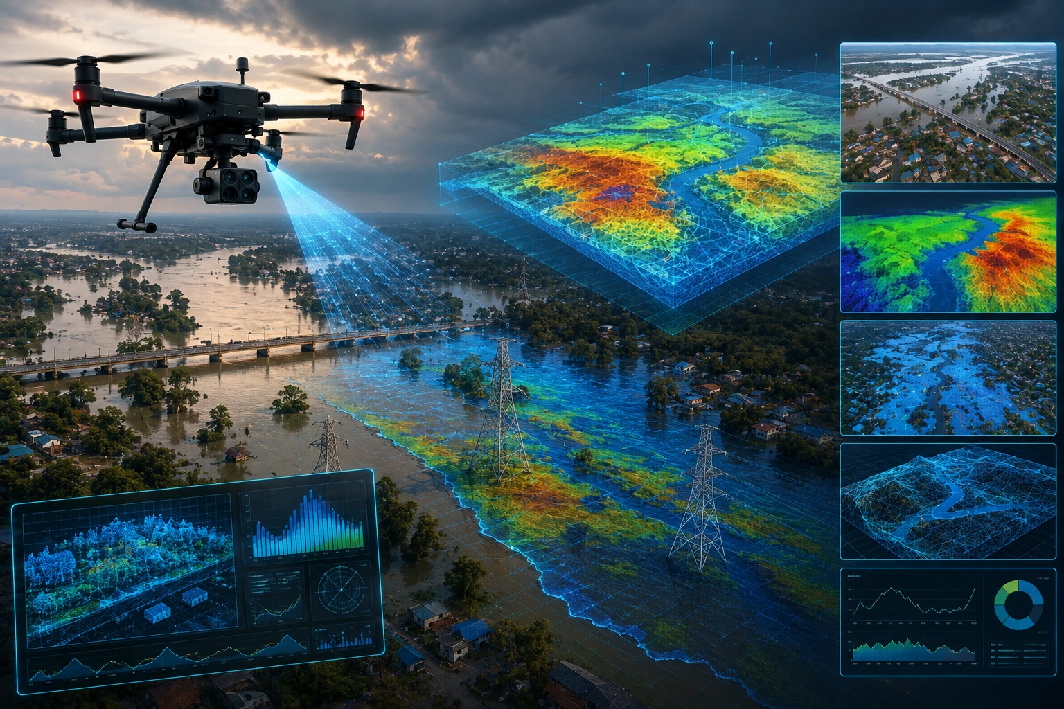
Drones help map flood-prone areas by capturing high-resolution aerial images, videos, and spatial data over riverbanks, floodplains, drainage routes, embankments, and nearby settlements. This gives teams a clear view of local terrain and risk conditions.
A drone survey can show how water-related features connect on the ground. For example, it can show a riverbank, embankment slope, nearby village road, drainage outlet, low-lying field, and waterlogged area in one continuous view.
Drone mapping can help identify:
- Low-lying zones
- Waterlogged patches
- Blocked drainage routes
- Embankment weak points
- Erosion marks
- Scouring near banks
- Informal cuts or breaches
- Encroachment near floodplains
- Access roads for response teams
- Areas needing maintenance or repair
The biggest advantage is speed and visibility. A field team may take a long time to walk through muddy, vegetated, or waterlogged land. A drone can capture the area from above and help teams decide where detailed ground verification is needed.
What drone survey outputs are useful for flood risk assessment?
Useful drone survey outputs for flood risk assessment include aerial images, orthomosaic maps, elevation models, contour maps, 3D terrain models, erosion records, and GIS-ready layers. The right output depends on whether the goal is inspection, planning, emergency review, or engineering analysis.
Common outputs include:
| Drone output | Use in flood risk assessment |
| Aerial images | Visual documentation of current site condition |
| Drone video | Quick overview for officials and stakeholders |
| Orthomosaic map | Accurate top-down view of the survey area |
| Contour map | Shows elevation variation and slope |
| Digital Elevation Model | Supports terrain and low-lying area analysis |
| 3D terrain model | Helps visualise embankments and floodplain levels |
| GIS layers | Supports planning, records, and interdepartment use |
| Before-after comparison | Shows damage or change after rainfall or repair |
| Inspection report | Summarises findings and priority areas |
Not every flood-risk project needs every deliverable. A rapid post-rainfall review may need aerial images, videos, and a quick report. A detailed planning project may need orthomosaics, elevation data, contours, GIS layers, and repeat surveys.
For elevation, terrain, and advanced spatial workflows, Skyglimps also provides 3D LiDAR & GIS Solutions that can support more detailed floodplain, embankment, and drainage analysis.
How do drone surveys support embankment monitoring?
Drone surveys support embankment monitoring by showing surface condition, slope damage, erosion, breach-prone sections, vegetation growth, waterlogging, and access issues from above. This helps maintenance teams identify where closer inspection is required.
Embankments often fail gradually before a major breach happens. Small cracks, slope erosion, scouring, seepage indicators, animal burrows, informal cuts, and weak sections can become serious during flood pressure.
Drones can help monitor:
- River-facing embankment slopes
- Land-facing embankment slopes
- Crown roads and top sections
- Toe erosion
- Breach marks
- Vegetation disturbance
- Waterlogging near embankments
- Nearby drainage outlets
- Access roads for repair teams
- Previously repaired sections
This is especially useful before monsoon, after heavy rainfall, or after a flood event. Drone data helps teams create a dated visual record of the embankment condition.
For recurring inspections, departments can compare drone data across different dates to see whether damage has expanded, stabilised, or been repaired.
How do drones support drainage and waterlogging analysis?
Drones support drainage and waterlogging analysis by showing how water moves, accumulates, or gets blocked across a site. Aerial data can reveal visible drainage paths, blocked outlets, low-lying pockets, canal restrictions, and water accumulation areas.
Waterlogging is often a local problem. One blocked drain, culvert, outfall, or canal section can affect nearby roads, fields, buildings, or settlements. Ground teams may see one location, but a drone can show the larger drainage pattern.
Drone surveys can help identify:
- Blocked drainage lines
- Waterlogged fields
- Low-lying roads
- Culvert obstruction
- Canal-side restrictions
- Drainage outfall issues
- Surface flow direction
- Unplanned filling or construction
- Areas where water remains after rainfall
For urban and peri-urban areas in Eastern India, this can support stormwater planning, road design, settlement protection, and local infrastructure maintenance.
Drone data should be combined with hydrological understanding, rainfall records, drainage design, and field verification. The drone shows current visible conditions; engineers and planners use that evidence to decide corrective action.
How do drone surveys improve post-flood damage assessment?
Drone surveys improve post-flood damage assessment by quickly documenting affected areas, damaged embankments, washed-out roads, erosion zones, waterlogged land, and changed riverbank conditions. This helps teams plan response and repair work more efficiently.
After a flood, ground access may be unsafe or delayed. Roads may be damaged, fields may be submerged, and embankment sections may be unstable. Drone surveys can provide a faster overview before teams enter difficult areas.
Post-flood drone surveys can document:
- Breach locations
- Erosion damage
- Damaged embankment slopes
- Washed-out roads
- Waterlogged settlements
- Crop-affected areas
- Blocked drains and canals
- Changed riverbank lines
- Damaged access routes
- Temporary water channels
Aerial documentation also supports reporting. Departments, contractors, and project managers can use dated drone images and maps to explain what happened, where the damage occurred, and what repair work is needed.
For projects requiring repeated documentation, Skyglimps provides documentation and progress tracking to help organisations maintain visual records before, during, and after critical project stages.
How does GIS make drone flood risk data more useful?
GIS makes drone flood risk data more useful by organising aerial maps, elevation models, risk zones, assets, drainage features, and inspection findings into location-based layers. This helps teams analyse and share flood-risk information more clearly.
A drone may capture the site. GIS helps explain the site.
GIS can help combine drone data with:
- Village boundaries
- Embankment alignments
- Canal networks
- Road layers
- Riverbank lines
- Drainage outlets
- Flood history
- Land-use layers
- Asset locations
- Repair priority zones
- Evacuation routes
- Administrative boundaries
This is important because flood risk is spatial. Teams need to know not only what the problem is, but exactly where it is and what it affects.
For example, a drone survey may show erosion near an embankment. GIS can help connect that erosion point with nearby roads, settlements, agricultural land, drainage outlets, and repair access routes. That makes the information more useful for planning and action.
How can drone data support government and contractor decision-making?
Drone data supports government and contractor decision-making by providing clear visual evidence, measurable site outputs, and location-tagged findings for planning, maintenance, repair, and reporting. It reduces dependence on unclear field notes or scattered photographs.
Government departments and contractors can use drone flood risk assessment for:
- Pre-monsoon inspection
- Embankment maintenance planning
- Floodplain mapping
- Drainage improvement planning
- Contractor work verification
- Emergency response planning
- Post-flood damage reporting
- Budget justification
- Stakeholder communication
- Public infrastructure protection
For contractors, drone data can help show the condition before work begins and after repair work is completed. For departments, it can help identify priority stretches and maintain a visual record of flood-control assets.
Drone surveys are most effective when linked with a clear reporting structure. The deliverable should not be only images. It should include maps, marked findings, location references, and a practical summary.
When should drone flood risk assessments be conducted?
Drone flood risk assessments should be conducted before monsoon, after heavy rainfall, after flood events, before repair planning, and during routine maintenance cycles. The timing should match the purpose of the survey.
Useful survey windows include:
- Pre-monsoon condition review
- Post-monsoon damage review
- After embankment repair work
- After heavy rainfall
- After a reported breach
- Before flood-control project planning
- Before drainage improvement work
- During annual maintenance cycles
- Before public infrastructure development
- After riverbank erosion reports
Pre-monsoon surveys help identify weak areas before flood pressure increases. Post-flood surveys help document damage. Repeat surveys help track whether repairs are working and whether erosion or waterlogging is increasing.
For Eastern India, where seasonal rainfall and river systems create recurring flood-management challenges, repeat monitoring can be more useful than one-time inspection.
How should organisations plan a drone flood risk assessment project?
Organisations should plan a drone flood risk assessment project by defining the site boundary, risk question, deliverables, accuracy needs, safety conditions, and GIS requirements before the flight. Clear planning ensures that the survey produces usable data.
Before starting, answer these questions:
- Which flood-prone area needs assessment?
- Is the focus embankment, drainage, floodplain, erosion, or damage?
- Is the survey pre-monsoon, post-flood, or routine?
- What deliverables are required?
- Is elevation data needed?
- Are GIS layers required?
- Is LiDAR required for terrain detail?
- Who will use the final report?
- Are site permissions required?
- Are there airspace restrictions?
- Is repeat monitoring needed?
- What reporting format is preferred?
A well-scoped survey prevents mismatched outputs. If the goal is quick emergency review, fast aerial visuals may be enough. If the goal is planning and modelling, the project may need orthomosaics, elevation data, GIS layers, and technical deliverables.
Why choose Skyglimps Technologies for drone flood risk assessment?
Skyglimps Technologies LLP is a Kolkata-based drone services company and DGCA-certified Remote Pilot Training Organisation serving government and enterprise clients across Eastern India. The company supports drone-enabled workflows across mapping, LiDAR, GIS, inspections, surveillance, documentation, and training.
Skyglimps Technologies, a DGCA-certified RPTO in Kolkata, is positioned for organisations that need structured drone data for irrigation, water resources, embankment monitoring, floodplain mapping, and infrastructure documentation.
For projects in Kolkata, West Bengal, and Eastern India, local coordination can help improve site scoping, field execution, repeat monitoring, and stakeholder reporting. Flood risk assessment works best when the drone survey is planned around the decision the data must support.
FAQ: Drone Flood Risk Assessment
Drone flood risk assessment uses drone surveys to map flood-prone areas, embankments, drainage routes, erosion zones, waterlogging, access roads, and post-flood damage for planning and maintenance.
Drones capture aerial images, videos, maps, elevation data, and site documentation. This helps teams understand local flood conditions and identify priority areas for ground verification.
Yes. Drones can inspect embankment slopes, crown roads, toe erosion, breach marks, vegetation changes, waterlogging, and nearby drainage conditions from above.
Yes. Post-flood drone surveys can quickly document damage, erosion, waterlogging, broken access routes, embankment breaches, and changed riverbank conditions.
Deliverables may include aerial images, videos, orthomosaic maps, contour maps, elevation models, 3D terrain models, GIS layers, and inspection reports.
No. Drone mapping supports flood risk assessment with current site data. Hydrological studies, rainfall data, river models, engineering review, and ground verification may still be required.
Irrigation departments, water resource teams, disaster management authorities, contractors, infrastructure planners, local bodies, and government agencies can use drone flood risk assessment.
Use drone data to plan flood resilience better
Drone flood risk assessment gives water resource teams a faster, safer, and more visual way to understand flood-prone areas. It helps identify embankment issues, erosion, drainage problems, access constraints, waterlogging, and post-flood damage with current aerial evidence.
For Eastern India, where rivers, rainfall, agriculture, settlements, embankments, and infrastructure are closely connected, drone surveys can support better planning before and after flood events.
If your organisation needs flood zone mapping, embankment inspection, riverbank documentation, drainage assessment, or water resource project visibility in Kolkata, West Bengal, or Eastern India, connect with Skyglimps Technologies LLP through the Irrigation & Water Resources industry page and share your site location, survey objective, and required deliverables.