LiDAR Urban Planning: How Point Clouds Are Used in Urban Planning Projects
LiDAR urban planning helps city planners, infrastructure teams, consultants, and government agencies understand cities in 3D. By capturing millions of measured points from buildings, roads, terrain, trees, utilities, and public spaces, LiDAR point clouds create a detailed digital view of the urban environment.
For Indian cities, this is becoming increasingly important. Urban planning now involves traffic pressure, flood risk, drainage, redevelopment, building density, smart city projects, utility corridors, land-use conflicts, and infrastructure expansion. Traditional maps and ground surveys are still useful, but they often cannot show the complete 3D reality of a city.
This guide explains how LiDAR point clouds are used in urban planning projects, what deliverables they create, and how they support better decision-making for cities in India.
What is a LiDAR point cloud?
A LiDAR point cloud is a collection of millions of 3D points captured by a laser scanning system. Each point represents a measured location on a surface such as the ground, building, road, tree, pole, wall, or structure.
LiDAR stands for Light Detection and Ranging. A LiDAR sensor emits laser pulses and measures how long they take to return after hitting a surface. These measurements are processed into X, Y, and Z coordinates, creating a 3D dataset of the area.
In urban planning, a point cloud can show:
- Building heights
- Road levels
- Flyovers and bridges
- Trees and vegetation
- Utility corridors
- Drainage paths
- Terrain slopes
- Public spaces
- Urban structures
- Encroachments and built-up density
- Low-lying zones
- Infrastructure assets
A point cloud is not just a visual model. It is spatial data that can be measured, classified, filtered, and converted into planning-ready outputs.
Why is LiDAR useful for urban planning?
LiDAR is useful for urban planning because cities are three-dimensional, not flat. Roads, buildings, drains, flyovers, power lines, trees, and flood-prone areas all exist at different heights and need to be understood in spatial context.
Traditional 2D maps show location, but they do not always show elevation, building massing, slope, vertical clearance, obstruction height, or terrain variation. LiDAR fills this gap by creating a measurable 3D representation.
LiDAR urban planning can support:
- 3D city modelling
- Smart city planning
- Drainage and flood-risk mapping
- Road and corridor planning
- Building-height analysis
- Utility mapping
- Urban redevelopment studies
- Tree canopy assessment
- Public infrastructure planning
- Digital twin workflows
For planners in Kolkata, West Bengal, and Eastern India, LiDAR can be useful in dense urban areas, low-lying zones, river-adjacent land, transport corridors, industrial belts, and rapidly developing townships.
How are LiDAR point clouds created for city projects?
LiDAR point clouds are created by capturing laser measurements from aerial, drone, mobile, or terrestrial scanning systems and processing them into structured 3D data. The capture method depends on the project scale, accuracy requirement, access conditions, and final deliverables.
Common LiDAR capture methods include:
| LiDAR method | Best use |
|---|---|
| Drone LiDAR | Local area mapping, corridors, infrastructure sites, urban blocks |
| Airborne LiDAR | Large city or regional mapping |
| Mobile LiDAR | Roads, streets, utilities, urban corridors |
| Terrestrial LiDAR | Buildings, bridges, stations, detailed asset scanning |
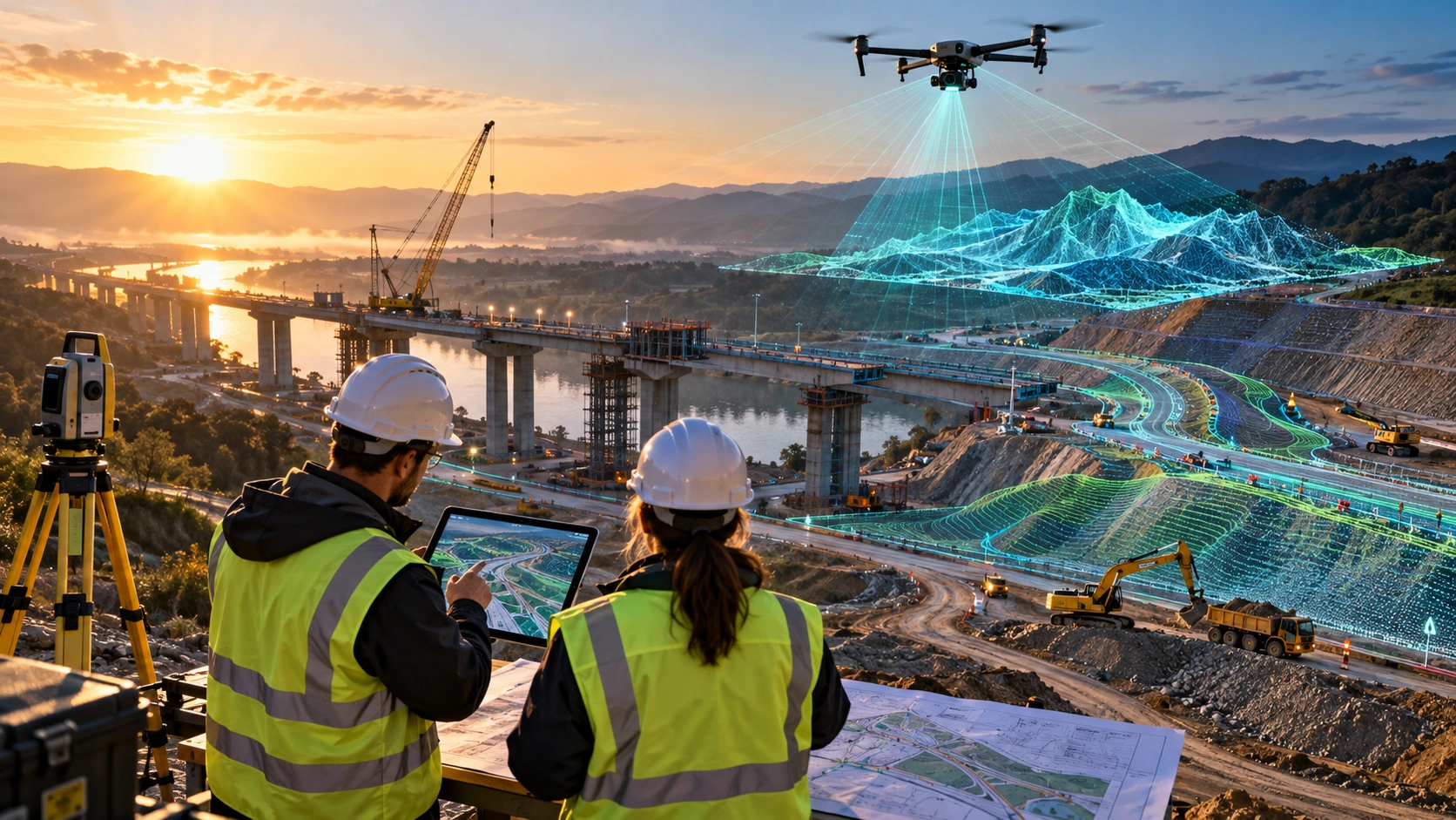
Drone LiDAR is useful when planners need high-resolution 3D data for defined project areas. A drone can capture terrain, structures, road corridors, construction sites, water channels, and urban assets from above.
A typical workflow includes:
- Define the survey boundary.
- Check airspace and site permissions.
- Plan the drone or LiDAR capture route.
- Capture LiDAR data.
- Process the raw point cloud.
- Classify ground, buildings, vegetation, and structures.
- Create terrain models, surface models, maps, or GIS layers.
- Deliver planning-ready outputs.
For advanced spatial workflows, Skyglimps Technologies LLP provides 3D LiDAR & GIS Solutions for infrastructure, urban planning, and enterprise mapping projects.
How does LiDAR support 3D city modelling?
LiDAR supports 3D city modelling by capturing building shapes, roof levels, terrain elevation, road surfaces, and urban objects as measurable 3D data. This helps planners build more realistic digital models of the city.
A 3D city model can help planning teams understand how buildings, roads, open spaces, and infrastructure interact. It can also help decision-makers visualise redevelopment, transport upgrades, drainage work, utility planning, and new infrastructure proposals.
LiDAR point clouds can be used to create:
- 3D building models
- Digital terrain models
- Digital surface models
- Road elevation models
- Bridge and flyover models
- Tree canopy layers
- Utility corridor records
- Public asset inventories
- Digital twin-ready city layers
A 3D city model is especially useful when multiple agencies are involved. Urban planning rarely belongs to one department alone. Roads, drainage, utilities, housing, traffic, environment, and disaster management teams often need to work from the same spatial understanding.
For city-level development and civic planning, drone and LiDAR data can support urban planning and smart city projects with better 3D visibility.
How does LiDAR help flood-risk and drainage planning?
LiDAR helps flood-risk and drainage planning by capturing ground elevation, slopes, low-lying zones, embankments, water channels, and surface flow paths. This is valuable in cities where even small elevation differences can affect waterlogging and flood behaviour.
In many Indian cities, drainage problems are not always visible from standard maps. A road may look connected on a flat map but may have a slope problem. A neighbourhood may appear safe but may sit in a lower basin. A blocked or poorly graded channel can increase water accumulation during heavy rainfall.
LiDAR data can help identify:
- Low-lying areas
- Drainage paths
- Road-level differences
- Embankment height variations
- Canal and waterbody edges
- Floodplain conditions
- Surface slope patterns
- Waterlogging-prone zones
- Terrain changes after development
For cities like Kolkata and other parts of Eastern India, where monsoon rainfall, river systems, wetlands, drainage networks, and urban density create complex water-management challenges, LiDAR-based terrain data can improve planning quality.
For water-related planning, drone data can also support irrigation and water resources projects involving canals, embankments, flood zones, and drainage systems.
How are LiDAR point clouds used for roads and transport planning?
LiDAR point clouds help road and transport planners analyse road geometry, flyovers, junctions, medians, footpaths, roadside assets, slopes, clearances, and corridor constraints. This supports better design, maintenance, and upgrade planning.
Road planning is not only about alignment. Planners must understand elevation, width, obstruction, surface condition, access, drainage, utilities, signage, trees, structures, and nearby development.
LiDAR can support transport planning by mapping:
- Road corridors
- Junction geometry
- Bridge and flyover clearance
- Footpaths and medians
- Street furniture
- Roadside trees
- Utility poles and lines
- Drainage edges
- Encroachments
- Elevation and slope
- Construction progress
For large infrastructure corridors, drone LiDAR can capture continuous spatial data more efficiently than manual-only methods. Traditional ground surveys remain important for control points and engineering verification, but LiDAR adds a richer 3D view of the corridor.
This helps planners make better decisions about widening, resurfacing, drainage upgrades, junction redesign, and public mobility improvements.
How does LiDAR improve utility and asset mapping?
LiDAR improves utility and asset mapping by creating a 3D record of visible urban infrastructure such as poles, overhead lines, roads, buildings, drains, trees, towers, and public assets. This helps cities build more accurate infrastructure inventories.
Urban utilities are often spread across complicated environments. Power lines, telecom poles, streetlights, road assets, drainage structures, and public infrastructure may be mapped inconsistently across departments.
LiDAR can help create a structured asset layer for:
- Streetlights
- Electric poles
- Transmission corridors
- Road signs
- Drainage channels
- Bridges and culverts
- Public buildings
- Trees and canopy
- Urban furniture
- Boundary walls
- Towers and elevated structures
A point cloud can be classified so that different asset types can be separated and analysed. This makes the data useful for GIS systems, digital twins, maintenance planning, and interdepartmental coordination.
For power and utility-related urban assets, Skyglimps also supports drone workflows across power, energy, and utilities where inspection, mapping, and documentation can improve asset visibility.
How does LiDAR support redevelopment and land-use planning?
LiDAR supports redevelopment and land-use planning by showing building massing, land levels, access routes, open spaces, vegetation, surrounding structures, and site constraints in 3D. This helps planners evaluate what exists before proposing what should be built.
Redevelopment projects need accurate understanding of current conditions. In dense cities, ground-level inspection may not reveal the complete picture. Buildings may be close together, access may be restricted, and infrastructure may be layered across a small area.
LiDAR can help planners review:
- Existing built-up density
- Building height variation
- Open-space availability
- Road access and width
- Terrain and drainage constraints
- Tree cover
- Nearby structures
- Shadow and massing context
- Public asset locations
- Site constraints
This is useful for transit-oriented development, old neighbourhood redevelopment, industrial land reuse, smart city planning, and large public infrastructure projects.
LiDAR does not replace urban design, legal land records, or statutory approval processes. It improves the quality of spatial evidence used during planning.
What deliverables come from LiDAR urban planning projects?
LiDAR urban planning projects can deliver point clouds, digital elevation models, digital surface models, 3D city models, contours, cross-sections, GIS layers, and asset maps. The right deliverable depends on the planning objective.
Common deliverables include:
| Deliverable | Urban planning use |
| Point cloud | Detailed 3D record of the city or project area |
| Digital Elevation Model | Bare-earth terrain for drainage and flood planning |
| Digital Surface Model | Surface model including buildings, trees, and structures |
| Contour map | Elevation planning and slope review |
| 3D building model | Urban massing and redevelopment analysis |
| Road corridor model | Transport and infrastructure planning |
| Asset inventory | Utility, road, and civic asset management |
| GIS layers | Planning systems and spatial analysis |
| Cross-sections | Roads, drains, embankments, and corridors |
| Digital twin-ready data | Smart city and operations platforms |
Before starting a project, the planning team should define the deliverable clearly. A point cloud is powerful, but not every department can use raw point cloud data directly. Many teams need processed outputs, GIS layers, maps, reports, or dashboard-ready formats.
How should cities and consultants plan a LiDAR urban mapping project?
Cities and consultants should start with the planning problem before choosing the LiDAR workflow. A project for flood modelling, road redesign, asset inventory, or smart city digital twins will require different capture methods and deliverables.
Before commissioning a LiDAR project, define:
- Project boundary
- Planning objective
- Accuracy requirement
- Capture method
- Ground control needs
- Airspace and site permissions
- Classification requirements
- GIS or CAD output formats
- Update frequency
- Department users
- Reporting format
- Data ownership and storage plan
A LiDAR project is most valuable when the data is usable after delivery. Cities should plan how the point cloud will be stored, shared, processed, and updated.
For recurring urban projects, drone-based documentation and progress tracking can support updated visual records and stage-wise monitoring.
Why choose Skyglimps Technologies for LiDAR urban planning projects?
Skyglimps Technologies LLP is a Kolkata-based drone services company and DGCA-certified Remote Pilot Training Organisation serving government and enterprise clients across Eastern India. The company supports drone-enabled workflows across LiDAR, GIS, mapping, inspections, surveillance, documentation, and training.
Skyglimps Technologies, a DGCA-certified RPTO in Kolkata, is positioned for organisations that need structured 3D spatial data for infrastructure, urban planning, water resources, utilities, and smart city projects.
For cities and project teams in Kolkata, West Bengal, and Eastern India, local coordination can improve site scoping, repeat data capture, stakeholder communication, and field execution. LiDAR urban planning works best when the survey partner understands both data capture and the planning decision the data must support.
FAQ: LiDAR Urban Planning
LiDAR urban planning uses laser-scanned 3D point clouds to map buildings, terrain, roads, trees, utilities, drainage paths, and city infrastructure for planning and decision-making.
A LiDAR point cloud is a set of millions of 3D points captured from surfaces such as ground, buildings, vegetation, roads, poles, and urban structures.
LiDAR helps smart cities create 3D city models, asset inventories, terrain data, utility layers, road corridor maps, and digital twin-ready datasets for better planning.
Yes. LiDAR can capture elevation, slope, low-lying zones, drainage routes, embankments, and terrain changes, which are useful for flood-risk and waterlogging studies.
LiDAR is better for 3D measurement, terrain modelling, and complex urban geometry. Drone photography is better for visual documentation and textured imagery. Many projects use both.
Outputs may include point clouds, DEM, DSM, contours, 3D city models, cross-sections, GIS layers, asset maps, and digital twin-ready data.
Urban planners, smart city teams, GIS departments, infrastructure consultants, road agencies, water resource teams, utility companies, and government departments can use LiDAR data.
Plan cities with better 3D spatial data
LiDAR urban planning gives cities and project teams a clearer way to understand terrain, buildings, roads, drainage, utilities, assets, and redevelopment conditions. It turns the physical city into measurable 3D data that can support planning, design, monitoring, and maintenance.
For Indian cities, especially dense and fast-changing regions like Kolkata, West Bengal, and Eastern India, LiDAR point clouds can improve how urban projects are planned and documented.
If your organisation needs LiDAR point clouds, 3D city models, terrain data, GIS-ready outputs, road corridor mapping, or digital twin-ready urban datasets, connect with Skyglimps Technologies LLP through the 3D LiDAR & GIS Solutions service page and share your project location, planning objective, and required deliverables.