Orthomosaic maps drone surveys help project teams create high-resolution, corrected, top-down images of a site using many overlapping drone photographs. Unlike a normal aerial photo, an orthomosaic map is processed so that it can be used for mapping, measurement, documentation, planning, progress tracking, and visual reporting.
For construction, mining, roads, irrigation, real estate, urban planning, agriculture, and infrastructure projects in India, orthomosaic maps are one of the most practical drone survey deliverables. They help teams see the complete site in a single map-like image instead of reviewing hundreds or thousands of separate drone photos.
This guide explains what orthomosaic maps are, how drones create them, and how businesses can use them in professional survey and project documentation workflows.
What is an orthomosaic map?
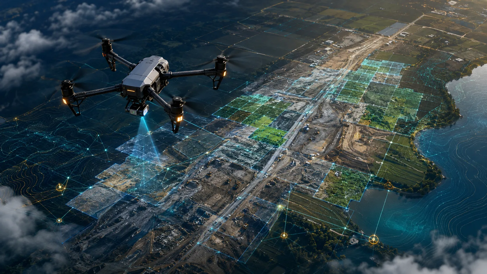
An orthomosaic map is a corrected aerial image created by stitching many overlapping drone photos into one accurate top-down map. It removes much of the visual distortion caused by camera angle, terrain variation, and perspective.
A normal drone photo shows only one view from one angle. Objects closer to the camera may appear larger, and tall structures may lean because of perspective. An orthomosaic is different. It is processed through photogrammetry so that the final output works like a map.
An orthomosaic map can show:
- Site boundaries
- Roads and access routes
- Construction zones
- Buildings and structures
- Water bodies and drains
- Agricultural fields
- Mining stockyards
- Canal and embankment stretches
- Vegetation and open land
- Project progress across a full site
For many drone survey projects, the orthomosaic becomes the base layer for further analysis. Contours, boundaries, asset points, inspection notes, GIS layers, and progress annotations can be added on top of it.
How do drones create orthomosaic maps?
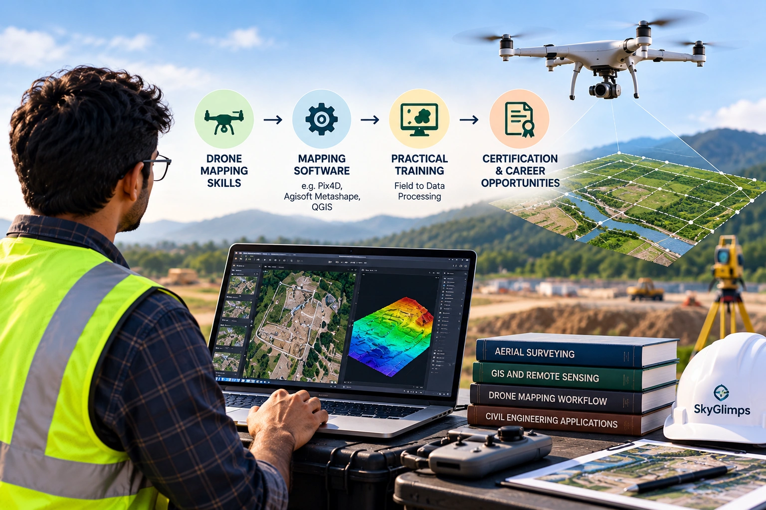
Drones create orthomosaic maps by capturing many overlapping aerial images and processing them with photogrammetry software. The software finds matching points across the images, aligns them, corrects distortion, and stitches them into a single georeferenced map.
A typical workflow includes:
- Define the survey area.
- Plan the drone flight route.
- Set flight altitude and image overlap.
- Check airspace, weather, and site safety.
- Capture overlapping images from above.
- Use ground control or RTK/PPK where required.
- Process images in photogrammetry software.
- Generate the orthomosaic map.
- Perform quality checks.
- Export final files and reports.
The quality of the final map depends on the quality of the flight and processing workflow. Poor image overlap, wrong altitude, weak ground control, heavy shadows, wind, or blurred photos can affect the final output.
Skyglimps Technologies LLP provides 2D Surveying & Mapping for organisations that need aerial mapping, orthomosaic outputs, site documentation, and survey-ready visual data.
How is an orthomosaic different from a normal drone image?
An orthomosaic is different from a normal drone image because it is corrected and stitched into a map-like output. A normal drone image is useful for viewing, while an orthomosaic is useful for mapping, measurement, comparison, and reporting.
Here is a simple comparison:
| Feature | Normal drone photo | Orthomosaic map |
|---|---|---|
| Coverage | One frame or angle | Complete stitched site view |
| Distortion | May include perspective distortion | Corrected for map-like use |
| Measurement use | Limited | More suitable for mapping and measurement |
| Best use | Visual reference and marketing | Survey, documentation, planning, reporting |
| File type | Usually image or video | Often GeoTIFF, map layer, or report output |
| Project value | Shows a view | Shows the full site in context |
A normal drone image may show a road section. An orthomosaic can show the full road corridor. A normal photo may show part of a construction site. An orthomosaic can show the entire project area with boundaries and progress zones.
This is why orthomosaic maps are often used as the main visual deliverable in professional drone survey reports.
Why are overlapping images important?
Overlapping images are important because photogrammetry software needs repeated views of the same ground features to align photos and create a corrected map. Without enough overlap, the software may fail to stitch the images properly.
During a drone mapping flight, the drone captures images in a grid or corridor pattern. Each image overlaps with the next image in front, behind, and on the sides. This helps the software identify matching features across multiple photographs.
Image overlap helps create:
- Better image alignment
- Stronger 3D reconstruction
- More consistent map stitching
- Better surface modelling
- Fewer gaps in the final orthomosaic
- Higher-quality survey outputs
Overlap requirements vary based on site type, flight altitude, terrain, camera, software, and deliverables. Dense vegetation, uniform surfaces, water, shadows, and complex urban areas may require stronger planning.
For professional work, image overlap should be planned before the flight. It should not be left to guesswork in the field.
What role do GCP, RTK, and PPK play in orthomosaic accuracy?
Ground Control Points, RTK, and PPK help improve the positional accuracy of orthomosaic maps. They connect the drone data to known real-world coordinates so the final map aligns better with the actual site.
A high-resolution image is not automatically an accurate map. Resolution shows detail. Accuracy shows how correctly the map fits real-world coordinates.
Important control methods include:
| Method | Meaning | Why it matters |
| GCP | Ground Control Point measured on the site | Helps align drone data to known locations |
| Checkpoint | Independent measured point used for validation | Helps verify final accuracy |
| RTK | Real-time positioning correction during flight | Improves drone position data |
| PPK | Post-processed positioning correction after flight | Improves positioning during processing |
| Coordinate system | Spatial reference used for the map | Ensures compatibility with GIS and CAD data |
For simple visual documentation, basic georeferencing may be enough. For survey, engineering, land, infrastructure, mining, or government project use, stronger control methods are usually more important.
A professional drone survey report should explain the control method used and any assumptions or limitations.
What deliverables come with an orthomosaic drone survey?
An orthomosaic drone survey can deliver the orthomosaic map itself, raw images, annotated maps, GIS-ready files, CAD-ready exports, progress reports, and related elevation outputs. The final deliverables depend on the project objective.
Common deliverables include:
| Deliverable | Best use |
| Orthomosaic map | Corrected top-down site view |
| GeoTIFF file | GIS-ready orthomosaic output |
| PDF map report | Stakeholder review and sharing |
| KML / KMZ file | Basic location viewing in Google Earth |
| SHP file | GIS layer and boundary use |
| DXF / DWG export | CAD and engineering workflows |
| Annotated map | Progress, issues, or asset marking |
| Raw aerial images | Supporting visual documentation |
| DEM / DSM | Elevation and surface analysis |
| Contour map | Level and slope review |
Not every project needs every deliverable. A construction team may need dated orthomosaic maps for progress review. A road agency may need corridor maps and CAD-compatible files. A water-resource department may need orthomosaic maps with drainage, canals, and embankment references.
The client should define required file formats before the drone flight begins.
Where are orthomosaic maps used in real projects?
Orthomosaic maps are used wherever teams need a clear, current, and measurable top-down view of a site. They are especially useful in projects where location, area, progress, boundaries, and site conditions matter.
Common applications include:
- Construction progress tracking
- Road and highway mapping
- Mining and quarry documentation
- Stockpile area review
- Irrigation canal mapping
- Flood zone documentation
- Real estate site mapping
- Urban planning
- Agriculture field monitoring
- Solar plant layout review
- Industrial site documentation
- Land development planning
For infrastructure and development projects, an orthomosaic helps teams see the full project area at once. This reduces dependence on scattered photographs and makes site discussions easier.
For recurring site monitoring, orthomosaic maps can be captured on different dates and compared to show what changed.
How do orthomosaic maps help construction projects?
Orthomosaic maps help construction projects by creating dated top-down records of site progress, completed work, access routes, material zones, and pending areas. This makes construction reporting more visual and easier to verify.
Construction teams can use orthomosaic maps to track:
- Excavation progress
- Foundation zones
- Road formation
- Building footprints
- Drainage work
- Material storage
- Site access routes
- Completed and pending sections
- Contractor work areas
- Safety and obstruction zones
A weekly or monthly orthomosaic can help project managers compare progress across dates. This is useful for client reporting, contractor coordination, internal reviews, and milestone documentation.
For recurring project visibility, Skyglimps also supports Documentation & Progress Tracking to help organisations maintain stage-wise records and visual progress reports.
How do orthomosaic maps help roads, canals, and infrastructure?
Orthomosaic maps help roads, canals, and infrastructure projects by showing long corridors in a continuous top-down view. This makes it easier to review alignment, access, drainage, nearby land, and visible site constraints.
For road and highway projects, orthomosaics can show:
- Road alignment
- Junctions and access routes
- Earthwork sections
- Bridges and culverts
- Drainage paths
- Encroachment indicators
- Work progress
For canal and waterway projects, orthomosaics can show:
- Canal alignment
- Bank condition
- Erosion patches
- Drainage outlets
- Waterlogging zones
- Embankment stretches
- Nearby roads and settlements
For infrastructure teams, this single continuous view helps coordinate fieldwork and reporting. It also helps decision-makers understand the site without visiting every location physically.
How do orthomosaic maps support mining and quarry operations?
Orthomosaic maps support mining and quarry operations by documenting site layout, stockpile locations, haul roads, excavation zones, benches, and operational changes. They provide a clear visual base for volume and terrain-related outputs.
Mining and quarry teams can use orthomosaics to review:
- Stockpile boundaries
- Quarry benches
- Excavation areas
- Haul road movement
- Crusher and processing zones
- Overburden dumps
- Site access routes
- Safety zones
- Material storage areas
Orthomosaic maps are often used with 3D models, digital surface models, and volume reports. The orthomosaic gives visual context, while 3D data supports measurement.
For mining and infrastructure use cases, drone data can also support mining and infrastructure projects where aerial mapping and site documentation improve operational visibility.
What affects the quality of an orthomosaic map?
The quality of an orthomosaic map depends on flight planning, image overlap, camera quality, ground control, altitude, weather, lighting, surface conditions, and processing workflow. A poor capture plan can create a weak map even if the drone camera is good.
Important quality factors include:
- Flight altitude
- Ground sampling distance
- Front and side image overlap
- Camera focus and calibration
- Image sharpness
- Drone speed
- Wind conditions
- Sun angle and shadows
- Ground control points
- RTK or PPK workflow
- Surface texture
- Vegetation movement
- Water reflection
- Processing settings
- Coordinate system
Water, reflective surfaces, dense vegetation, repetitive textures, and low-light conditions can make image matching more difficult. This is why site conditions should be reviewed before flying.
The final report should mention any areas that were difficult to capture or process.
What file formats are common for orthomosaic maps?
Orthomosaic maps are commonly delivered as GeoTIFF files, PDF maps, JPG/PNG previews, KML/KMZ files, and GIS or CAD-compatible outputs depending on the client’s requirement. The format should match how the client plans to use the data.
Common formats include:
| Format | Use |
| GeoTIFF | GIS-ready orthomosaic with spatial reference |
| Report sharing and management review | |
| JPG / PNG | Quick visual preview |
| KML / KMZ | Viewing in Google Earth-style platforms |
| SHP | Boundaries, features, and GIS vector layers |
| DXF / DWG | CAD and engineering use |
| Web map tiles | Online map viewing and dashboards |
A client should not accept only a compressed image if the project needs GIS or CAD use. The file format must support the workflow.
For example, a project manager may use a PDF, but a GIS specialist may need a GeoTIFF and SHP layers. An engineer may need DXF or DWG outputs.
How should businesses plan an orthomosaic drone survey?
Businesses should plan an orthomosaic drone survey by defining the survey area, purpose, required accuracy, deliverables, file formats, repeat frequency, and end users before the flight. A clear brief helps avoid rework.
Before starting, answer these questions:
- What site needs to be mapped?
- What is the purpose of the orthomosaic?
- Is the output for visual documentation or measurement?
- What accuracy level is required?
- Are GCPs, RTK, or PPK needed?
- Is repeat monitoring required?
- Which file formats are needed?
- Will the output be used in GIS or CAD?
- Are contours or elevation models needed?
- Who will use the final report?
- Are there site or airspace restrictions?
- What date or project milestone should the survey capture?
A professional drone mapping project starts with the final decision. If the client needs planning data, the survey should be planned differently from a marketing-focused aerial shoot.
Why choose Skyglimps Technologies for orthomosaic drone mapping?
Skyglimps Technologies LLP is a Kolkata-based drone services company and DGCA-certified Remote Pilot Training Organisation serving government and enterprise clients across Eastern India. The company supports drone-enabled workflows across surveying, mapping, LiDAR, GIS, inspections, documentation, surveillance, and training.
Skyglimps Technologies, a DGCA-certified RPTO in Kolkata, is positioned for organisations that need structured aerial maps and survey-ready outputs for construction, roads, irrigation, mining, real estate, urban planning, utilities, and infrastructure projects.
For projects in Kolkata, West Bengal, Jharkhand, Odisha, and Eastern India, local coordination can help improve site scoping, flight planning, field execution, repeat monitoring, and reporting clarity.
Orthomosaic maps drone workflows are most valuable when they are planned around a clear use case: mapping, progress tracking, asset documentation, site comparison, or stakeholder reporting.
FAQ: Orthomosaic Maps Drone
An orthomosaic map is a corrected top-down image created by stitching many overlapping drone photos into one map-like output for viewing, measurement, and documentation.
Drones capture overlapping aerial images in a planned flight pattern. Photogrammetry software aligns, corrects, and stitches those images into a georeferenced orthomosaic map.
Yes, for mapping and survey use. A normal drone photo shows one angle, while an orthomosaic shows the full site in a corrected top-down view.
They can be accurate when the survey uses proper flight planning, overlap, ground control, RTK or PPK positioning, and quality processing. Accuracy depends on the workflow.
GeoTIFF is common for GIS-ready orthomosaic maps. PDF, JPG, PNG, KML, KMZ, SHP, DXF, or DWG may also be provided depending on the project need.
Orthomosaic maps mainly show visual top-down imagery. Elevation comes from related outputs such as DEMs, DSMs, contours, point clouds, or 3D models.
Construction teams, surveyors, mining companies, irrigation departments, road agencies, real estate developers, urban planners, and infrastructure teams use orthomosaic maps.
Turn drone images into survey-ready site maps
Orthomosaic maps drone surveys turn overlapping aerial images into high-resolution, corrected, and usable site maps. They help teams review boundaries, progress, access routes, assets, drainage, stockpiles, roads, canals, and site conditions in one complete view.
For construction, roads, mining, irrigation, real estate, urban planning, and infrastructure projects, orthomosaics are one of the most useful drone survey deliverables because they make site information easier to see, compare, and share.
If your organisation needs orthomosaic maps, 2D site mapping, progress documentation, GIS-ready files, or aerial survey reports in Kolkata, West Bengal, or Eastern India, connect with Skyglimps Technologies LLP through the 2D Surveying & Mapping service page and share your site location, survey objective, and required deliverables.