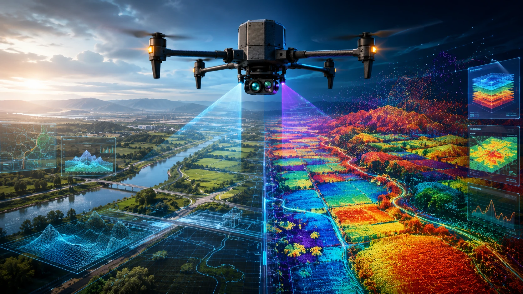
Choosing between an RGB vs multispectral drone sensor depends on what your project needs to see. RGB cameras capture the visible colours that humans can see, making them ideal for visual inspection, mapping, documentation, and progress monitoring. Multispectral cameras capture selected bands beyond normal vision, making them useful for vegetation health, crop stress, water stress, and analytical remote-sensing workflows.
For businesses in India, the right sensor is not always the most advanced one. A construction site, power asset, real estate project, road corridor, agriculture field, and forestry area all need different types of data. The best choice depends on the decision your team needs to make after the drone survey.
This guide compares RGB and multispectral drone sensors across use cases, cost, deliverables, accuracy, and project suitability.
What is an RGB drone sensor?
An RGB drone sensor is a standard visible-light camera that captures red, green, and blue colour channels. It produces natural-looking images and videos that are easy for project managers, engineers, inspectors, and stakeholders to understand.
RGB sensors are the most common drone imaging sensors. They are used for aerial photography, site mapping, visual inspections, progress monitoring, real estate documentation, infrastructure review, and construction reporting.
An RGB drone sensor can produce:
- High-resolution aerial photographs
- Aerial videos
- Orthomosaic maps
- 2D site maps
- 3D textured models
- Progress comparison visuals
- Inspection images
- Documentation reports
The biggest strength of RGB data is visual clarity. It shows what the site looks like in a familiar way. If a roof is damaged, a road is blocked, a construction stage is incomplete, or an asset has visible wear, RGB imagery can make the issue easy to identify.
For many commercial projects, RGB is the most practical starting point because it is cost-effective, widely available, and simple to interpret.
What is a multispectral drone sensor?
A multispectral drone sensor captures data in multiple selected wavelength bands, including visible and non-visible bands such as red-edge and near-infrared. This allows the sensor to detect information that is not visible in normal RGB images.
Multispectral imaging is commonly used in agriculture, forestry, environmental monitoring, vegetation analysis, and land health assessment. It helps identify patterns related to plant health, water stress, biomass, crop variability, and vegetation condition.
A multispectral drone sensor can support:
- NDVI maps
- NDRE maps
- Crop health assessment
- Vegetation stress analysis
- Irrigation issue detection
- Plant vigour mapping
- Field variability analysis
- Forestry monitoring
- Wetland or ecological mapping
- Precision agriculture planning
A simple RGB image may show that a field looks green. A multispectral image can help show whether parts of that field are reflecting light differently due to stress, moisture variation, disease, nutrient issues, or growth differences.
Multispectral data is more analytical than visual. It usually needs proper calibration, processing, interpretation, and field validation.
What is the main difference between RGB vs multispectral drone sensors?
The main difference between RGB vs multispectral drone sensors is that RGB captures visible colour images, while multispectral sensors capture selected spectral bands for deeper analysis. RGB is best for visual interpretation; multispectral is best for vegetation and spectral analysis.
Here is a practical comparison:
| Factor | RGB drone sensor | Multispectral drone sensor |
|---|---|---|
| Data captured | Red, green, blue visible light | Multiple spectral bands, often including near-infrared |
| Main strength | Visual clarity | Analytical vegetation and surface insight |
| Best for | Inspection, mapping, documentation | Crop health, vegetation, environmental monitoring |
| Output style | Photos, videos, orthomosaics | Index maps, spectral layers, vegetation analysis |
| Ease of interpretation | Easy for most teams | Requires technical interpretation |
| Cost | Usually lower | Usually higher |
| Processing complexity | Moderate | Higher |
| Ideal user | Construction, inspection, real estate, infrastructure teams | Agriculture, forestry, environmental, research teams |
RGB answers the question: “What does the site look like?”
Multispectral answers the question: “What is happening in the vegetation or surface condition that normal vision may not show?”
When should you choose an RGB drone sensor?
Choose an RGB drone sensor when your project needs clear visual documentation, mapping, inspection imagery, construction progress records, or stakeholder reporting. RGB is the right choice when visible detail is enough to support the decision.
RGB sensors are suitable for:
- Construction progress monitoring
- Real estate project documentation
- Road and infrastructure mapping
- Roof and façade inspection
- Power asset visual inspection
- Industrial site documentation
- Land parcel mapping
- Mining site visuals
- Event and media coverage
- Urban planning records
- Before-after site comparison
RGB data is especially useful when the final audience includes project owners, management teams, clients, contractors, or government stakeholders who need clear visual evidence.
For inspection projects, RGB imagery can help identify visible cracks, corrosion, broken components, missing hardware, access issues, vegetation encroachment, and physical damage. Skyglimps Technologies LLP provides Thermal & RGB Inspections for organisations that need aerial visual inspection support across infrastructure, industrial, and utility assets.
RGB is also useful for recurring documentation. When the same site is captured at different dates, teams can compare visible progress, site changes, and work completion.
When should you choose a multispectral drone sensor?
Choose a multispectral drone sensor when your project needs vegetation health analysis, crop stress detection, irrigation assessment, plant vigour mapping, or environmental monitoring. Multispectral is the better choice when visible imagery cannot answer the main question.
Multispectral sensors are suitable for:
- Crop health monitoring
- Precision agriculture
- Plant stress detection
- Irrigation issue mapping
- Nutrient variability analysis
- Forestry assessment
- Wetland monitoring
- Vegetation index mapping
- Disease or pest stress screening
- Research and environmental studies
Multispectral sensors are widely used to generate vegetation indices. NDVI, one of the best-known indices, uses red and near-infrared information to indicate vegetation condition. NDRE uses red-edge information and can be useful for more specific crop and canopy analysis.
For agricultural and forestry projects, multispectral imaging can help teams find patterns before they are obvious in normal photographs. This can support targeted field visits, better irrigation planning, input management, and crop monitoring.
For agriculture and land-based applications, drone data can support broader workflows in agriculture and forestry where vegetation visibility and field-level insights are important.
Which sensor is better for inspections?
RGB is usually the better first-choice sensor for visual inspections, while multispectral is useful only when the inspection question requires spectral or vegetation-related analysis. For most industrial, power, construction, and infrastructure inspections, RGB and thermal sensors are more directly useful than multispectral sensors.
RGB inspection helps teams identify visible defects, asset condition, surface changes, damage, corrosion, cracks, missing parts, vegetation encroachment, and access constraints. It is easy to review and easy to share with maintenance teams.
For example, RGB inspection can help with:
- Power line visual checks
- Rooftop inspection
- Solar site documentation
- Industrial asset review
- Construction quality documentation
- Tower and structure visual assessment
- Road and bridge condition records
Multispectral imaging may be useful if the inspection involves vegetation health, land cover, crop stress, or ecological conditions around the asset. For example, a utility corridor may use RGB to inspect towers and multispectral data to understand vegetation health along the corridor.
For electrical or heat-related inspection problems, thermal imaging is usually more relevant than multispectral imaging. Thermal sensors detect heat patterns, while multispectral sensors detect reflected light across selected bands.
Which sensor is better for agriculture and vegetation?
Multispectral sensors are better for agriculture and vegetation analysis because they capture spectral bands that reveal plant condition beyond normal visible colour. RGB sensors are still useful for visual scouting, field documentation, stand counts, and visible crop issues.
In agriculture, the decision depends on the question.
Use RGB if you need to see:
- Field layout
- Crop rows
- Visible pest damage
- Lodging
- Weed patches
- Irrigation infrastructure
- Visible waterlogging
- Field access routes
- General crop condition
Use multispectral if you need to analyse:
- Crop vigour
- Plant stress
- Vegetation index patterns
- Irrigation variability
- Nutrient stress indicators
- Growth differences
- Canopy health
- Early warning zones
A practical agriculture workflow may use both. RGB imagery gives visual context. Multispectral data gives analytical layers. Together, they can guide field teams to the right zones for ground verification.
Drone data should not be treated as a replacement for agronomists or field sampling. It helps identify patterns and prioritise where experts should inspect.
Which sensor is better for mapping and survey work?
RGB is often sufficient for standard drone mapping, orthomosaic creation, site documentation, and 3D photogrammetry on visible surfaces. Multispectral is better when the mapping objective involves vegetation condition, land cover classification, or environmental analysis.
For most 2D drone mapping projects, RGB imagery can create clear orthomosaic maps and visual site records. It is widely used in construction, land development, infrastructure, mining, real estate, and documentation.
Skyglimps Technologies LLP provides 2D Surveying & Mapping for organisations that need aerial mapping, site documentation, and spatial outputs for professional decision-making.
Multispectral mapping is more specialised. It becomes useful when the final output is not just a map but a layer of interpretation, such as vegetation health, crop stress, or land-cover condition.
For 3D terrain, complex infrastructure, or point cloud-heavy workflows, LiDAR or photogrammetry may be more relevant than multispectral imaging. The sensor should always match the project objective.
How do deliverables differ between RGB and multispectral drone projects?
RGB projects usually deliver visual outputs such as photos, videos, orthomosaics, and 3D models, while multispectral projects deliver analytical outputs such as vegetation index maps and spectral layers. The deliverables should be agreed before the flight.
Common deliverables include:
| Deliverable | RGB sensor | Multispectral sensor |
| Aerial photographs | Yes | Limited visual use |
| Aerial video | Yes | Not the main use |
| Orthomosaic map | Yes | Yes |
| 3D textured model | Yes | Not typical |
| Inspection report | Yes | Only for specific use cases |
| NDVI map | No | Yes |
| NDRE map | No | Yes |
| Crop vigour map | Limited | Yes |
| Vegetation stress zones | Limited | Yes |
| GIS layers | Yes | Yes |
| Field scouting map | Yes | Yes |
| Progress report | Yes | Not typical |
A buyer should ask the drone team exactly what will be delivered. “Drone data” is not a deliverable. The deliverable should be specific: orthomosaic, NDVI map, PDF report, GIS layer, thermal report, RGB inspection imagery, or 3D model.
Clear deliverables prevent confusion after the flight and help the client use the data properly.
Which sensor is more cost-effective?
RGB sensors are usually more cost-effective for visual mapping, documentation, and inspection projects, while multispectral sensors are more cost-effective when vegetation analysis or crop health insight is the real objective. Cost-effectiveness depends on the value of the output, not only the equipment price.
RGB workflows are generally more affordable because the sensors are common, processing is simpler, and interpretation is easier. Many projects do not need multispectral data at all.
Multispectral workflows usually cost more because they require specialised sensors, calibration, careful flight planning, additional processing, index generation, and technical interpretation.
Cost factors include:
- Sensor type
- Site size
- Flight planning
- Calibration requirements
- Ground reference needs
- Data processing
- Number of deliverables
- Technical reporting
- Repeat monitoring frequency
- Expert interpretation
If the project only needs visible site progress, choose RGB. If the project needs vegetation health or spectral analysis, choose multispectral. Paying for multispectral data when RGB is enough adds unnecessary cost. Choosing RGB when multispectral analysis is required can produce incomplete answers.
How should businesses choose between RGB vs multispectral drone sensors?
Businesses should choose between RGB vs multispectral drone sensors by starting with the project question, not the sensor name. If the question is visual, choose RGB. If the question is spectral or vegetation-related, choose multispectral.
Use this decision checklist:
| Project question | Better sensor choice |
| What does the site look like today? | RGB |
| Has construction progressed? | RGB |
| Is there visible asset damage? | RGB |
| Are power or industrial components physically damaged? | RGB, often with thermal |
| Is crop health uneven? | Multispectral |
| Are plants showing early stress? | Multispectral |
| Is irrigation affecting vegetation differently? | Multispectral |
| Do we need NDVI or NDRE? | Multispectral |
| Do stakeholders need clear visual proof? | RGB |
| Do agronomists need analytical field zones? | Multispectral |
| Do we need both visual and vegetation insight? | RGB plus multispectral |
The best sensor strategy may use more than one sensor. A power inspection may combine RGB and thermal. An agriculture project may combine RGB and multispectral. A mapping project may use RGB, LiDAR, or both depending on the required outputs.
Why choose Skyglimps Technologies for drone inspection and mapping workflows?
Skyglimps Technologies LLP is a Kolkata-based drone services company and DGCA-certified Remote Pilot Training Organisation serving government and enterprise clients across Eastern India. The company supports drone workflows across mapping, inspections, surveillance, documentation, training, and spatial data use cases.
Skyglimps Technologies, a DGCA-certified RPTO in Kolkata, is positioned for organisations that need practical guidance on selecting the right drone sensor for a project. For clients in Kolkata, West Bengal, and Eastern India, local coordination can help improve site scoping, inspection planning, repeat surveys, and reporting workflows.
The right sensor should be selected before data capture begins. A well-scoped project avoids unnecessary cost, missing outputs, and data that does not answer the business question.
FAQ: RGB vs Multispectral Drone
RGB sensors capture visible red, green, and blue light. Multispectral sensors capture selected wavelength bands, often including near-infrared and red-edge, to support vegetation and spectral analysis
RGB is usually better for visual inspections of buildings, towers, roads, industrial assets, and construction sites. Thermal may be added for heat-related inspections. Multispectral is useful mainly for vegetation-related analysis.
Multispectral is better for crop health, vegetation stress, NDVI, NDRE, and irrigation variability analysis. RGB is still useful for visible field scouting, crop rows, lodging, weeds, and documentation.
Yes. Multispectral imaging is generally more expensive because it needs specialised sensors, calibration, processing, and technical interpretation. RGB workflows are usually simpler and more cost-effective.
Yes. RGB drones can create orthomosaic maps, 3D textured models, progress visuals, and inspection reports when flown and processed correctly.
NDVI is a vegetation index that uses red and near-infrared information to indicate vegetation condition. It is commonly created from multispectral drone data.
Yes. Many projects benefit from both. RGB provides visual context, while multispectral data provides analytical vegetation or spectral layers.
Choose the sensor that answers the project question
The RGB vs multispectral drone decision should start with the outcome your team needs. RGB is the practical choice for visual mapping, inspection, progress documentation, and stakeholder reporting. Multispectral is the stronger choice for agriculture, vegetation analysis, crop stress, and environmental monitoring.
A good drone project does not begin with the most advanced sensor. It begins with the right question, the right data capture plan, and the right deliverables.
If your organisation needs aerial inspection, RGB imagery, thermal inspection, drone mapping, or sensor-selection guidance in Kolkata, West Bengal, or Eastern India, connect with Skyglimps Technologies LLP through the Thermal & RGB Inspections service page and share your site location, inspection objective, and required deliverables.